Perfect setup for Monday morning fog: recent heavy rain, followed by a clearing sky and light winds.
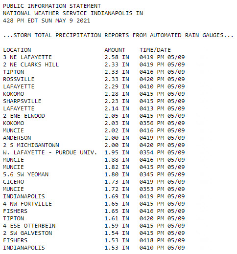
Rainfall amounts were over two inches around Lafayette, and between 1.5 and 2 inches over much of Indy near and north of I-70.
Never miss me! Subscribe for free. My Huge Radar has real-time weather tracking, current temperatures, and severe weather watches and warnings. Get detailed Indiana conditions by clicking here. Click here to see my central Indiana 7-Day Forecast. Follow these links to get my forecasts for Lafayette, Muncie, Hendricks County, and Hamilton County. Need a second opinion? Click here for central Indiana National Weather Service forecasts. (Some charts via WeatherBELL.)
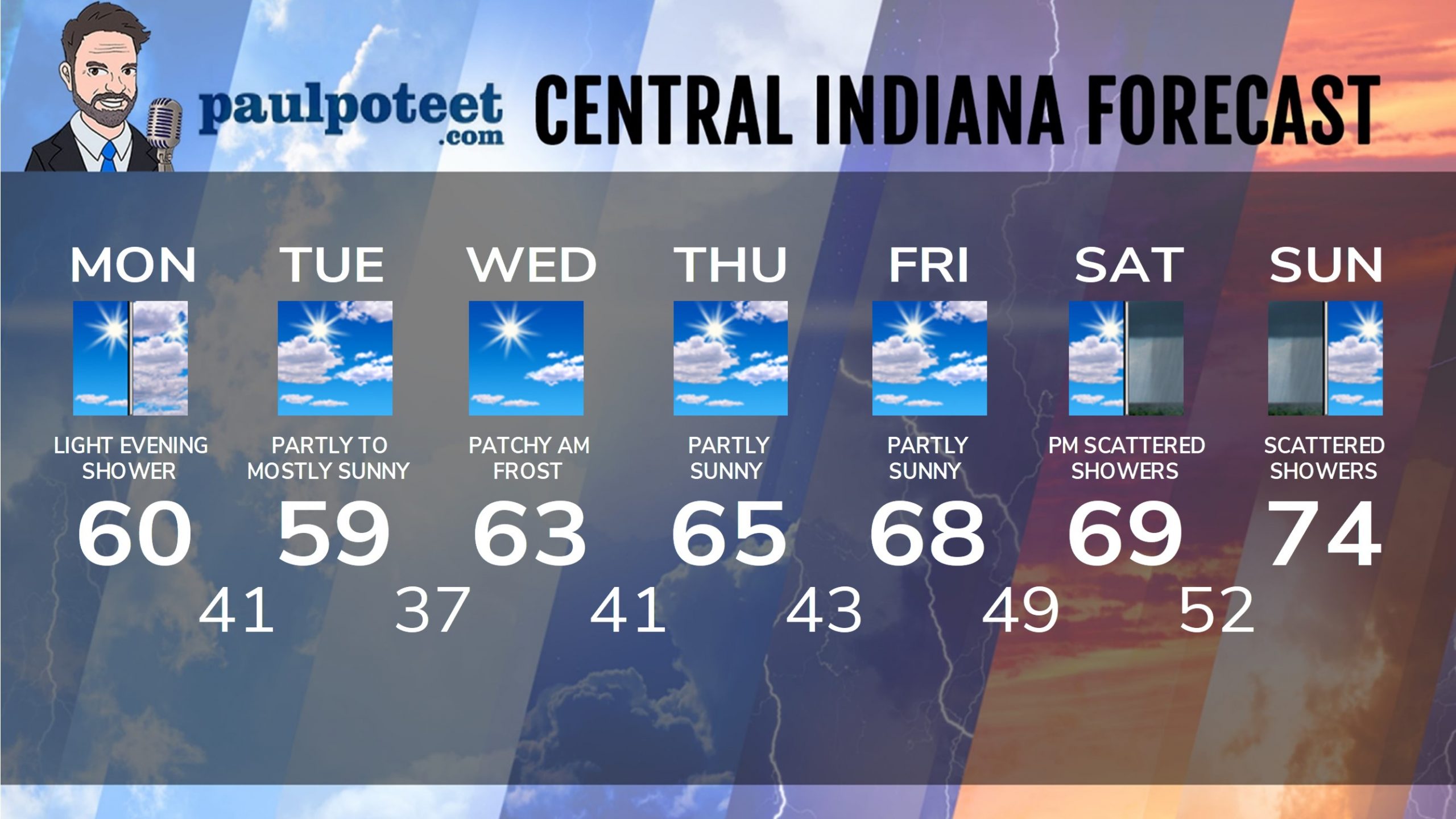
INDY SEVEN DAY FORECAST
Today: Early morning patchy fog and frost, then mostly sunny. Clouds increase in the afternoon. High 60.
Tonight: Mostly cloudy, with a few light showers possible. Low 41.
Tuesday: Partly to mostly sunny. High 59.
Tuesday Night: Mostly clear. Low 37.
Wednesday: Patchy morning frost, then mostly sunny. High 63.
Wednesday Night: Mostly clear. Low 41.
Thursday: Partly sunny. High 65.
Thursday Night: Partly cloudy. Low 43.
Friday: Partly sunny. High 68.
Friday Night: Partly cloudy. Low 49.
Saturday: Partly sunny, with scattered showers by afternoon. High 69.
Saturday Night: Scattered showers. Low 52.
Sunday: Scattered showers, mainly in the morning. High 74.
Never miss me! Subscribe for free. My Huge Radar has real-time weather tracking, current temperatures, and severe weather watches and warnings. Get detailed Indiana conditions by clicking here. Click here to see my central Indiana 7-Day Forecast. Follow these links to get my forecasts for Lafayette, Muncie, Hendricks County, and Hamilton County. Need a second opinion? Click here for central Indiana National Weather Service forecasts. (Some charts via WeatherBELL.)


