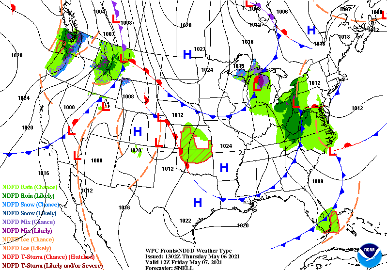
Cold front number one arrives today, bringing afternoon showers and storms. There is a risk of some small hail with any storms.

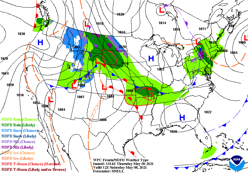
Cold front number two arrives Friday. The shower threat is smaller, but I’m saying…there’s still a chance.
Finally: high pressure noses into the area Friday night and Saturday. Nice, clear sky. Well…clear and cold early Saturday morning. Could be some patchy frost.
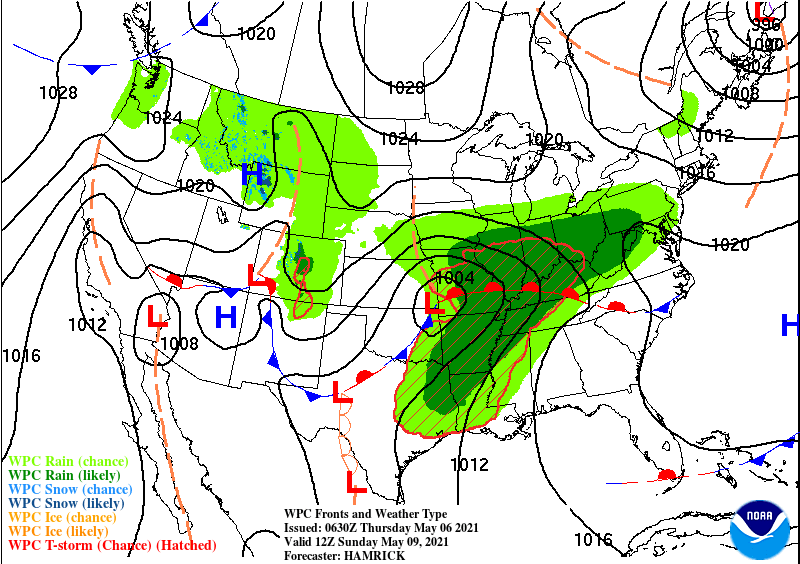
Mom’s Day still looks soggy, and there could also be some thunder, depending on the eventual placement of the storm system.
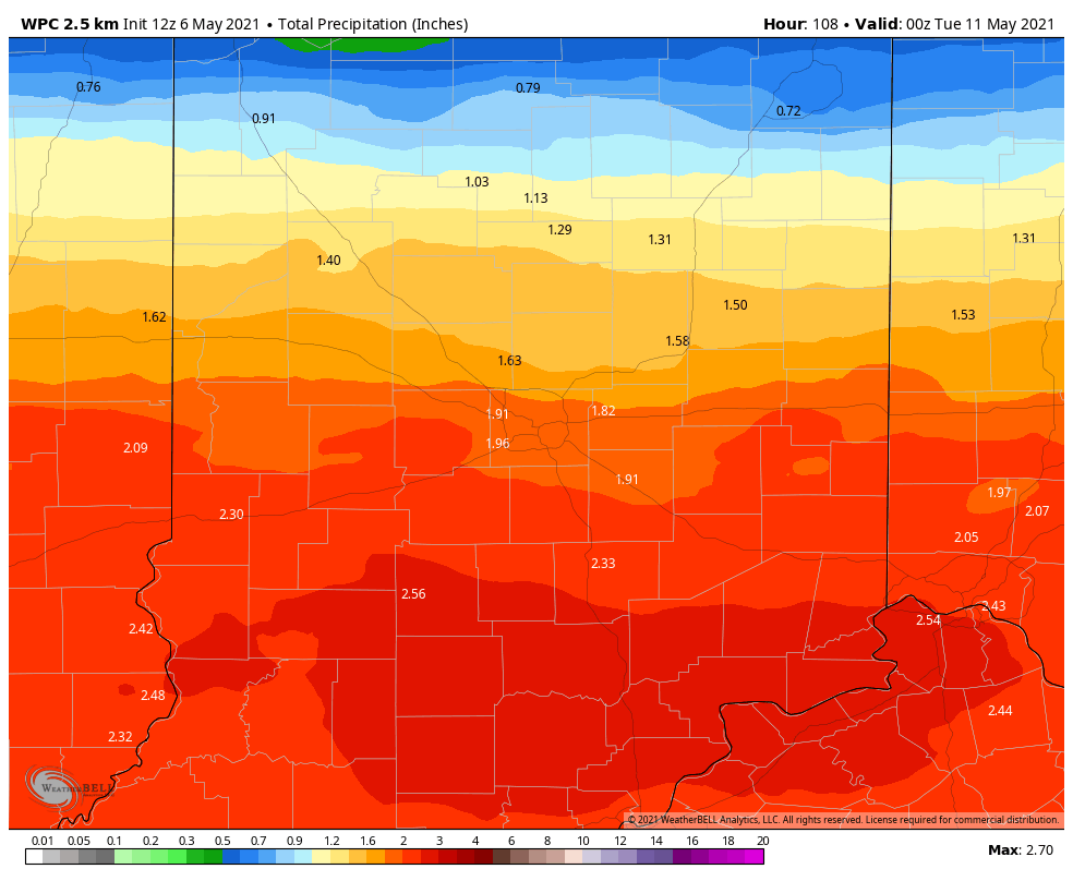
Over an inch of rain is likely through Sunday night, with the bulk of that coming Sunday.
Never miss me! Subscribe for free. My Huge Radar has real-time weather tracking, current temperatures, and severe weather watches and warnings. Get detailed Indiana conditions by clicking here. Click here to see my central Indiana 7-Day Forecast. Follow these links to get my forecasts for Lafayette, Muncie, Hendricks County, and Hamilton County. Need a second opinion? Click here for central Indiana National Weather Service forecasts. (Some charts via WeatherBELL.)
INDY SEVEN DAY FORECAST
Today: Partly to mostly cloudy. Afternoon showers and storms. High 63.
Tonight: Scattered showers in the evening. Partly cloudy overnight. Low 38.
Friday: Partly sunny. Spotty showers possible. Wind gusting to 30 mph. High 62.
Friday Night: Partly cloudy evening. Clear overnight. Patchy frost possible. Low 37.
Saturday: Mostly sunny morning. Partly cloudy afternoon. High 60.
Saturday Night: Showers likely late, with some thunder possible. Low 45.
Sunday: Rainy, with some thunder possible. High 56.
Sunday Night: Showers and storms in the evening. Low 43.
Monday: Partly sunny. High 59.
Monday Night: Partly cloudy. Low 40.
Tuesday: Partly sunny. High 62.
Tuesday Night: Partly cloudy. Low 42.
Wednesday: Partly sunny. High 63.

Never miss me! Subscribe for free. My Huge Radar has real-time weather tracking, current temperatures, and severe weather watches and warnings. Get detailed Indiana conditions by clicking here. Click here to see my central Indiana 7-Day Forecast. Follow these links to get my forecasts for Lafayette, Muncie, Hendricks County, and Hamilton County. Need a second opinion? Click here for central Indiana National Weather Service forecasts. (Some charts via WeatherBELL.)


