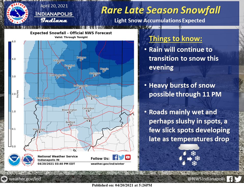
(Via @NWSIndianapolis.) Rain will continue to transition to snow this evening. Bursts of heavy snow possible through 11 PM. Accums primarily on grassy and elevated surfaces due to warm pavement, although a few slick spots could develop during the heaviest snowfall or late tonight as temps drop. #INwx https://t.co/0VAWAoekwn
My Huge Radar has real-time weather tracking, current temperatures, and severe weather watches and warnings. Get detailed Indiana conditions by clicking here. Follow these links to get my forecasts for Lafayette, Muncie, Hendricks County, and Hamilton County. Need a second opinion? Click here for central Indiana National Weather Service forecasts.
Never miss me! Subscribe for free. My Huge Radar has real-time weather tracking, current temperatures, and severe weather watches and warnings. Get detailed Indiana conditions by clicking here. Click here to see my central Indiana 7-Day Forecast. Follow these links to get my forecasts for Lafayette, Muncie, Hendricks County, and Hamilton County. Need a second opinion? Click here for central Indiana National Weather Service forecasts. (Some charts via WeatherBELL.)


