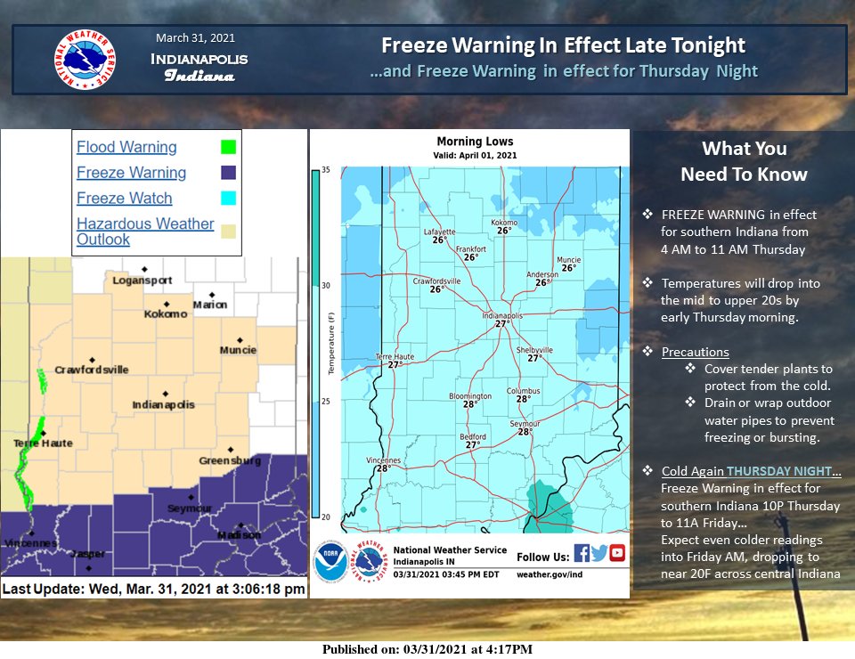
A hard freeze is coming tonight. It’s been determined the growing season has started in southern Indiana, so there’s a warning there, but it’s gonna be cold statewide.
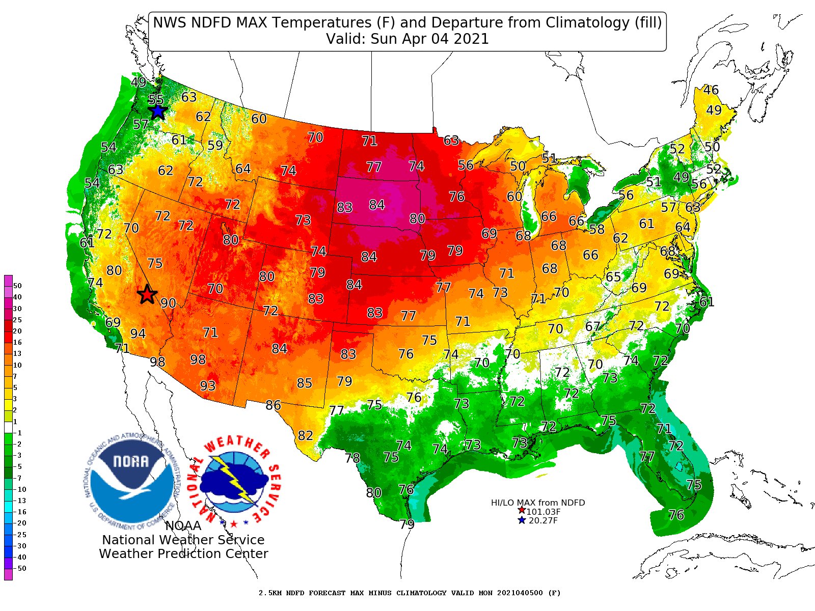
Recovery begins this weekend, and we’re back above average by Easter Sunday.
Never miss me! Subscribe for free. My Huge Radar has real-time weather tracking, current temperatures, and severe weather watches and warnings. Get detailed Indiana conditions by clicking here. Click here to see my central Indiana 7-Day Forecast. Follow these links to get my forecasts for Lafayette, Muncie, Hendricks County, and Hamilton County. Need a second opinion? Click here for central Indiana National Weather Service forecasts. (Some charts via WeatherBELL.)
INDY SEVEN DAY FORECAST
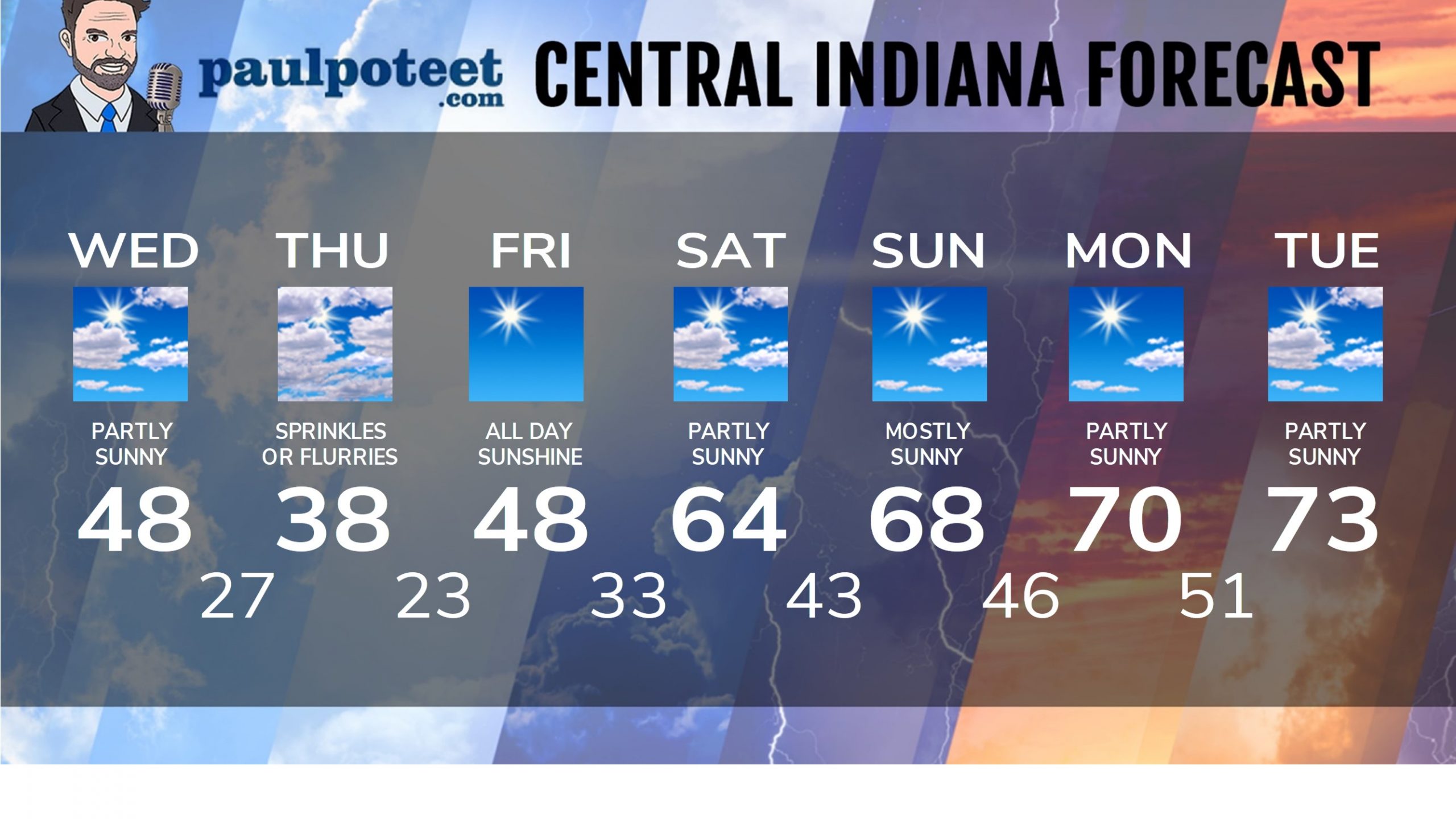
Today: Partly to mostly sunny in the morning. Partly to mostly cloudy in the afternoon. Much cooler. Wind gusts to around 30 mph. High 48.
Tonight: Partly cloudy. Evening wind gusts to 30 mph. Flurries possible overnight. Low 27.
Thursday: Partly to mostly cloudy, breezy, with a few sprinkles or flurries. Wind gusting to 30 mph. High 38. Morning chills in the teens.
Thursday Night: Clear and frosty. Low 23.
Friday: All day sunshine. High 48.
Friday Night: Mostly clear and frosty. Low 33.
Saturday: Partly to mostly sunny. High 64.
Saturday Night: Mostly clear. Low 43.
Easter Sunday: Mostly sunny. High 68.
Sunday Night: Mostly clear. Low 46.
Monday: Partly sunny. High 70.
Monday Night: Partly cloudy. Low 51.
Tuesday: Partly sunny. High 73.
Never miss me! Subscribe for free. My Huge Radar has real-time weather tracking, current temperatures, and severe weather watches and warnings. Get detailed Indiana conditions by clicking here. Click here to see my central Indiana 7-Day Forecast. Follow these links to get my forecasts for Lafayette, Muncie, Hendricks County, and Hamilton County. Need a second opinion? Click here for central Indiana National Weather Service forecasts. (Some charts via WeatherBELL.)


