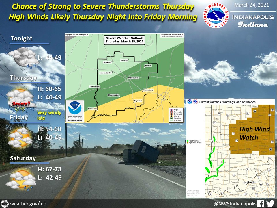
(Via @NWSIndianapolis.) Rain chances toward daybreak Thu, quickly ramping up. Strong/severe t-storms possible PM. Rain wanes & winds increase Thu night to 50-60 mph in High Wind Watch area, 40-50 elsewhere. Variable clouds Fri & Sat. Thru Sat: Highs mid 50s-lower 70s, lows in 40s. #INwx #nwsind https://t.co/plDP1ZksfL
My Huge Radar has real-time weather tracking, current temperatures, and severe weather watches and warnings. Get detailed Indiana conditions by clicking here. Follow these links to get my forecasts for Lafayette, Muncie, Hendricks County, and Hamilton County. Need a second opinion? Click here for central Indiana National Weather Service forecasts.
Never miss me! Subscribe for free. My Huge Radar has real-time weather tracking, current temperatures, and severe weather watches and warnings. Get detailed Indiana conditions by clicking here. Click here to see my central Indiana 7-Day Forecast. Follow these links to get my forecasts for Lafayette, Muncie, Hendricks County, and Hamilton County. Need a second opinion? Click here for central Indiana National Weather Service forecasts. (Some charts via WeatherBELL.)


