Friday is the last day of Winter, and it may be the last day with highs in the 40s in central Indiana!

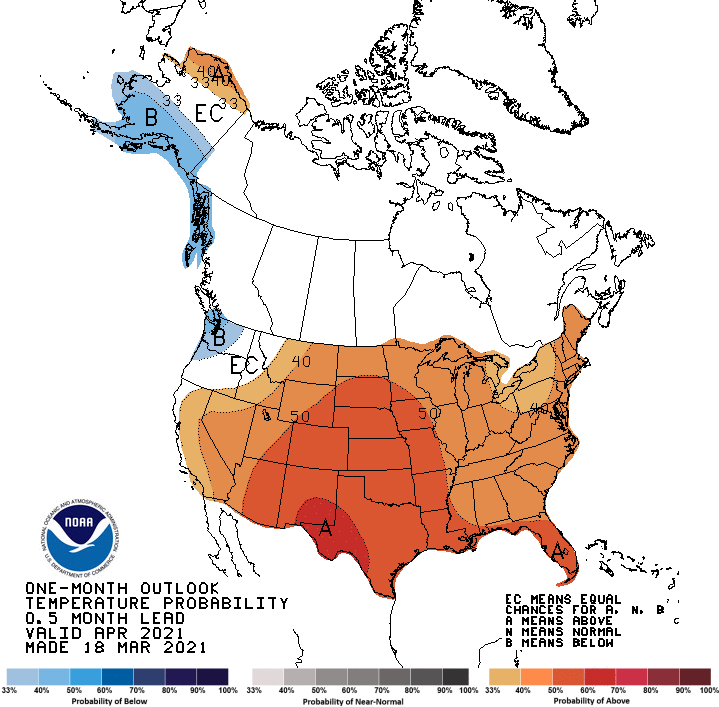
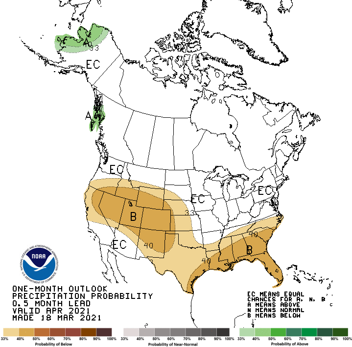
The outlook for April released yesterday indicates warmer than average conditions are likely for the Midwest. Precipitation looks to be average.
Never miss me! Subscribe for free. My Huge Radar has real-time weather tracking, current temperatures, and severe weather watches and warnings. Get detailed Indiana conditions by clicking here. Click here to see my central Indiana 7-Day Forecast. Follow these links to get my forecasts for Lafayette, Muncie, Hendricks County, and Hamilton County. Need a second opinion? Click here for central Indiana National Weather Service forecasts. (Some charts via WeatherBELL.)
INDY SEVEN DAY FORECAST
Friday: Mostly sunny. Morning wind gusts to 30 mph, with morning chills in the teens. High 48.
Friday Night: Clear. Low 27.
Saturday: Sunny. High 57.
Saturday Night: Clear. Low 33.
Sunday: Sunny morning. Mostly sunny late afternoon. High 63.
Sunday Night: Mostly clear. Low 38.
Monday: Mostly to partly sunny. High 67.
Monday Night: Partly cloudy. Low 46.
Tuesday: Mostly cloudy. Scattered showers and maybe a storm. High 64.
Tuesday Night: Scattered showers and maybe a storm. Low 50.
Wednesday: Mostly to partly cloudy, with spotty showers and maybe a storm. High 64.
Wednesday Night: Partly cloudy. Low 45.
Thursday: Mostly cloudy. Scattered showers and maybe a storm. High 60.
:end
Never miss me! Subscribe for free. My Huge Radar has real-time weather tracking, current temperatures, and severe weather watches and warnings. Get detailed Indiana conditions by clicking here. Click here to see my central Indiana 7-Day Forecast. Follow these links to get my forecasts for Lafayette, Muncie, Hendricks County, and Hamilton County. Need a second opinion? Click here for central Indiana National Weather Service forecasts. (Some charts via WeatherBELL.)


It is still beautiful outside! Mu huskies are loving the weather today.