The wind peaked at 54 mph in Lafayette Monday! Other gusts: 48 mph in Indy, 39 mph in Terre Haute, and 38 mph in Muncie and Bloomington.
Good news: we lost the wind. Bad news: that’s contributing to the fog. A Dense Fog Advisory is in place for the western part of the state in the morning.

What a nasty day Monday was. Relentless cold rain, and temperatures above the surface that were cold enough for ice to form on tree limbs and windshields and side mirrors.
I guess it pales compared to what folks out west put up with this weekend.
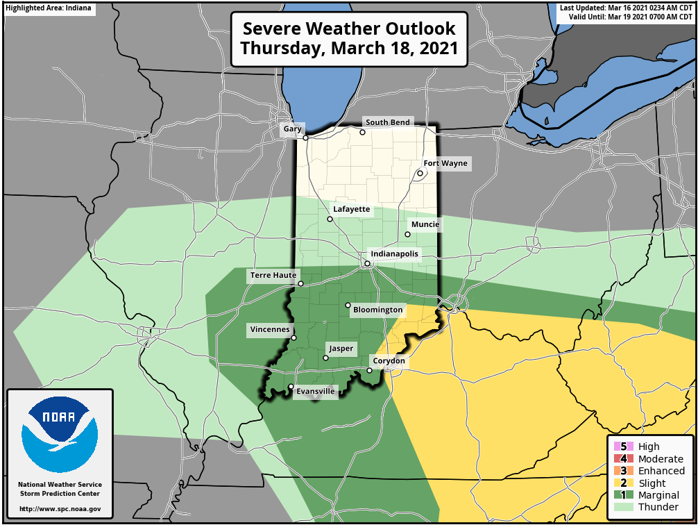
Our next big weathermaker will bring rain and thunder (even a marginal severe storm risk) late Wednesday night and Thursday morning.
Never miss me! Subscribe for free. My Huge Radar has real-time weather tracking, current temperatures, and severe weather watches and warnings. Get detailed Indiana conditions by clicking here. Click here to see my central Indiana 7-Day Forecast. Follow these links to get my forecasts for Lafayette, Muncie, Hendricks County, and Hamilton County. Need a second opinion? Click here for central Indiana National Weather Service forecasts. (Some charts via WeatherBELL.)
INDY SEVEN DAY FORECAST
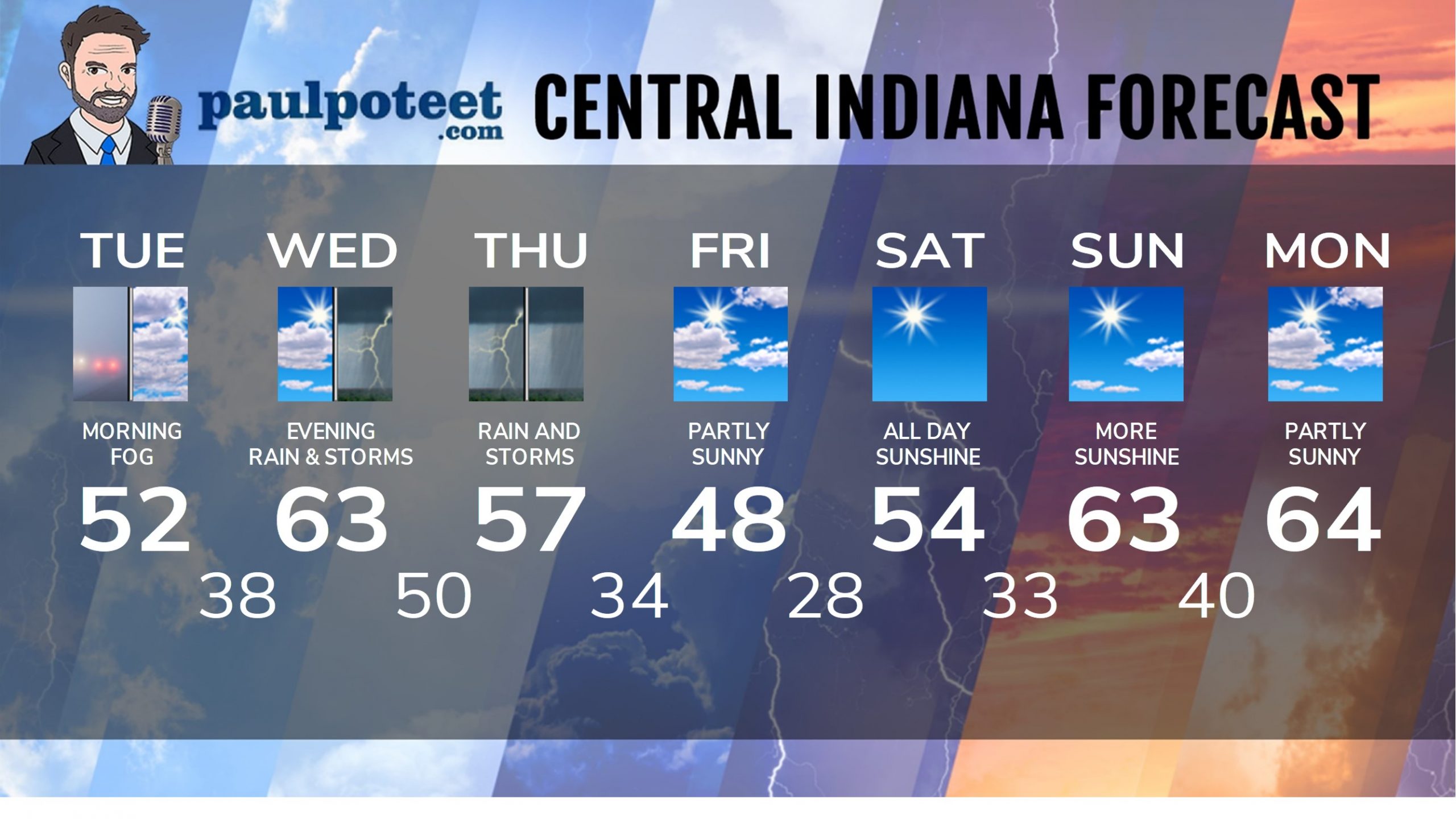
Today: Dense morning fog. Some peeks of sunshine later in the afternoon. High 52.
Tuesday Night: Partly cloudy. Low 38.
Wednesday: Partly sunny. High 63.
Wednesday Night: Showers and storms late evening and overnight. Low 50.
Thursday: Periods of rain. Rumbles of thunder in the morning. High 57.
Thursday Night: Scattered showers. Low 34.
Friday: Partly sunny. High 48.
Friday Night: Partly cloudy. Low 28.
Saturday: Partly sunny. High 54.
Saturday Night: Mostly clear. Low 33.
Sunday: Sunny. High 63.
Saturday Night: Mostly clear. Low 40.
Sunday: Sunny. High 64.
Never miss me! Subscribe for free. My Huge Radar has real-time weather tracking, current temperatures, and severe weather watches and warnings. Get detailed Indiana conditions by clicking here. Click here to see my central Indiana 7-Day Forecast. Follow these links to get my forecasts for Lafayette, Muncie, Hendricks County, and Hamilton County. Need a second opinion? Click here for central Indiana National Weather Service forecasts. (Some charts via WeatherBELL.)


