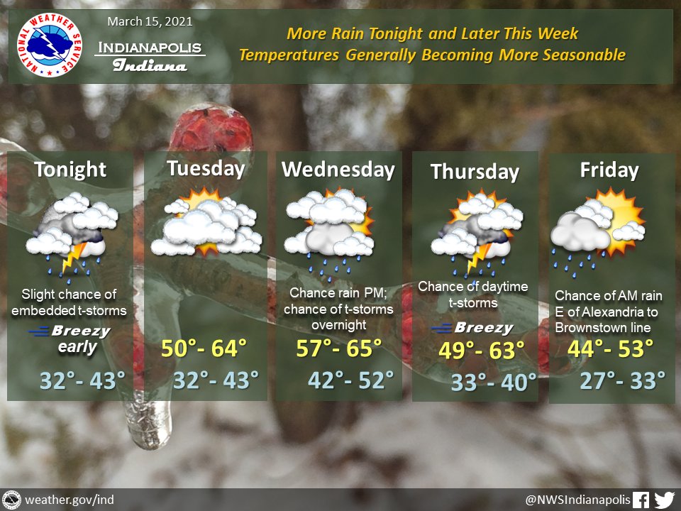
(Via @NWSIndianapolis.) Rain returns this evening but with slowly rising temps & diminishing winds. Dry & warmer Tue. Rain & t-storm chances return for Wed thru early Fri. Breezy Thu. Thru Fri, high temps will range from 44-65° & lows from 27-52, warmest Wednesday, coldest Friday. #INwx #nwsind https://t.co/WFLvHHeKcp
My Huge Radar has real-time weather tracking, current temperatures, and severe weather watches and warnings. Get detailed Indiana conditions by clicking here. Follow these links to get my forecasts for Lafayette, Muncie, Hendricks County, and Hamilton County. Need a second opinion? Click here for central Indiana National Weather Service forecasts.
Never miss me! Subscribe for free. My Huge Radar has real-time weather tracking, current temperatures, and severe weather watches and warnings. Get detailed Indiana conditions by clicking here. Click here to see my central Indiana 7-Day Forecast. Follow these links to get my forecasts for Lafayette, Muncie, Hendricks County, and Hamilton County. Need a second opinion? Click here for central Indiana National Weather Service forecasts. (Some charts via WeatherBELL.)


