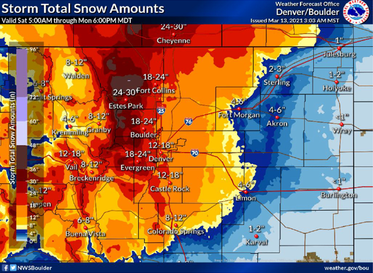
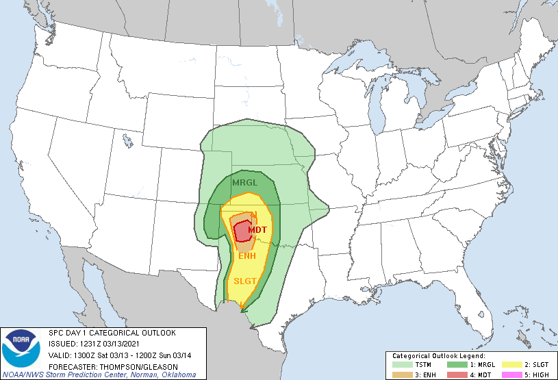
A foot of snow in Denver, a risk for tornadoes in Texas, and a Monday morning mix in central Indiana. The last weekend of weather has a few wrinkles.
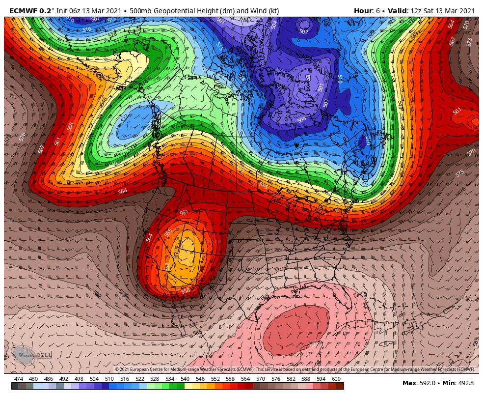
The edge of the energy from that stacked system in the West will rotate toward us Monday.
Although most of the atmosphere above us will be above freezing, there will be a period of time Monday morning with surface temps right around 32. A wintry mix of snow, sleet or freezing rain is possible, especially from the middle of morning rush hour to around lunch.
Never miss me! Subscribe for free. My Huge Radar has real-time weather tracking, current temperatures, and severe weather watches and warnings. Get detailed Indiana conditions by clicking here. Click here to see my central Indiana 7-Day Forecast. Follow these links to get my forecasts for Lafayette, Muncie, Hendricks County, and Hamilton County. Need a second opinion? Click here for central Indiana National Weather Service forecasts. (Some charts via WeatherBELL.)
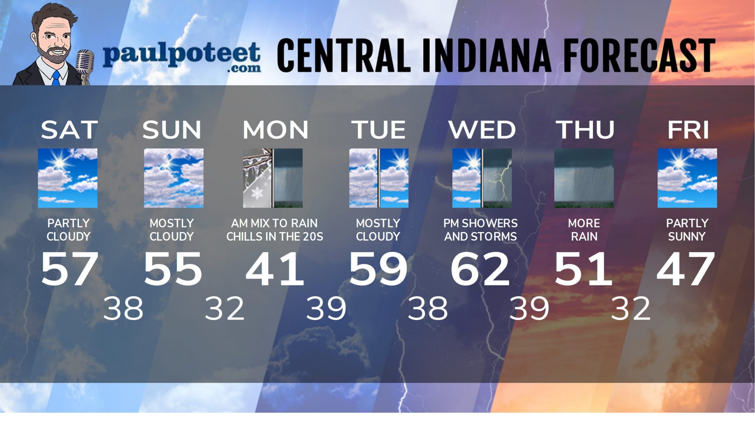
INDY SEVEN DAY FORECAST
Saturday: Partly sunny. High 57.
Saturday Night: Clouds increase. Low 38.
Sunday: Mostly cloudy. High 55.
Sunday Night: Small shower chance after midnight, possibly mixed with freezing rain, sleet or snow. Low 32.
Monday: Morning showers, possibly mixed with freezing rain, sleet or snow. Wind gusts to 30 mph. Chills in the 20s! High 41.
Monday Night: Scattered showers. Low 39.
Tuesday: Mostly cloudy. High 59.
Tuesday Night: Partly cloudy. Low 38.
Wednesday: Partly sunny morning. Scattered showers and storms develop in the afternoon. High 62.
Wednesday Night: Showers and storms. Low 39.
Thursday: Periods of rain. Rumbles of thunder in the morning. High 51.
Thursday Night: Partly cloudy. Low 32.
Friday: Partly sunny. High 47.
Never miss me! Subscribe for free. My Huge Radar has real-time weather tracking, current temperatures, and severe weather watches and warnings. Get detailed Indiana conditions by clicking here. Click here to see my central Indiana 7-Day Forecast. Follow these links to get my forecasts for Lafayette, Muncie, Hendricks County, and Hamilton County. Need a second opinion? Click here for central Indiana National Weather Service forecasts. (Some charts via WeatherBELL.)


