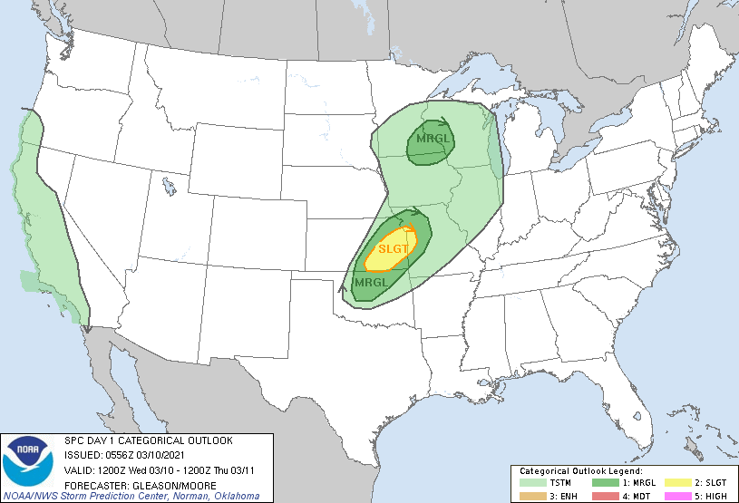
Ma Nature is waking up. Severe storms are possible in the Plains today…
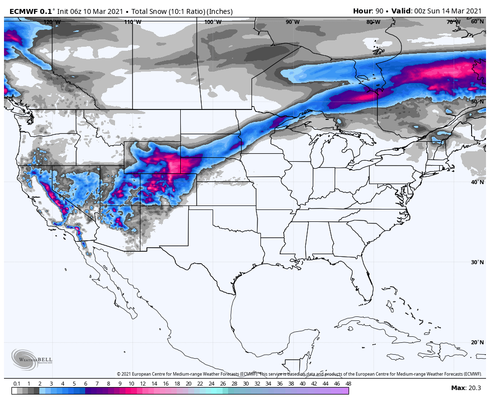
And a foot of snow is looking likely along the Front Range of the Rockies (including Denver) this weekend…
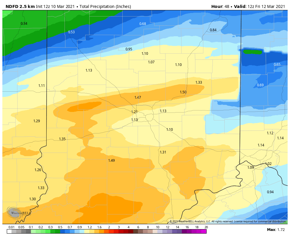
We’ll get the edge of all that energy today, with big breezes in the afternoon and evening. Expect gusts to 40 mph…45 mph around Lafayette, where a Wind Advisory is in place. Our biggest overall threat is Thursday, and it comes from heavy rain. An inch of precipitation is possible.
Never miss me! Subscribe for free. My Huge Radar has real-time weather tracking, current temperatures, and severe weather watches and warnings. Get detailed Indiana conditions by clicking here. Click here to see my central Indiana 7-Day Forecast. Follow these links to get my forecasts for Lafayette, Muncie, Hendricks County, and Hamilton County. Need a second opinion? Click here for central Indiana National Weather Service forecasts. (Some charts via WeatherBELL.)
INDY SEVEN DAY FORECAST
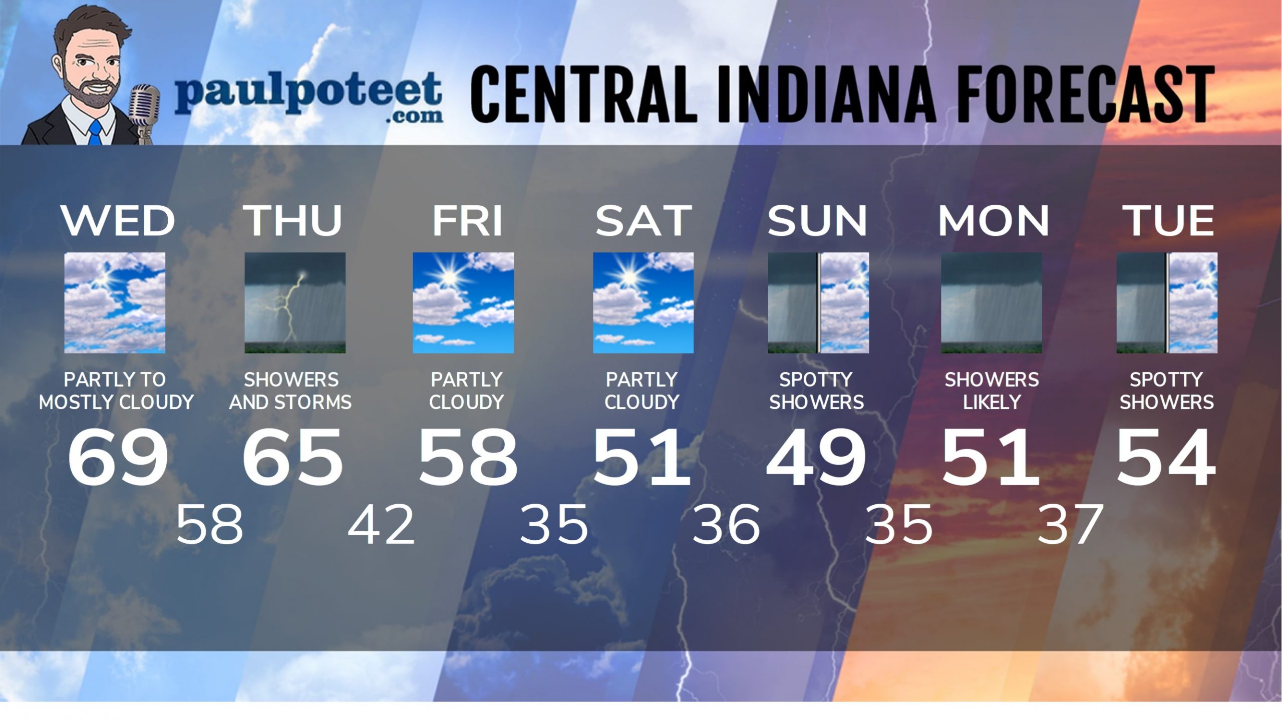
Today: Partly to mostly cloudy. Wind gusting to 40 mph in the afternoon. High 69.
Tonight: Scattered showers after midnight. Wind gusting to 40 mph. Low 58.
Thursday: Periods of rain. Wind gusting to 35 mph. Thunder also possible. High 65.
Thursday Night: Rain and storms. Wind gusting to 30 mph. Low 42.
Friday: Partly cloudy. High 58.
Friday Night: Mostly cloudy. Low 35.
Saturday: Partly sunny and colder. High 51.
Saturday Night: Mostly cloudy. Low 36.
Sunday: Mostly cloudy with spotty showers. High 49.
Sunday Night: Spotty showers. Low 35.
Monday: Scattered showers. High 51.
Monday Night: Scattered showers. Low 37.
Tuesday: Scattered showers, mainly in the morning. High 54.
Never miss me! Subscribe for free. My Huge Radar has real-time weather tracking, current temperatures, and severe weather watches and warnings. Get detailed Indiana conditions by clicking here. Click here to see my central Indiana 7-Day Forecast. Follow these links to get my forecasts for Lafayette, Muncie, Hendricks County, and Hamilton County. Need a second opinion? Click here for central Indiana National Weather Service forecasts. (Some charts via WeatherBELL.)


