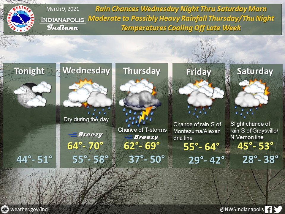
(Via @NWSIndianapolis.) Rain chances increase Wed night. Moderate to possibly heavy rain Thu/Thu night w/ possible thunder & stronger wind gusts. Diminishing rain Fri to Sat morn. Temps cooling late week, ranging 64-70° Wed to 45-53 Sat. Lows from 55-58° Wed night to 28-38 Sat night. #INwx #nwsind https://t.co/0UoXQZDaKR
My Huge Radar has real-time weather tracking, current temperatures, and severe weather watches and warnings. Get detailed Indiana conditions by clicking here. Follow these links to get my forecasts for Lafayette, Muncie, Hendricks County, and Hamilton County. Need a second opinion? Click here for central Indiana National Weather Service forecasts.
Never miss me! Subscribe for free. My Huge Radar has real-time weather tracking, current temperatures, and severe weather watches and warnings. Get detailed Indiana conditions by clicking here. Click here to see my central Indiana 7-Day Forecast. Follow these links to get my forecasts for Lafayette, Muncie, Hendricks County, and Hamilton County. Need a second opinion? Click here for central Indiana National Weather Service forecasts. (Some charts via WeatherBELL.)


