Shovel? You don’t need no stinkin’ shovel! At least, not for the next ten days.

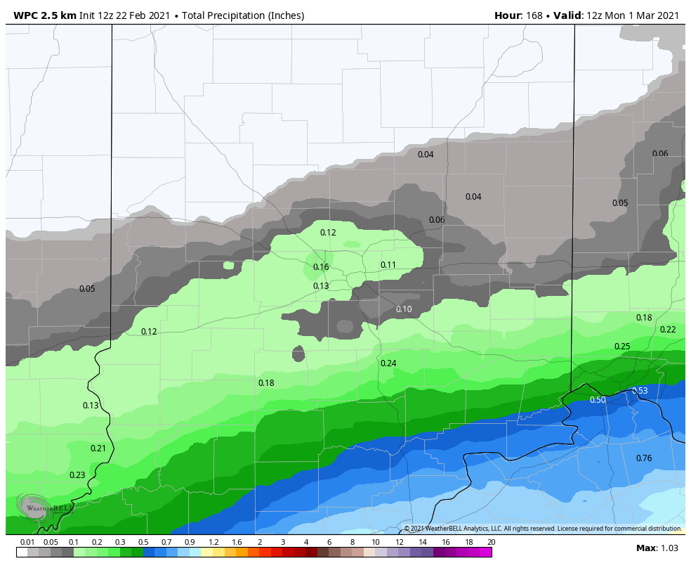
Rainfall also looks light for the next seven days.
That’s good news, as the temperatures I am expecting are gonna melt a lot of snow! We’ve already gone from 8 to 5 inches, as of late Sunday night.
Never miss me! Subscribe for free. My Huge Radar has real-time weather tracking, current temperatures, and severe weather watches and warnings. Get detailed Indiana conditions by clicking here. Click here to see my central Indiana 7-Day Forecast. Follow these links to get my forecasts for Lafayette, Muncie, Hendricks County, and Hamilton County. Need a second opinion? Click here for central Indiana National Weather Service forecasts. (Some charts via WeatherBELL.)
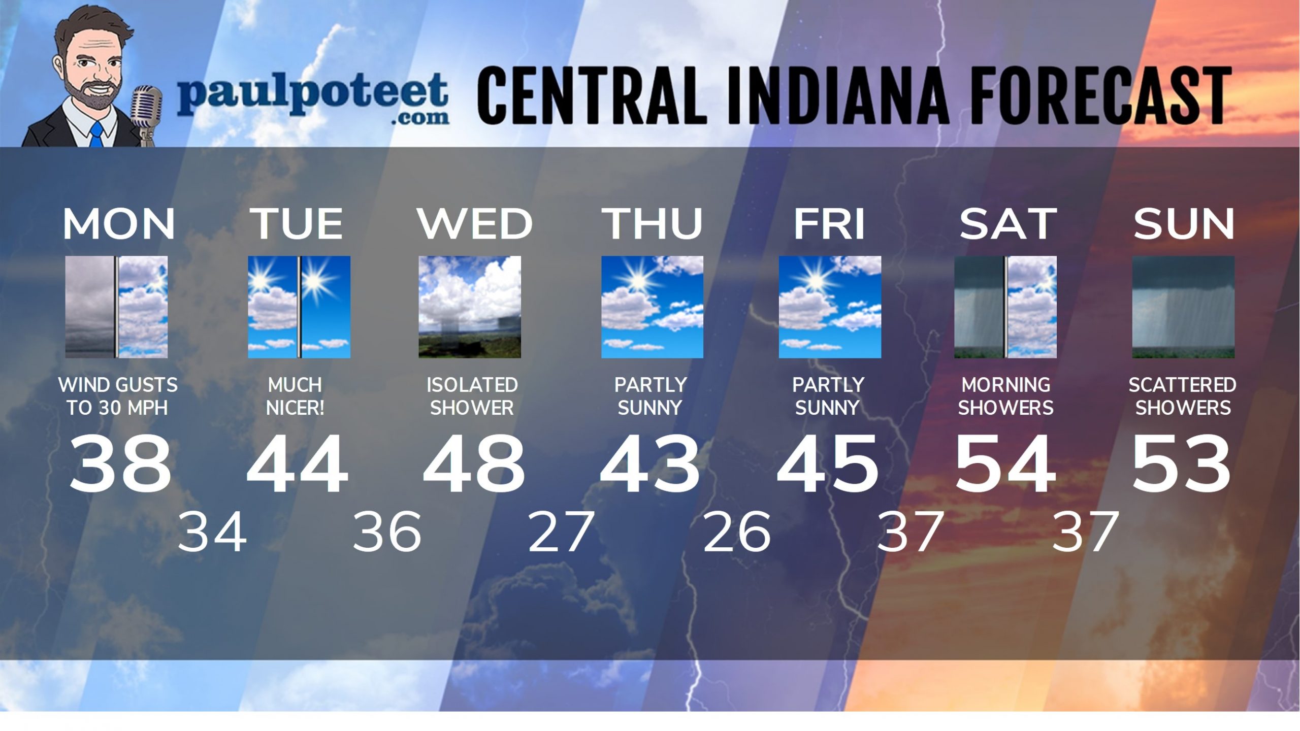
Today: Cloudy morning. Mostly cloudy afternoon. Wind gusting to 30 mph. (Chills in the 20s.) High 38.
Tonight: Partly cloudy. Wind gusting to 25 mph. Patchy fog possible. Low 34.
Tuesday: Partly, then mostly sunny. Wind gusting to 25 mph. High 44.
Tuesday Night: Partly cloudy. Low 36.
Wednesday: Partly sunny. Isolated shower possible. High 48.
Wednesday Night: Partly cloudy. Low 27.
Thursday: Partly sunny. High 43.
Thursday Night: Partly cloudy. Low 26.
Friday: Partly sunny. High 45.
Friday Night: Partly cloudy. Showers possible after midnight. Low 37.
Saturday: Morning showers. Some sun in the afternoon. High 54.
Saturday Night: Showers return late. Low 37.
Sunday: Cloudy, with scattered showers. High 53.
Never miss me! Subscribe for free. My Huge Radar has real-time weather tracking, current temperatures, and severe weather watches and warnings. Get detailed Indiana conditions by clicking here. Click here to see my central Indiana 7-Day Forecast. Follow these links to get my forecasts for Lafayette, Muncie, Hendricks County, and Hamilton County. Need a second opinion? Click here for central Indiana National Weather Service forecasts. (Some charts via WeatherBELL.)


