Progress! The snow depth officially this morning in Indy is down to 6 inches, from a peak of 8 inches earlier this week.
Indy’s also failed to hit the big four-oh since January 21st. If we can get to 40 this afternoon we will end the streak at 30 days, the 12th longest on record. If we don’t get there until Tuesday: the streak will be the 10th longest.
Never miss me! Subscribe for free. My Huge Radar has real-time weather tracking, current temperatures, and severe weather watches and warnings. Get detailed Indiana conditions by clicking here. Click here to see my central Indiana 7-Day Forecast. Follow these links to get my forecasts for Lafayette, Muncie, Hendricks County, and Hamilton County. Need a second opinion? Click here for central Indiana National Weather Service forecasts. (Some charts via WeatherBELL.)
INDY SEVEN DAY FORECAST
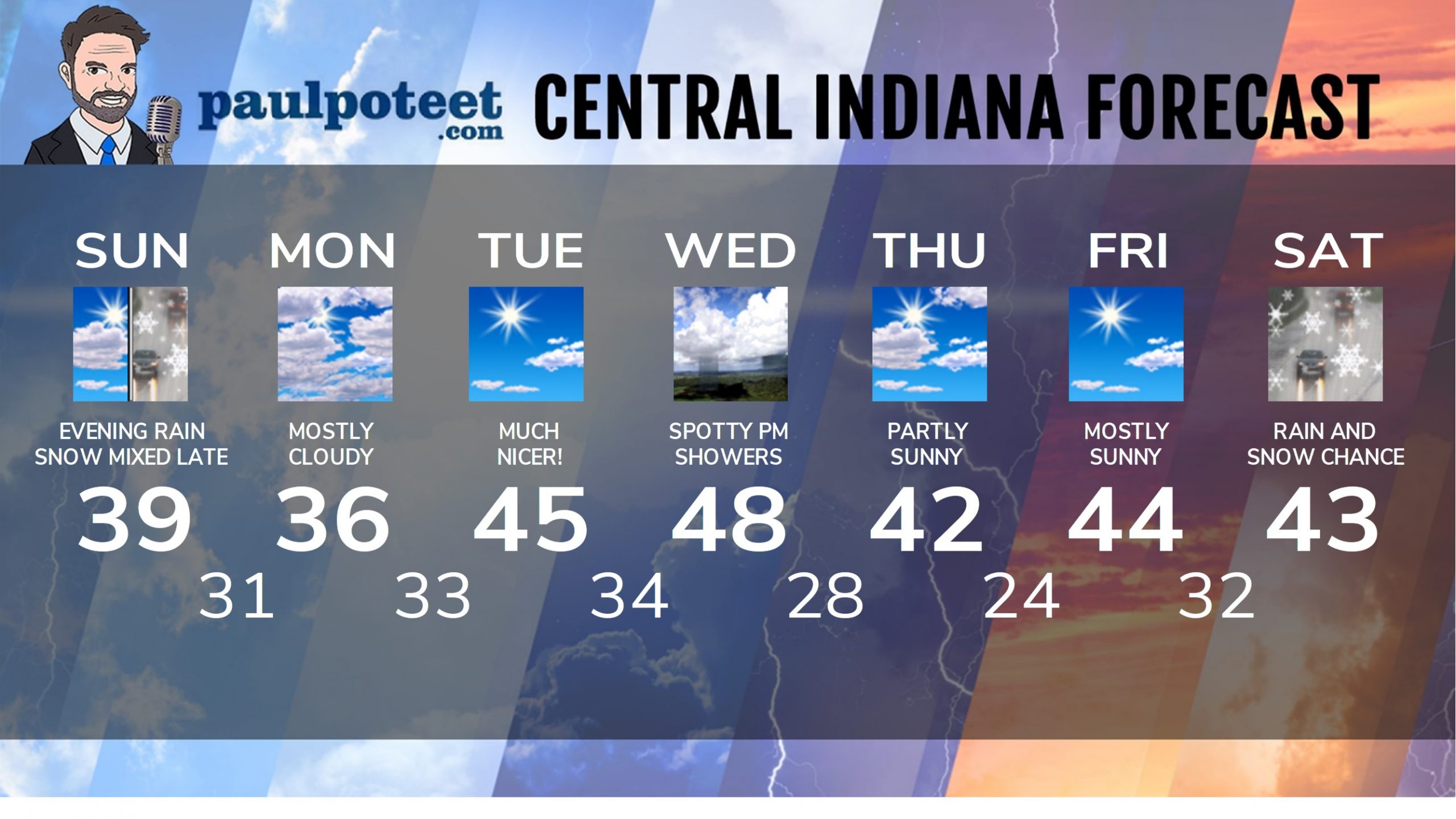
Today: Mostly cloudy. Wind gusting to 25 mph. High 39.
Tonight: Rainy. Snow may mix in north of Indy. Little or no accumulation. Wind gusting to 25 mph. Low 31.
Monday: Mostly cloudy. Wind gusting to 25 mph. High 36.
Monday Night: Partly cloudy. Low 33.
Tuesday: Mostly sunny. High 45.
Tuesday Night: Partly cloudy. Low 34.
Wednesday: Partly sunny. Spotty showers possible. High 48.
Wednesday Night: Mostly cloudy. A few snow showers possible in the evening. Low 28.
Thursday: Partly sunny. High 42.
Thursday Night: Partly cloudy. Low 24.
Friday: Mostly sunny. High 44.
Friday Night: Partly cloudy. Low 32.
Saturday: Rain and snow showers. High 43.
Never miss me! Subscribe for free. My Huge Radar has real-time weather tracking, current temperatures, and severe weather watches and warnings. Get detailed Indiana conditions by clicking here. Click here to see my central Indiana 7-Day Forecast. Follow these links to get my forecasts for Lafayette, Muncie, Hendricks County, and Hamilton County. Need a second opinion? Click here for central Indiana National Weather Service forecasts. (Some charts via WeatherBELL.)


Holy Moley it’s a heat wave! Bring on the shorts! 🤣