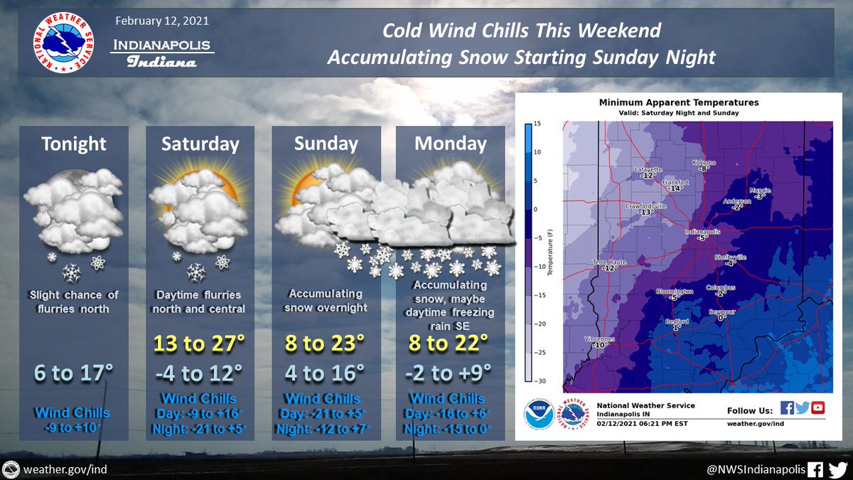
(Via @NWSIndianapolis.) Flurries at most into Sunday w/ cold temps. Wind chills at worst Sat night into Sun w/ readings -21 to +5°, coldest NW central IN. Accumulating snow Sun night thru Mon night. Winter Storm Watch late Sun night to Tue. Prepare now for cold and difficult travel. #INwx #nwsind https://t.co/dOpXVqZPK1
My Huge Radar has real-time weather tracking, current temperatures, and severe weather watches and warnings. Get detailed Indiana conditions by clicking here. Follow these links to get my forecasts for Lafayette, Muncie, Hendricks County, and Hamilton County. Need a second opinion? Click here for central Indiana National Weather Service forecasts.
Never miss me! Subscribe for free. My Huge Radar has real-time weather tracking, current temperatures, and severe weather watches and warnings. Get detailed Indiana conditions by clicking here. Click here to see my central Indiana 7-Day Forecast. Follow these links to get my forecasts for Lafayette, Muncie, Hendricks County, and Hamilton County. Need a second opinion? Click here for central Indiana National Weather Service forecasts. (Some charts via WeatherBELL.)


