Watch your step and your tires in the midday and afternoon today in central Indiana. A large low pressure system will be moving through the Midwest. The sequence: snow showers, sleet, freezing rain, and rain. The chance for freezing rain will linger into the evening north of Indianapolis.

Never miss me! Subscribe for free. My Huge Radar has real-time weather tracking, current temperatures, and severe weather watches and warnings. Get detailed Indiana conditions by clicking here. Click here to see my central Indiana 7-Day Forecast. Follow these links to get my forecasts for Lafayette, Muncie, Hendricks County, and Hamilton County. Need a second opinion? Click here for central Indiana National Weather Service forecasts. (Some charts via WeatherBELL.)
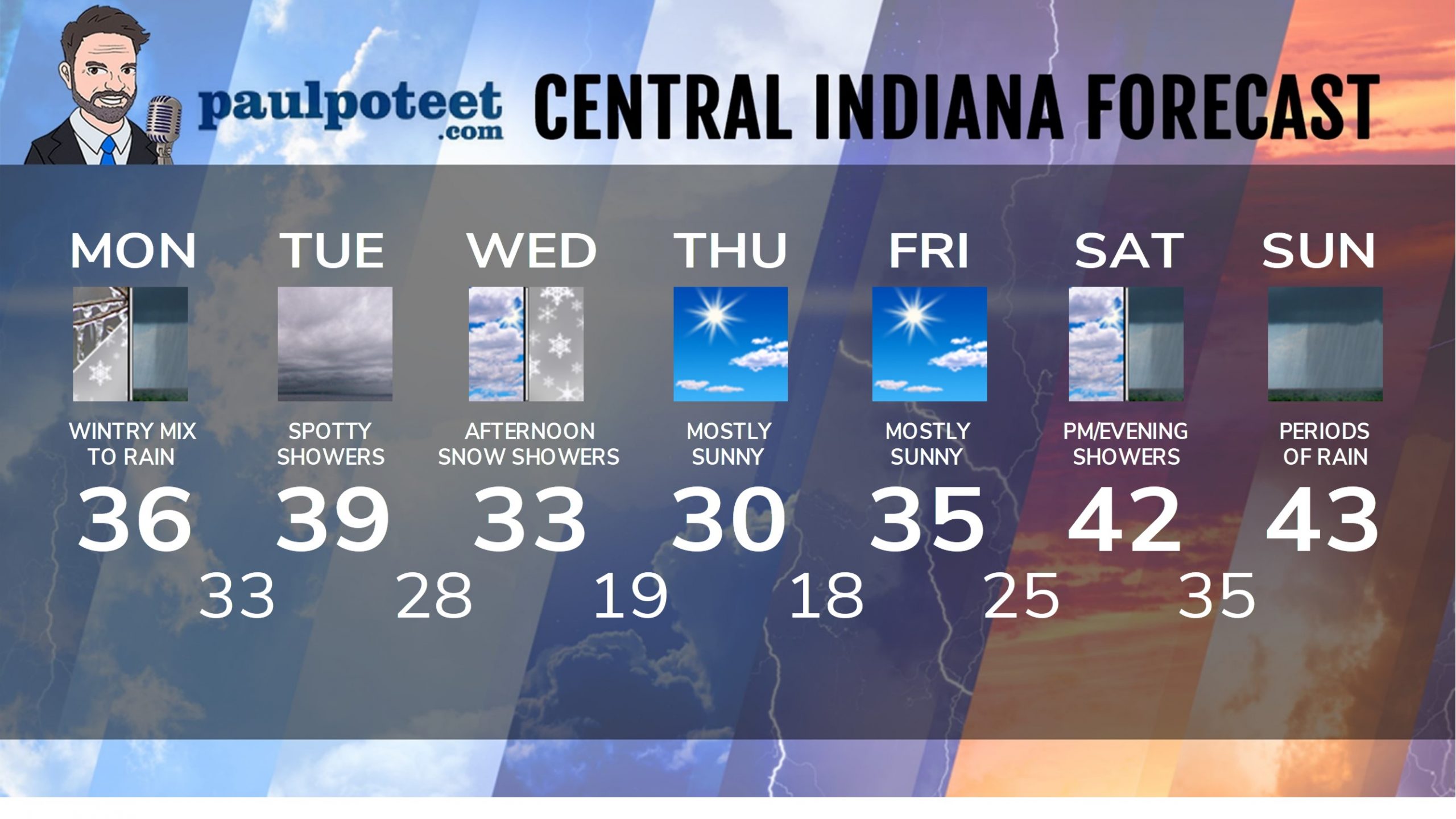
INDY SEVEN DAY FORECAST
Today: Mid to late morning wintry mix of snow and sleet leads to freezing rain and rain by afternoon. Around an inch of snow and sleet. High 36.
Tonight: Rain showers. Low 33.
Tuesday: Cloudy. Spotty rain showers. High 39.
Tuesday Night: Mostly cloudy. Low 28.
Wednesday: Mostly cloudy. Snow showers in the afternoon. High 33.
Wednesday Night: Mostly cloudy. Low 19.
Thursday: Mostly sunny. High 30.
Thursday Night: Mostly clear. Low 18.
Friday: Mostly sunny. High 35.
Friday Night: Partly cloudy. Low 25.
Saturday: Showers likely. High 42.
Saturday Night: Rainy. Low 35.
Sunday: Periods of rain. High 43.
Never miss me! Subscribe for free. My Huge Radar has real-time weather tracking, current temperatures, and severe weather watches and warnings. Get detailed Indiana conditions by clicking here. Click here to see my central Indiana 7-Day Forecast. Follow these links to get my forecasts for Lafayette, Muncie, Hendricks County, and Hamilton County. Need a second opinion? Click here for central Indiana National Weather Service forecasts. (Some charts via WeatherBELL.)


