Two rounds of wintry weather for central Indiana. The first arrives from the southwest from the predawn hours through daybreak Sunday morning. Expect some snow showers mixing with and changing to freezing rain, finally mixing with and changing to rain before diminishing in the afternoon.
The greatest impacts are expected across southern portions of central Indiana.
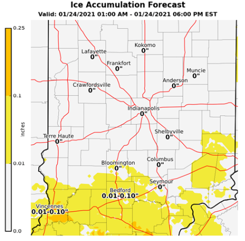
Ice accumulations are expected to be less than a tenth of an inch with a few tenths of an inch of snow. This will cause a thin layer of ice on untreated surfaces and will likely result in slick spots on roads, bridges and overpasses through early afternoon Sunday.
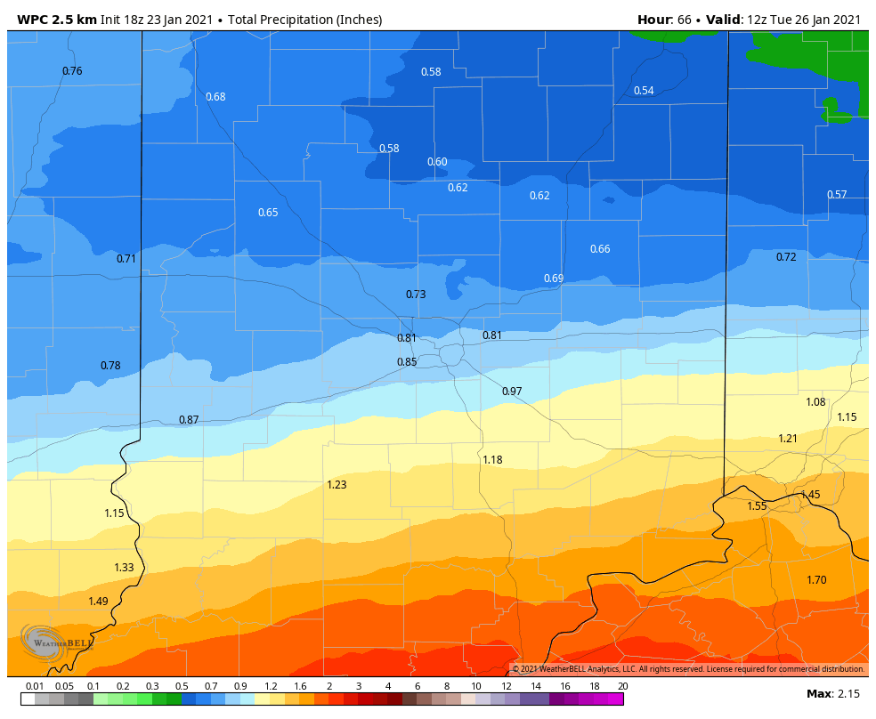
Another round of freezing rain looks likely Monday morning, especially north of I-70. The freezing rain will change over to rain by late morning, but Monday morning drive-time could certainly be slippery.
Monday moisture will range from a half-inch to over an inch of rain from north to south across central Indiana.
Never miss me! Subscribe for free. My Huge Radar has real-time weather tracking, current temperatures, and severe weather watches and warnings. Get detailed Indiana conditions by clicking here. Click here to see my central Indiana 7-Day Forecast. Follow these links to get my forecasts for Lafayette, Muncie, Hendricks County, and Hamilton County. Need a second opinion? Click here for central Indiana National Weather Service forecasts. (Some charts via WeatherBELL.)
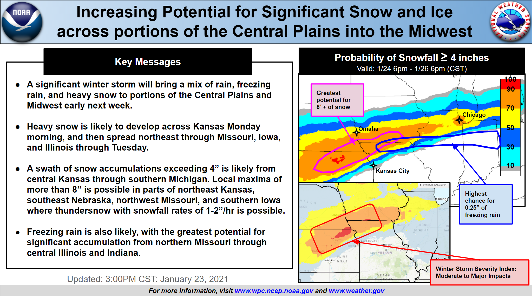
Snow lovers still gotta go elsewhere, I’m afraid. The image below (click here to enlarge) shows national impacts through Monday.
Never miss me! Subscribe for free. My Huge Radar has real-time weather tracking, current temperatures, and severe weather watches and warnings. Get detailed Indiana conditions by clicking here. Click here to see my central Indiana 7-Day Forecast. Follow these links to get my forecasts for Lafayette, Muncie, Hendricks County, and Hamilton County. Need a second opinion? Click here for central Indiana National Weather Service forecasts. (Some charts via WeatherBELL.)


