A couple of things to note on this visible satellite loop. First, the “lumpy” looking clouds to the east are associated with the trough of low pressure that brought some overnight precipitation to central Indiana. The solid gray area indicates the deck of low clouds across all of Indiana in the morning. That area of solid gray breaks up in Illinois. From there westward you’ll note the snow pack on the ground where there is gray with the outline of rivers within the gray. The clearing *could* work into Indiana (especially the western third of the state) this afternoon.

Never miss me! Subscribe for free. My Huge Radar has real-time weather tracking, current temperatures, and severe weather watches and warnings. Get detailed Indiana conditions by clicking here. Click here to see my central Indiana 7-Day Forecast. Follow these links to get my forecasts for Lafayette, Muncie, Hendricks County, and Hamilton County. Need a second opinion? Click here for central Indiana National Weather Service forecasts. (Some charts via WeatherBELL.)
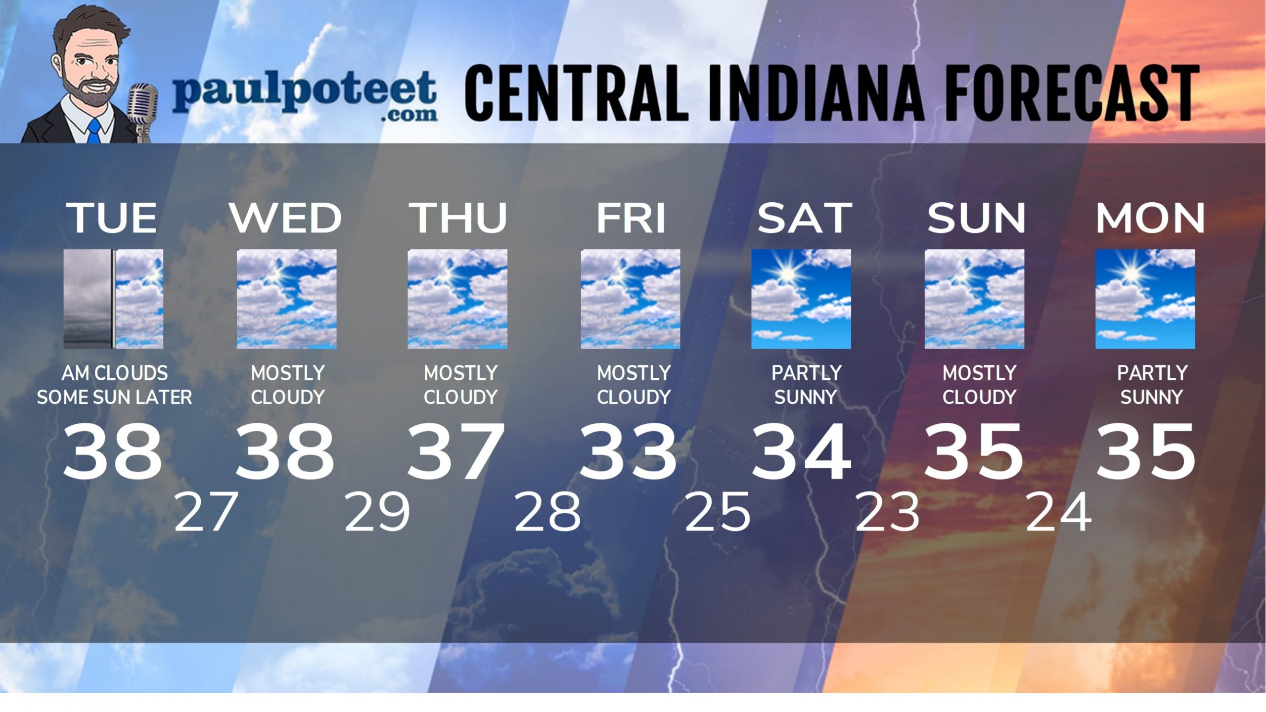
INDY SEVEN DAY FORECAST
Today: Cloudy, foggy morning. Breaks in the clouds are possible later in the afternoon. Cooler. High 38.
Tonight: Partly cloudy. Low 27.
Wednesday: Patches of morning fog. Mostly cloudy. High 38.
Wednesday Night: Mostly cloudy. Low 29.
Thursday: Mostly cloudy. High 37.
Thursday Night: Cloudy. Low 28.
Friday: Mostly cloudy. High 33.
Friday Night: Mostly cloudy. Low 25.
Saturday: Partly sunny. High 34.
Saturday Night: Partly cloudy. Low 23.
Sunday: Partly to mostly cloudy. High 35.
Sunday Night: Partly cloudy. Low 24.
Monday: Partly sunny. High 35.
Never miss me! Subscribe for free. My Huge Radar has real-time weather tracking, current temperatures, and severe weather watches and warnings. Get detailed Indiana conditions by clicking here. Click here to see my central Indiana 7-Day Forecast. Follow these links to get my forecasts for Lafayette, Muncie, Hendricks County, and Hamilton County. Need a second opinion? Click here for central Indiana National Weather Service forecasts. (Some charts via WeatherBELL.)


