Fog is thick Monday morning over some of the same areas (the northern Wabash Valley) that saw accumulating snow early Sunday.
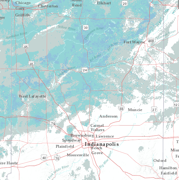
Here are some totals:
2.7″ Peru
2.5″ Logansport
2.3″ West Lafayette
2.1″ Kokomo
1.8″ Lafayette
1.5″ Hartford City
1.3″ Frankfort
Another round of rain and snow showers will be around later this evening and overnight around Lafayette, and overnight into early Tuesday morning over the rest of central Indiana.
Never miss me! Subscribe for free. My Huge Radar has real-time weather tracking, current temperatures, and severe weather watches and warnings. Get detailed Indiana conditions by clicking here. Click here to see my central Indiana 7-Day Forecast. Follow these links to get my forecasts for Lafayette, Muncie, Hendricks County, and Hamilton County. Need a second opinion? Click here for central Indiana National Weather Service forecasts. (Some charts via WeatherBELL.)
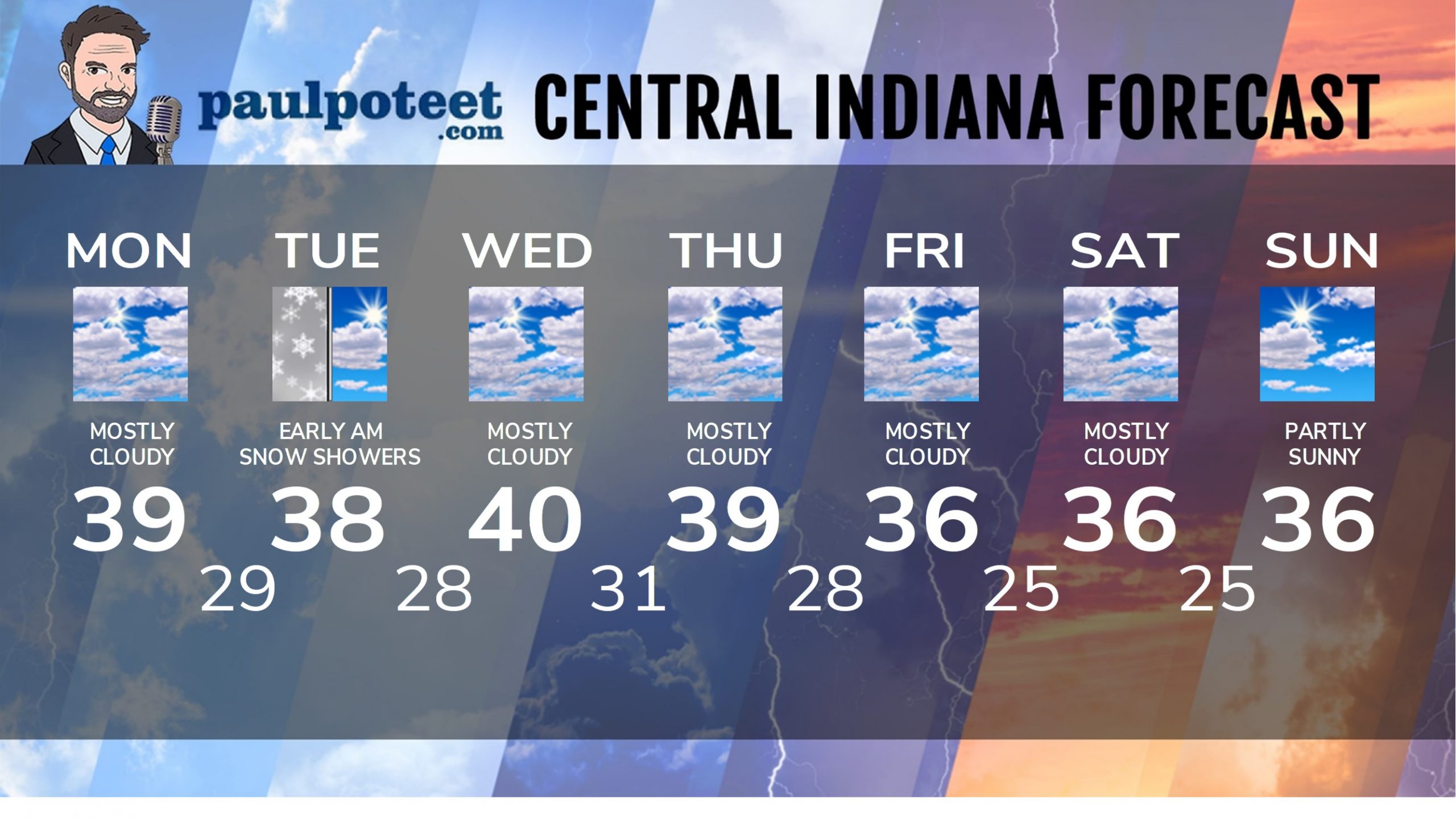
INDY SEVEN DAY FORECAST
Today: Patchy morning fog, then mostly cloudy. High 39.
Tonight: Mostly cloudy. Flurries and snow showers after midnight. Low 29.
Tuesday: Early morning flurries or snow showers, then mostly cloudy in the
morning. Partly sunny in the afternoon. High 38.
Tuesday Night: Partly cloudy. Low 28.
Wednesday: Mostly cloudy. High 40.
Wednesday Night: Mostly cloudy. Low 31.
Thursday: Mostly cloudy. High 39.
Thursday Night: Cloudy. Low 28.
Friday: Mostly cloudy. High 36.
Friday Night: Mostly cloudy. Low 25.
Saturday: Mostly cloudy. High 36.
Never miss me! Subscribe for free. My Huge Radar has real-time weather tracking, current temperatures, and severe weather watches and warnings. Get detailed Indiana conditions by clicking here. Click here to see my central Indiana 7-Day Forecast. Follow these links to get my forecasts for Lafayette, Muncie, Hendricks County, and Hamilton County. Need a second opinion? Click here for central Indiana National Weather Service forecasts. (Some charts via WeatherBELL.)


