Rain totals through 2pm in central Indiana generally range from a third to a half an inch.
.44″ Terre Haute
.43″ Bloomington
.35″ Lafayette
.30″ Indianapolis
.27″ Kokomo
.25″ Muncie
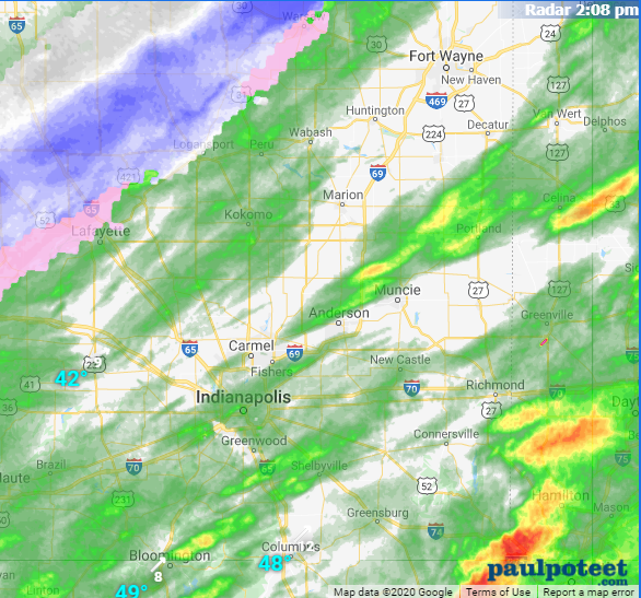
The rain to snow crossover will begin this afternoon in Lafayette and work southeastward through the late afternoon and early evening. Because of the recent/current temperature profiles I’m not expecting any big travel trouble. (That’ll come Friday morning!)
Never miss me! Subscribe for free. My Huge Radar has real-time weather tracking, current temperatures, and severe weather watches and warnings. Get detailed Indiana conditions by clicking here. Click here to see my central Indiana 7-Day Forecast. Follow these links to get my forecasts for Lafayette, Muncie, Hendricks County, and Hamilton County. Need a second opinion? Click here for central Indiana National Weather Service forecasts. (Some charts via WeatherBELL.)
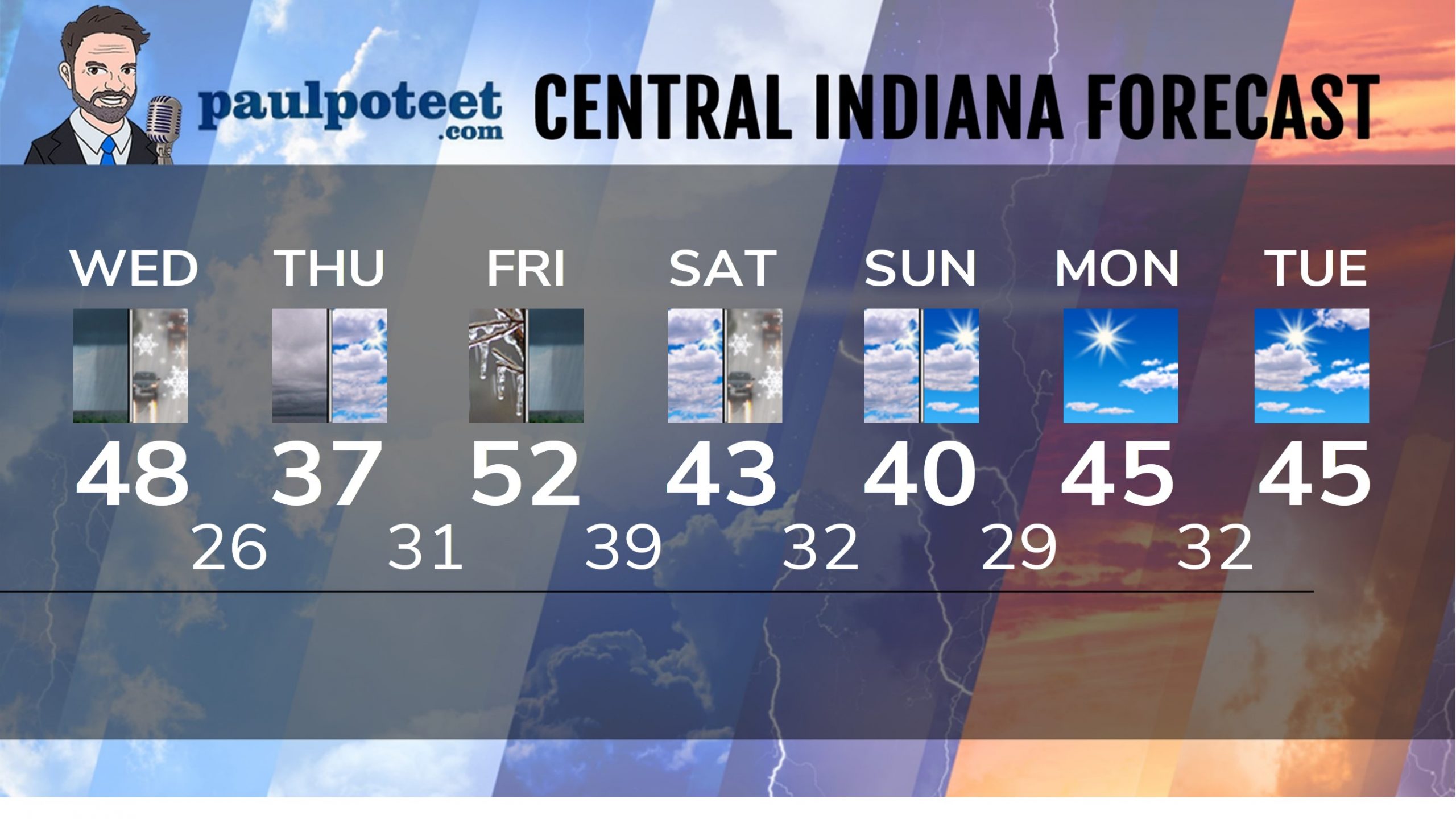
INDY SEVEN DAY FORECAST
Today: Rain by mid-morning. High 48.
Tonight: Rain, mixing with a little snow as it ends this evening. Mostly cloudy overnight. Low 26.
Thursday: Cloudy to mostly cloudy. High 37.
New Years Eve: Partly cloudy evening. Freezing rain chance starts after about 3am. Low 31.
New Years Day: Freezing rain and rain in the morning. Rain in the afternoon. High 52.
Friday Night: Evening showers. Low 39.
Saturday: Mostly cloudy. High 43.
Saturday Night: Rain showers, possibly mixed with snow. Low 32.
Sunday: Mostly to partly cloudy. High 40.
Sunday Night: Partly cloudy. Low 29.
Monday: Mostly sunny. High 45.
Monday Night: Partly cloudy. Low 32.
Tuesday: Partly sunny. High 45.
Never miss me! Subscribe for free. My Huge Radar has real-time weather tracking, current temperatures, and severe weather watches and warnings. Get detailed Indiana conditions by clicking here. Click here to see my central Indiana 7-Day Forecast. Follow these links to get my forecasts for Lafayette, Muncie, Hendricks County, and Hamilton County. Need a second opinion? Click here for central Indiana National Weather Service forecasts. (Some charts via WeatherBELL.)


