A little above average today, and a little more tomorrow, ahead of this Christmas Storm.
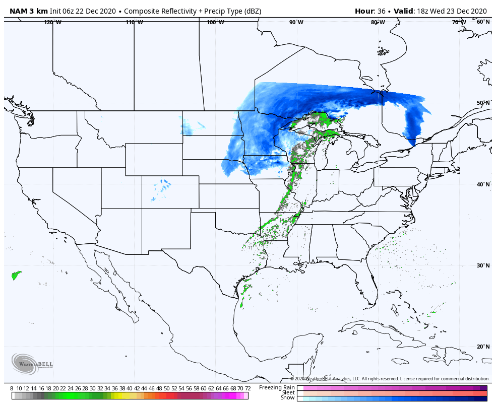
It brings us rain Wednesday night, and then some snow after midnight into Thursday morning. Not much, but maybe a little fresh white on the ground into Christmas morning. It sure ain’t gonna melt. These are potential Christmas morning chills.

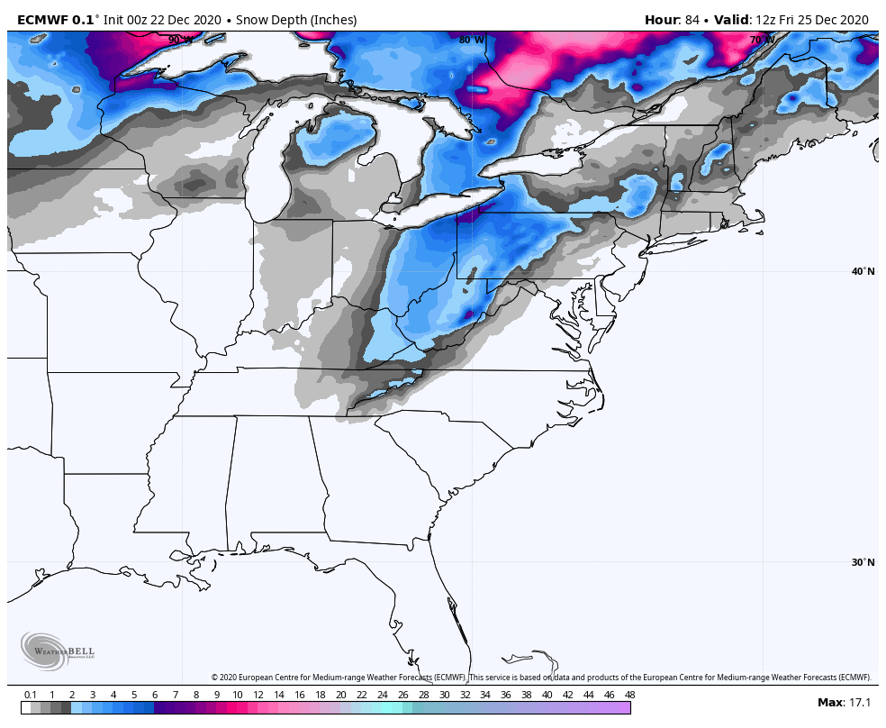
And this is one computer-modeled view of Christmas morning snow cover.
Never miss me! Subscribe for free. My Huge Radar has real-time weather tracking, current temperatures, and severe weather watches and warnings. Get detailed Indiana conditions by clicking here. Click here to see my central Indiana 7-Day Forecast. Follow these links to get my forecasts for Lafayette, Muncie, Hendricks County, and Hamilton County. Need a second opinion? Click here for central Indiana National Weather Service forecasts. (Some charts via WeatherBELL.)
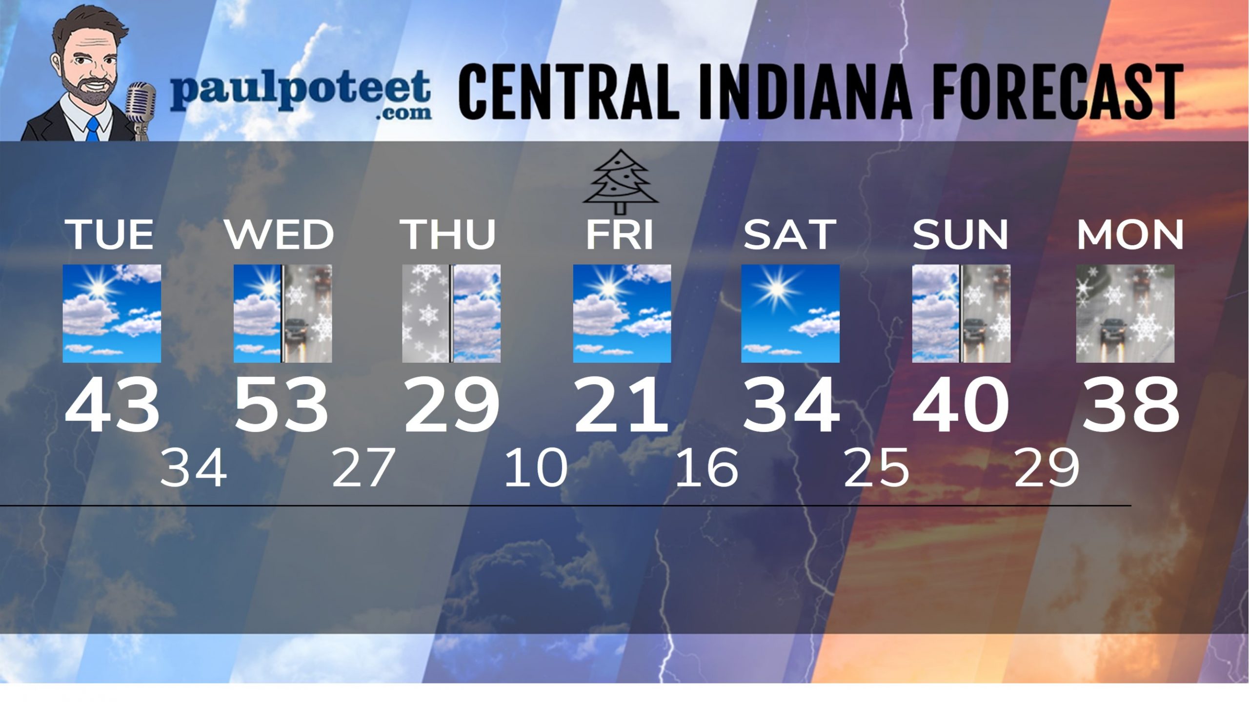
INDY SEVEN DAY FORECAST
Today: Partly sunny. High 43.
Tonight: Partly cloudy. Low 34.
Wednesday: Partly cloudy morning. Scattered afternoon showers. Wind gusting to 40 mph. High 53.
Wednesday Night: Rainy evening. Rain and snow overnight. Low 27.
Thursday: Mostly cloudy with a few flurries. High 29.
Christmas Eve: Mostly cloudy. A few flurries. Low 10.
Christmas Day: Partly sunny. High 21.
Friday Night: Mostly clear. Low 16.
Saturday: Mostly sunny. High 34.
Saturday Night: Partly cloudy. Low 25.
Sunday: Clouds increase. Late day showers. High 40.
Sunday Night: Mostly cloudy. Snow and rain showers. Low 29.
Monday: Mostly cloudy. Snow and rain showers. High 38.
Never miss me! Subscribe for free. My Huge Radar has real-time weather tracking, current temperatures, and severe weather watches and warnings. Get detailed Indiana conditions by clicking here. Click here to see my central Indiana 7-Day Forecast. Follow these links to get my forecasts for Lafayette, Muncie, Hendricks County, and Hamilton County. Need a second opinion? Click here for central Indiana National Weather Service forecasts. (Some charts via WeatherBELL.)


