Frosty mornings Friday and Saturday, with the coolest temperatures of the season so far.
FRIDAY LOWS
23 (!) Crawfordsville
26 Frankfort
27 Greencastle & T Haute
28 Martinsville
30 Lafayette, Kokomo, Columbus
31 Bloomington, Anderson
32 Shelbyville
33 Indy and Muncie
Never miss me! Subscribe for free. My Huge Radar has real-time weather tracking, current temperatures, and severe weather watches and warnings. Get detailed Indiana conditions by clicking here. Click here to see my central Indiana 7-Day Forecast. Follow these links to get my forecasts for Lafayette, Muncie, Hendricks County, and Hamilton County. Need a second opinion? Click here for central Indiana National Weather Service forecasts. (Some charts via WeatherBELL.)
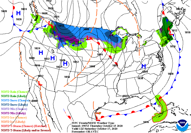
High pressure is large and in charge over the southern Plains sending a light westerly wind over the state Friday.

It moves to the east Saturday, changing the wind back to a more southerly direction, helping to send highs back in the 60s.
THURSDAY RAINFALL
0.22″ Muncie
0.18″ Indy (most in one day in almost two months!)
0.16″ Terre Haute
0.14″ Bloomington
0.05″ Lafayette
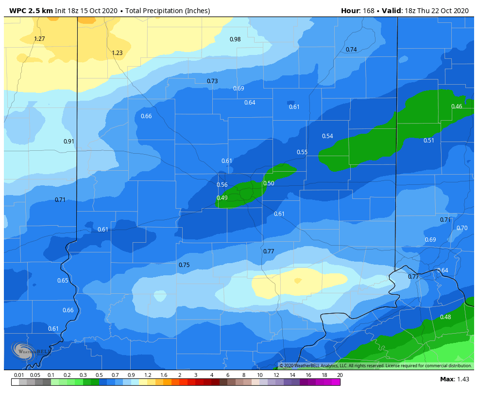
Our next chance of precipitation comes with a cold front Sunday afternoon and evening. It’s the first of several chances, which could bring a total of around a half inch of precipitation over through next Thursday. (Graphic via WeatherBELL.)
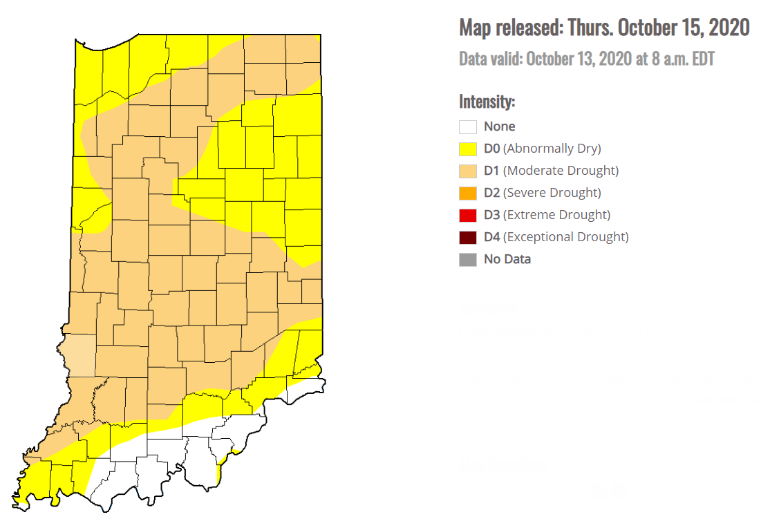
We need every drop, as confirmed by the latest Drought Monitor.
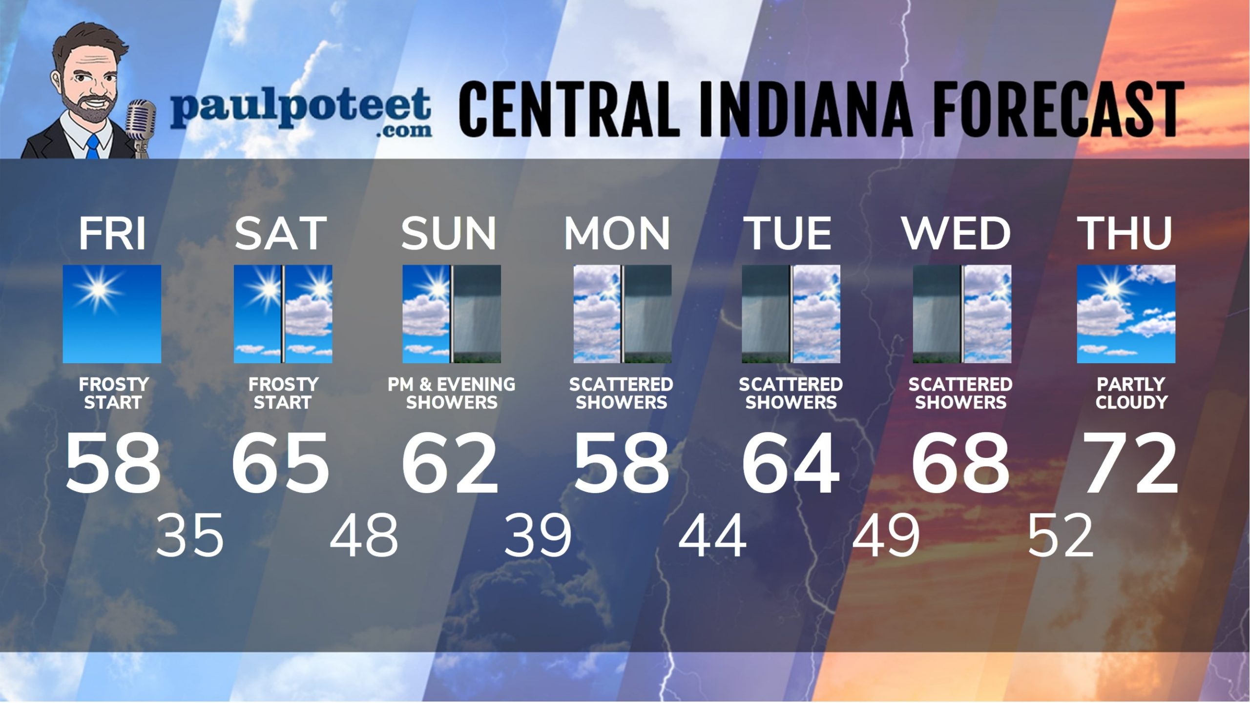
INDY SEVEN DAY FORECAST
Today: Morning frost, then sunny. High 58.
Tonight: Mostly clear. Low 35.
Saturday: Morning frost. Mostly to partly sunny. Wind gusts to 35 mph in the afternoon. High 65.
Saturday Night: Partly cloudy. Wind gusting to 30 mph. Low 48.
Sunday: Partly to mostly cloudy. Scattered afternoon showers. High 62.
Sunday Night: Mostly cloudy. Spotty showers. Low 39.
Monday: Mostly cloudy, with scattered showers, mainly in the afternoon. High 58.
Monday Night: Mostly cloudy. Low 44.
Tuesday: Mostly cloudy, with spotty showers, mainly in the morning. High 64.
Tuesday Night: Mostly cloudy, with spotty showers. Low 49.
Wednesday: Mostly cloudy, with scattered showers, mainly in the morning. High 68.
Wednesday Night: Partly cloudy. Low 52.
Thursday: Partly sunny. High 72.
Never miss me! Subscribe for free. My Huge Radar has real-time weather tracking, current temperatures, and severe weather watches and warnings. Get detailed Indiana conditions by clicking here. Click here to see my central Indiana 7-Day Forecast. Follow these links to get my forecasts for Lafayette, Muncie, Hendricks County, and Hamilton County. Need a second opinion? Click here for central Indiana National Weather Service forecasts. (Some charts via WeatherBELL.)


