Blame “Delta” for the clouds that will be around this weekend. They’ll be thickest east and south of Indy.
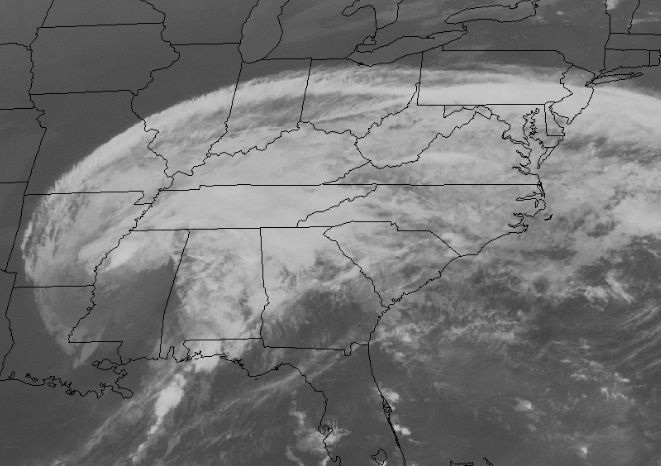
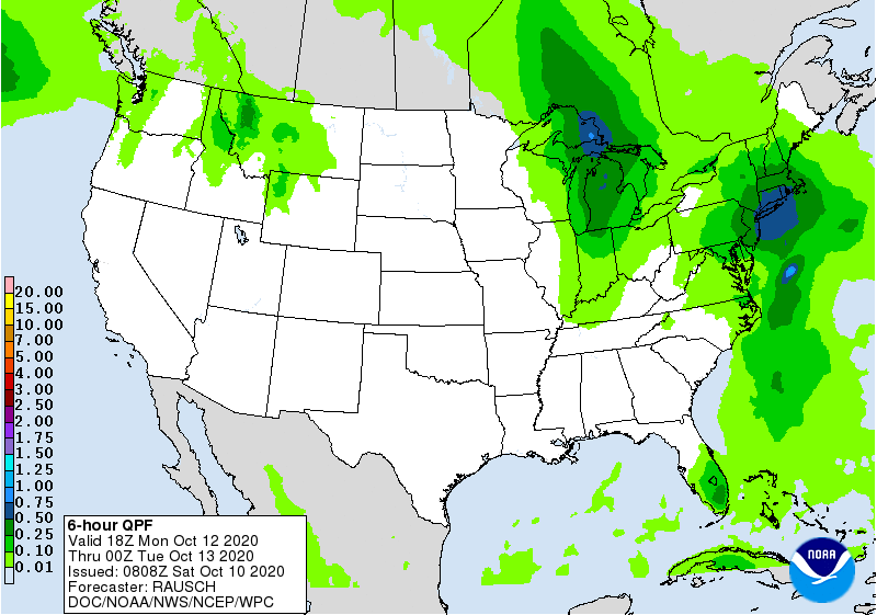
A few showers could pop Sunday morning east of Indianapolis as the remnant circulation exits eastward, but our next best chance of rain comes with an old fashioned front Monday afternoon. Hardly a drought-buster, though. Less than a quarter of an inch of precipitation expected.

Next chance is Thursday. Should be a decent system that will send us back below average. Maybe we can squeeze some showers then.
INDY SEVEN DAY FORECAST
Saturday: Mostly cloudy. High 81.
Saturday Night: Mostly cloudy. Low 61.
Sunday: Mostly cloudy in the morning. Partly cloudy in the afternoon. An isolated shower is possible. High 78.
Sunday Night: Partly cloudy. Low 62.
Columbus Day: Partly to mostly cloudy. Scattered showers and storms in the afternoon. High 77.
Monday Night: Scattered showers. Low 46.
Tuesday: Back to sunshine. High 72.
Tuesday Night: Mostly clear. Low 46.
Wednesday: Mostly sunny. High 73.
Wednesday Night: Mostly clear. Low 51.
Thursday: Mostly cloudy. Scattered showers. High 67.
Thursday Night: Showers early, then clearing. Low 37.
Friday: Mostly sunny and cooler. High 54.
Never miss me! Subscribe for free. My Huge Radar has real-time weather tracking, current temperatures, and severe weather watches and warnings. Get detailed Indiana conditions by clicking here. Click here to see my central Indiana 7-Day Forecast. Follow these links to get my forecasts for Lafayette, Muncie, Hendricks County, and Hamilton County. Need a second opinion? Click here for central Indiana National Weather Service forecasts. (Some charts via WeatherBELL.)


Indiana’s Weather For The Weekend: Blame “Delta” for the clouds that will be around this weekend. They’ll be thicke… https://t.co/0IeojZr24d
RT @PaulPoteet: Indiana’s Weather For The Weekend: Blame “Delta” for the clouds that will be around this weekend. They’ll be thickest east…