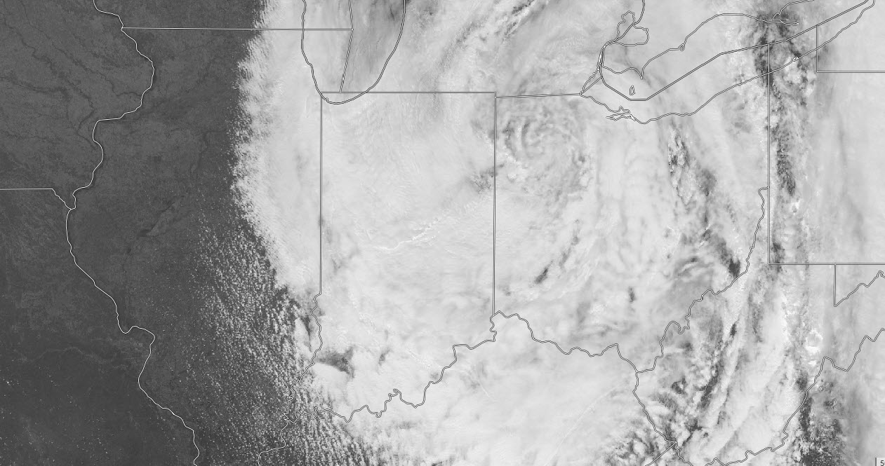
An upper level low over the Great Lakes sits and spins, bringing us clouds and cool breezes, with a few spotty showers to boot.
It’s fitting that the last day of this month would be below average. We’re running about two degrees below average and that’s the first month below average since last November.
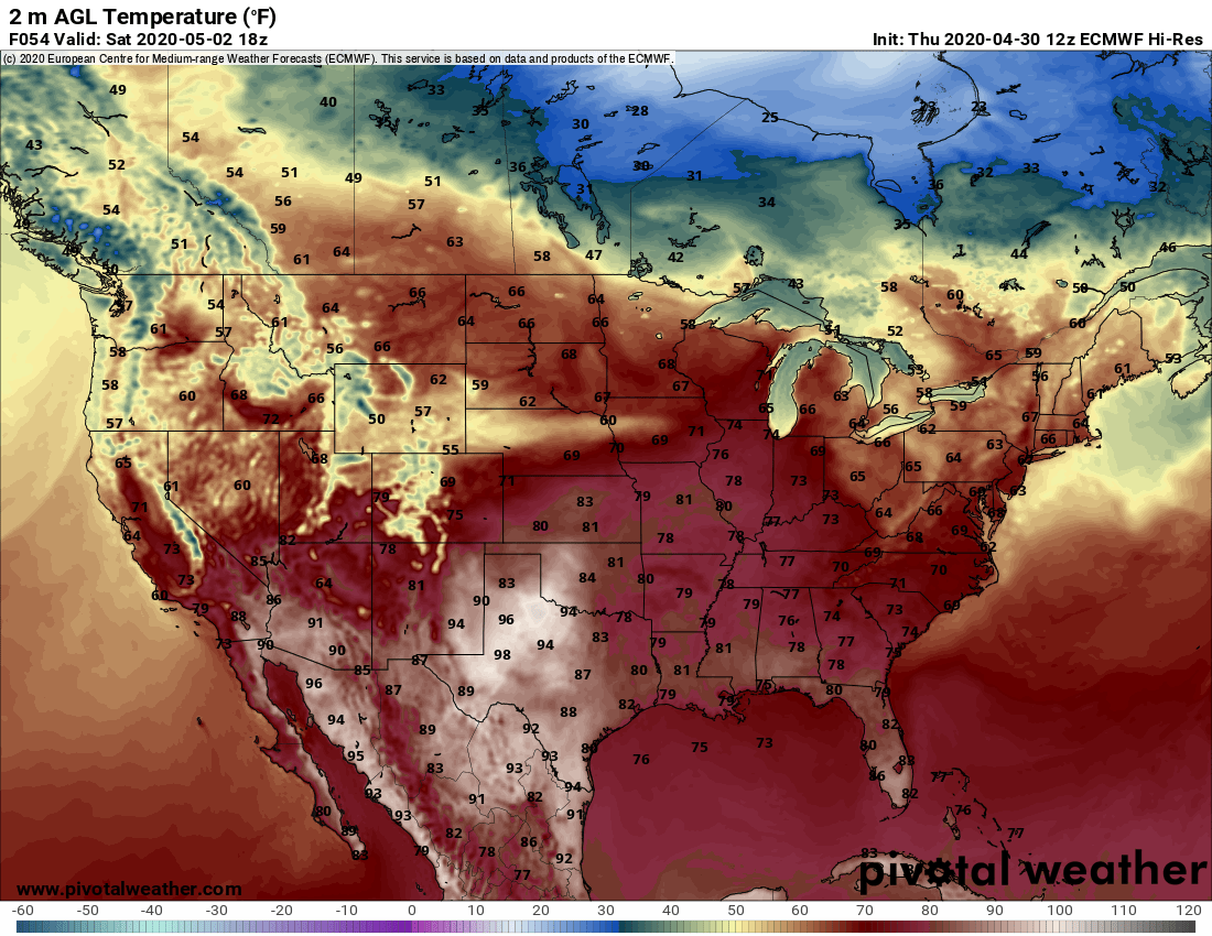
Tomorrow: it’s gonna be May. And it’s gonna be warmer, for a few days. Take a look at Saturday!
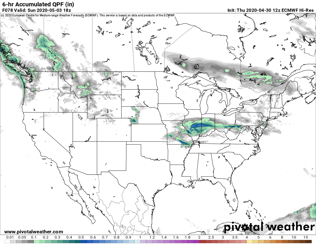
The next big shower and storm chance comes mainly during the daytime Sunday. Bookmark My Huge Radar for radar and warnings!
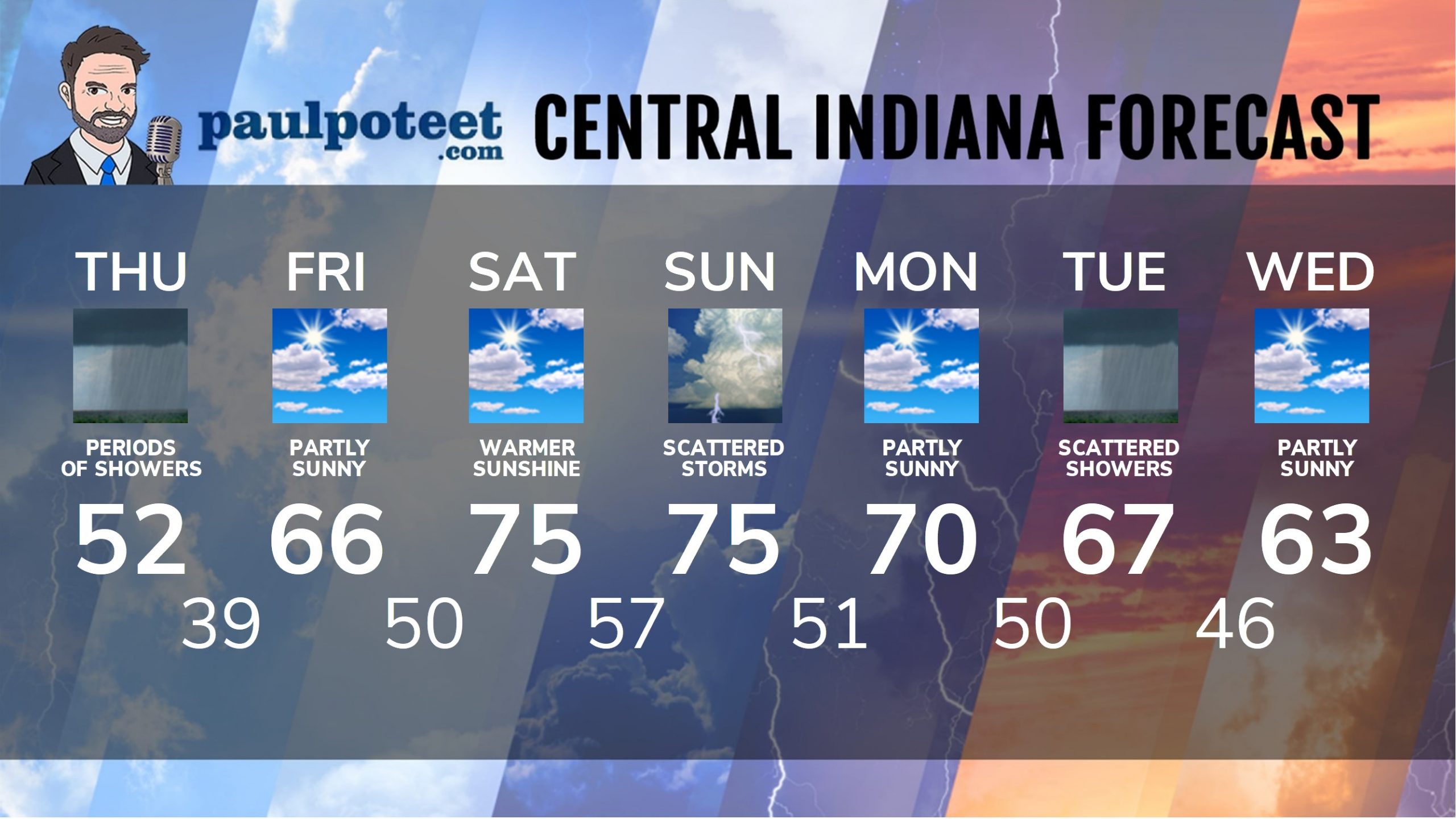
INDY SEVEN DAY FORECAST
Today: Cloudy and cooler, with periods of showers. Wind gusting to 30 mph. High 52.
Tonight: Showers end by mid-evening. Partly cloudy overnight. Low 39.
Friday: Partly to mostly sunny. High 66.
Friday Night: Partly cloudy. Low 50.
Saturday: Partly sunny and warmer. High 75.
Saturday Night: Shower and storm chances late. Low 57.
Sunday: Partly cloudy with periods of showers and storms. High 75.
Sunday Night: Scattered showers and storms. Low 51.
Monday: Partly sunny. High 70.
Monday Night: Partly cloudy. Low 50.
Tuesday: Partly to mostly cloudy with scattered showers. High 67.
Tuesday Night: Scattered showers. Low 46.
Wednesday: Partly sunny. High 63.
Never miss me! Subscribe for free. My Huge Radar has real-time weather tracking, current temperatures, and severe weather watches and warnings. Get detailed Indiana conditions by clicking here. Click here to see my central Indiana 7-Day Forecast. Follow these links to get my forecasts for Lafayette, Muncie, Hendricks County, and Hamilton County. Need a second opinion? Click here for central Indiana National Weather Service forecasts. (Some charts via WeatherBELL.)


Indiana’s Weather For Thursday: An upper level low over the Great Lakes sits and spins, bringing us clouds and cool… https://t.co/n9WVCinhdd