A cold front crashes into Indiana early Monday evening, shutting down the 50s TFN, and setting us up for wind chills in the teens Tuesday!
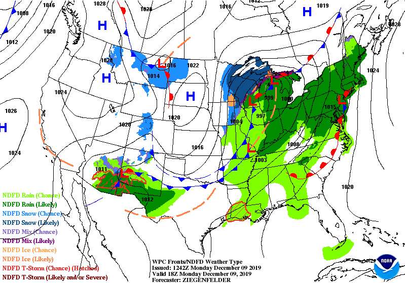
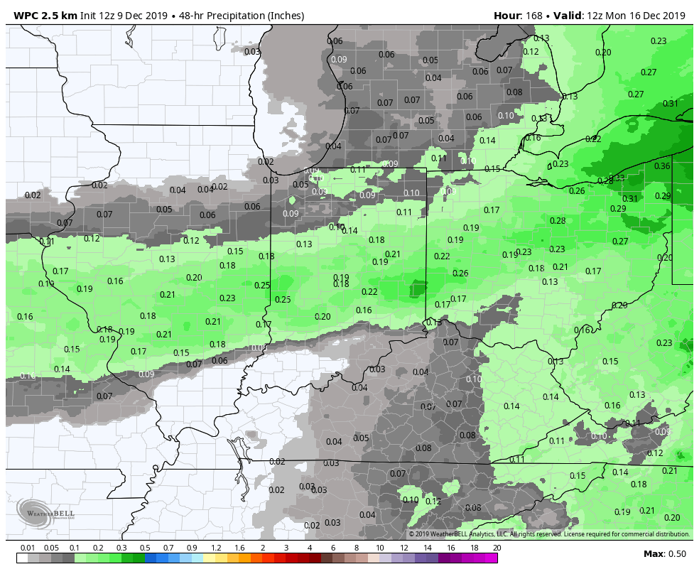
Central Indiana finishes with one-third to one-half of rain Monday, and stands to pick up a little more late Friday into Saturday.
WHITE CHRISTMAS WATCH
Snow showers are possible *next* Monday, with another chance Thursday. Neither one looks sticky–for the moment. Bit of a wild card the weekend the weekend before Christmas. Rain and/or snow and/or ice. Stay tuned!
INDY SEVEN DAY FORECAST
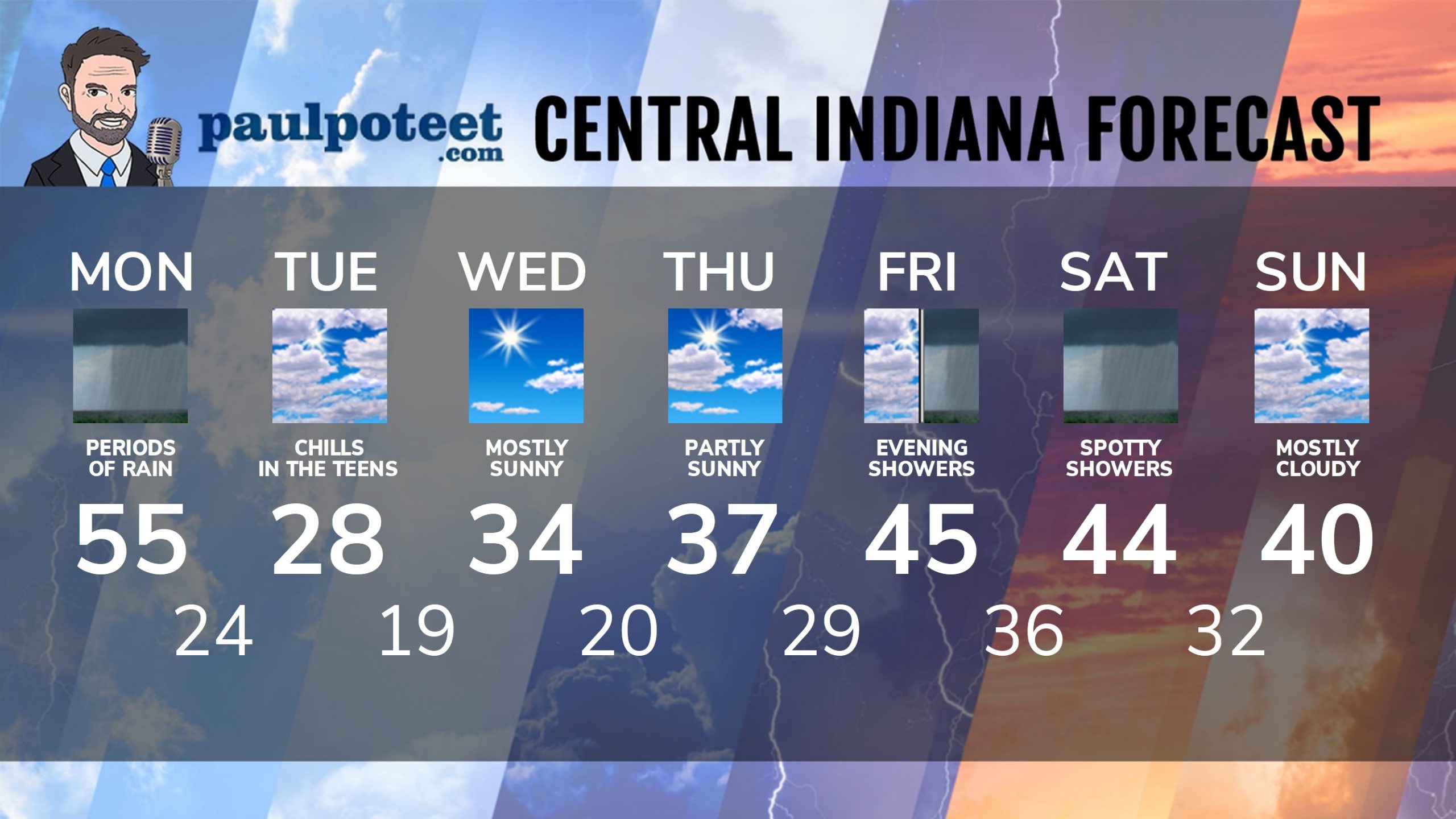
Monday: Rainy morning. Scattered afternoon showers. Wind gusting to 25 mph. High 55.
Monday Night: Scattered rain showers in the evening, then spotty rain and snow showers late. Low 24.
Tuesday: Mostly cloudy, with wind chills in the teens. High 28.
Tuesday Night: Clearing. Low 19.
Wednesday: Mostly sunny. High 34.
Wednesday Night: Partly cloudy. Low 20.
Thursday: Partly sunny. High 37.
Thursday Night: Partly cloudy. Low 29.
Friday: Partly to mostly cloudy. High 45.
Friday Night: Spotty rain showers. Low 36.
Saturday: Mostly cloudy with spotty showers. High 44.
Saturday Night: Rain and snow showers. Low 32.
Sunday: Mostly cloudy. High 40.
Never miss me! Subscribe for free. My Huge Radar has real-time weather tracking, current temperatures, and severe weather watches and warnings. Get detailed Indiana conditions by clicking here. Click here to see my central Indiana 7-Day Forecast. Follow these links to get my forecasts for Lafayette, Muncie, Hendricks County, and Hamilton County. Need a second opinion? Click here for central Indiana National Weather Service forecasts. (Some charts via WeatherBELL.)


Indiana’s Weather For The Week
A cold front crashes into Indiana early Monday evening, shutting down the 50s TFN,… https://t.co/SGvFy8SoR7