Thursday’s high of 50 at Indy was the biggest number since the day before Thanksgiving. Temps will go even higher for a few days before a cold front marches in on Monday.
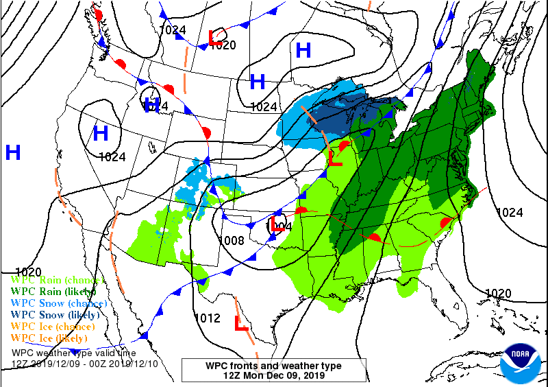
On that map green means rain and blue means snow. And that mean ol’ snow could mix in with the rain by Monday night as the cold front passes. We’re not expecting anything shovel-worthy.
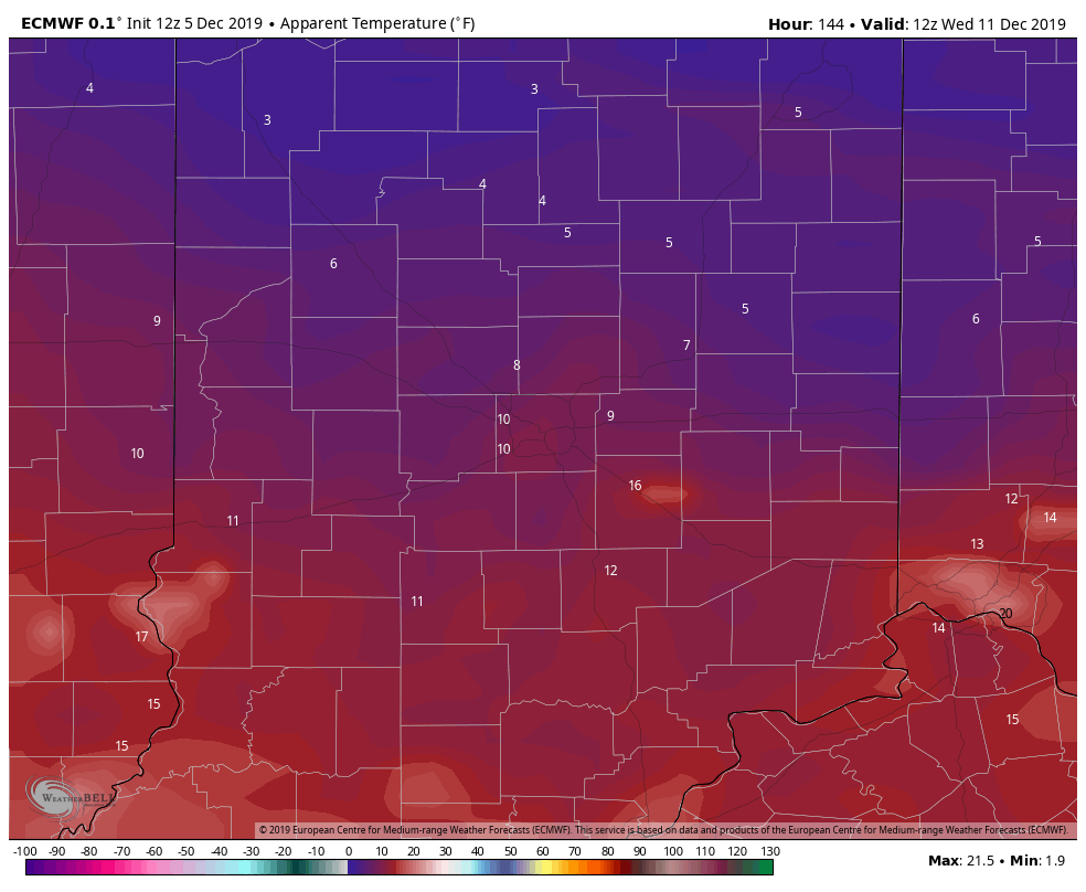
But temps will be wool-worthy! Here are computer-modeled wind chills for Wednesday, via WeatherBELL.
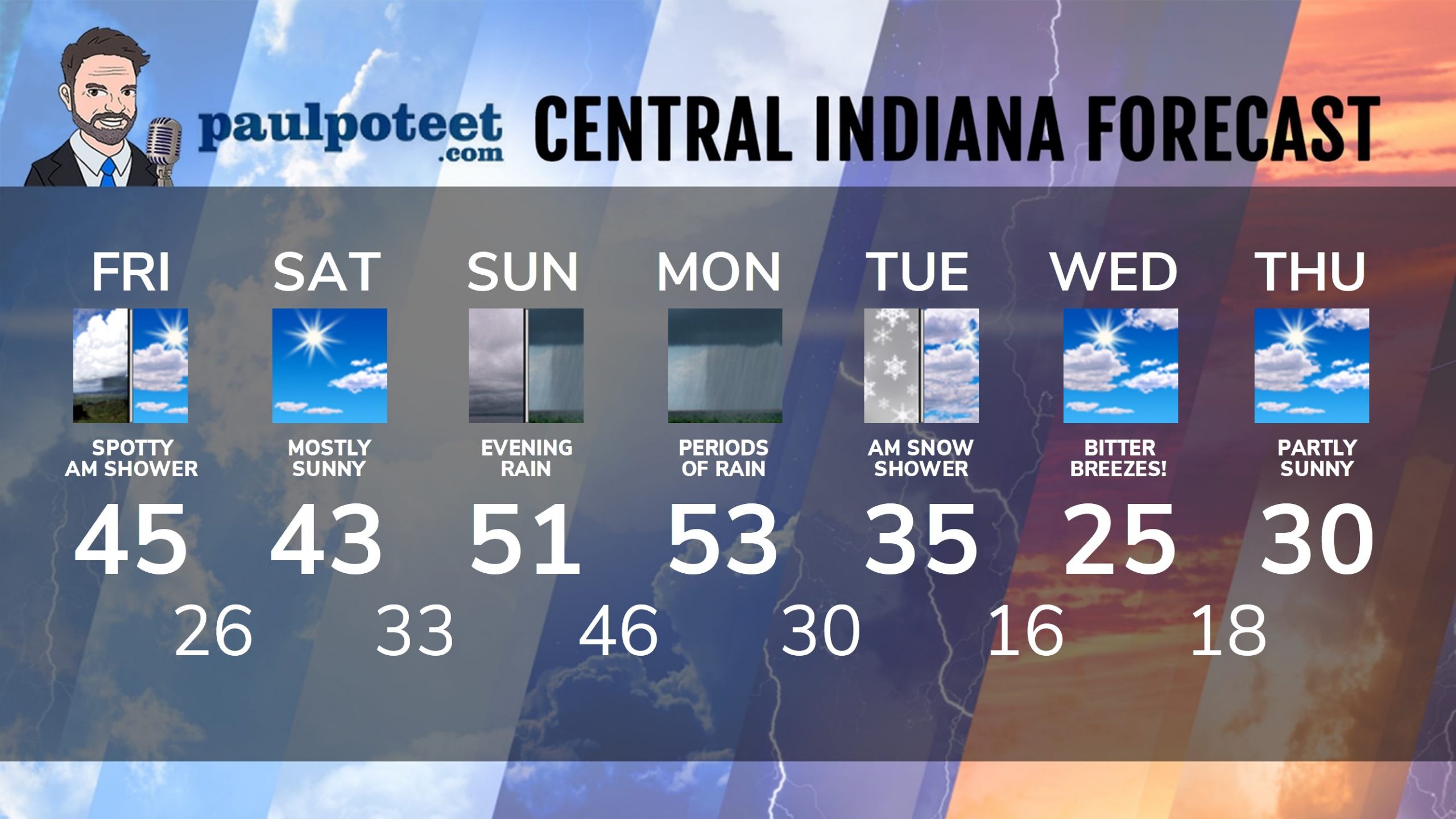
INDY SEVEN DAY FORECAST
Friday: Mostly cloudy morning, with a stray shower possible. Partly sunny afternoon. High 45.
Friday Night: Mostly clear. Low 26.
Saturday: Mostly sunny. High 43.
Saturday Night: Mostly clear. Low 33.
Sunday: Cloudy. High 51.
Sunday Night: Rainy. Low 46.
Monday: Rainy. High 53.
Monday Night: Showers, possibly mixed with snow. Low 30.
Tuesday: Mostly cloudy. Could be a few snow showers. High 35.
Tuesday Night: Partly cloudy. Low 16.
Wednesday: Partly sunny. High 25.
Wednesday Night: Partly cloudy. Low 18.
Thursday: Partly sunny. High 30.
Never miss me! Subscribe for free. My Huge Radar has real-time weather tracking, current temperatures, and severe weather watches and warnings. Get detailed Indiana conditions by clicking here. Click here to see my central Indiana 7-Day Forecast. Follow these links to get my forecasts for Lafayette, Muncie, Hendricks County, and Hamilton County. Need a second opinion? Click here for central Indiana National Weather Service forecasts. (Some charts via WeatherBELL.)


Indiana’s Weather For The Weekend
Thursday’s high of 50 at Indy was the biggest number since the day before Thank… https://t.co/0tGmOCXhOH
RT @PaulPoteet: Indiana’s Weather For The Weekend
Thursday’s high of 50 at Indy was the biggest number since the day before Thanksgiving.…