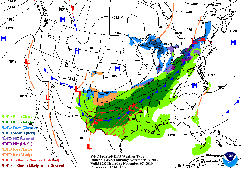
Little or no snow accumulation is expected today after the passage of a cold front overnight. Most of the moisture will have exited by midday, putting a stop to any rain or snow showers.
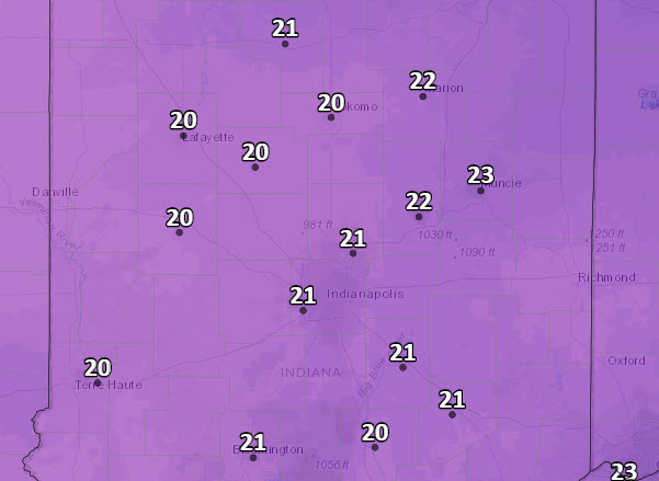
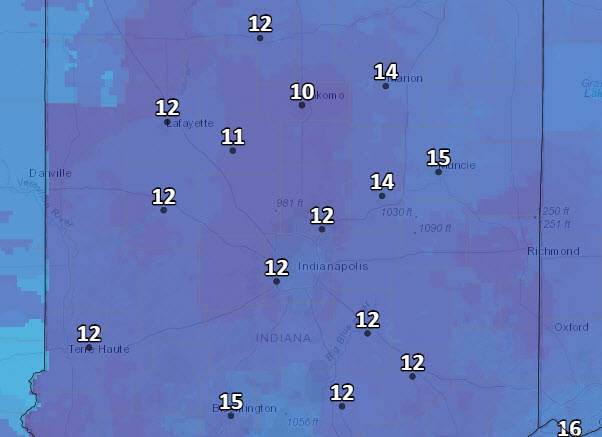
Look at these lows Friday morning…and wind chills in the teens!
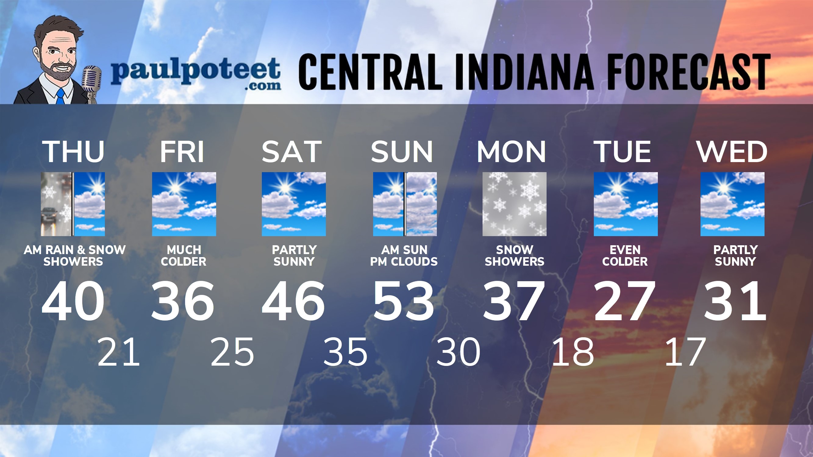
INDY SEVEN DAY FORECAST
Today: Showers south and southeast of Indy in the morning. Otherwise, spotty rain and snow showers, giving way to sunshine in the afternoon. Wind gusts to 25 mph. High 40.
Tonight: Clearing and colder. Low 21.
Friday: Partly sunny. High 36.
Friday Night: Partly cloudy. Low 25.
Saturday: Partly sunny. High 46.
Saturday Night: Partly cloudy. Low 35.
Sunday: Partly sunny morning morning. Mostly cloudy afternoon. High 53.
Sunday Night: Mostly cloudy. Stray rain or snow showers. Low 30.
Veterans Day: Rain and snow showers. High 37.
Monday Night: Snow showers. Low 18.
Tuesday: Partly sunny. High 27.
Tuesday Night: Partly cloudy. Low 17.
Wednesday: Partly sunny. High 31.
Never miss me! Subscribe for free. My Huge Radar has real-time weather tracking, current temperatures, and severe weather watches and warnings. Get detailed Indiana conditions by clicking here. Click here to see my central Indiana 7-Day Forecast. Follow these links to get my forecasts for Lafayette, Muncie, Hendricks County, and Hamilton County. Need a second opinion? Click here for central Indiana National Weather Service forecasts. (Some charts via WeatherBELL.)


Indiana’s Weather For Thursday
Little or no snow accumulation is expected today after the passage of a cold front… https://t.co/k5gkYyNcSD