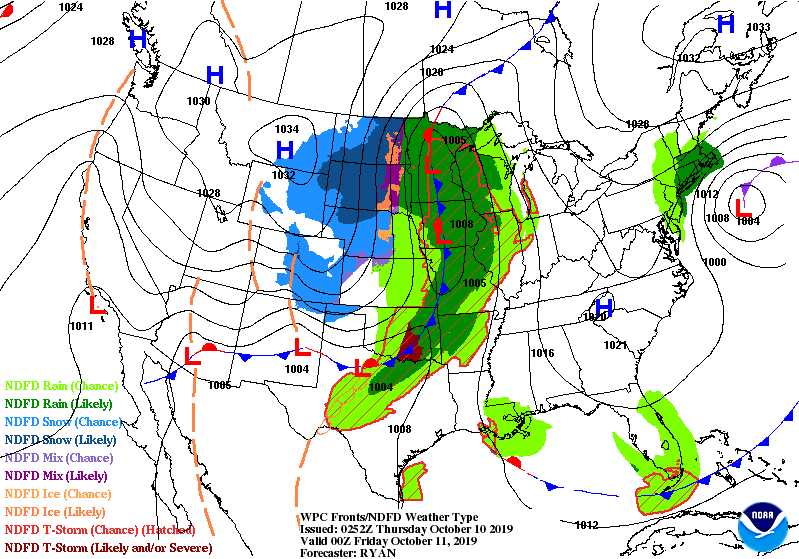
Gaze at that big system locked up in the middle of the country today.
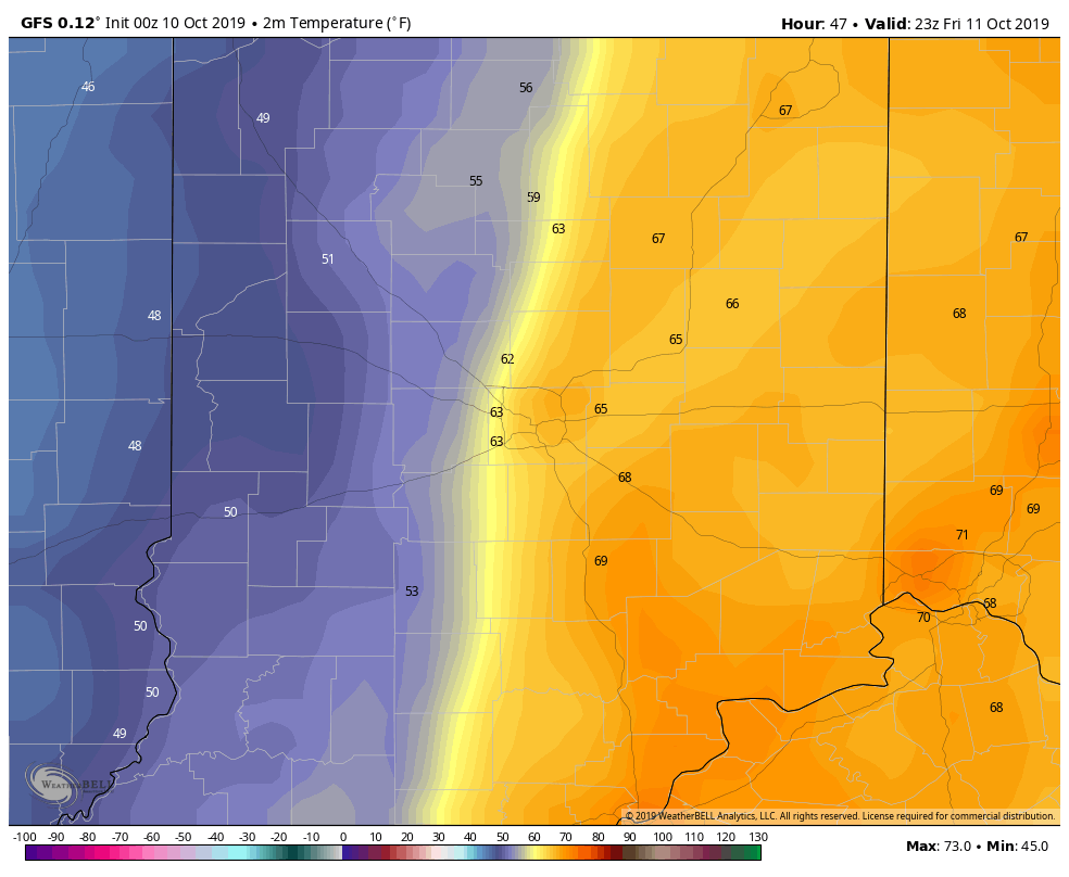
That sucker is headed toward central Indiana tomorrow. The biggest chance of showers and storms comes in the afternoon and early evening. A sharp cold front will mean temps well into the 60s at the start of Friday night football…falling to wind chills in the 40s by 10pm. (Chart shows temps at 7pm, via WeatherBell.)
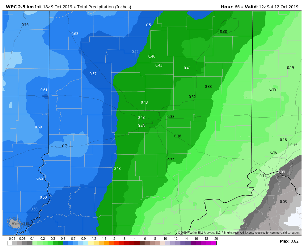
Final rain totals still look to be around half an inch. More to the west and less to the east of Indy. (Chart via WeatherBell.)
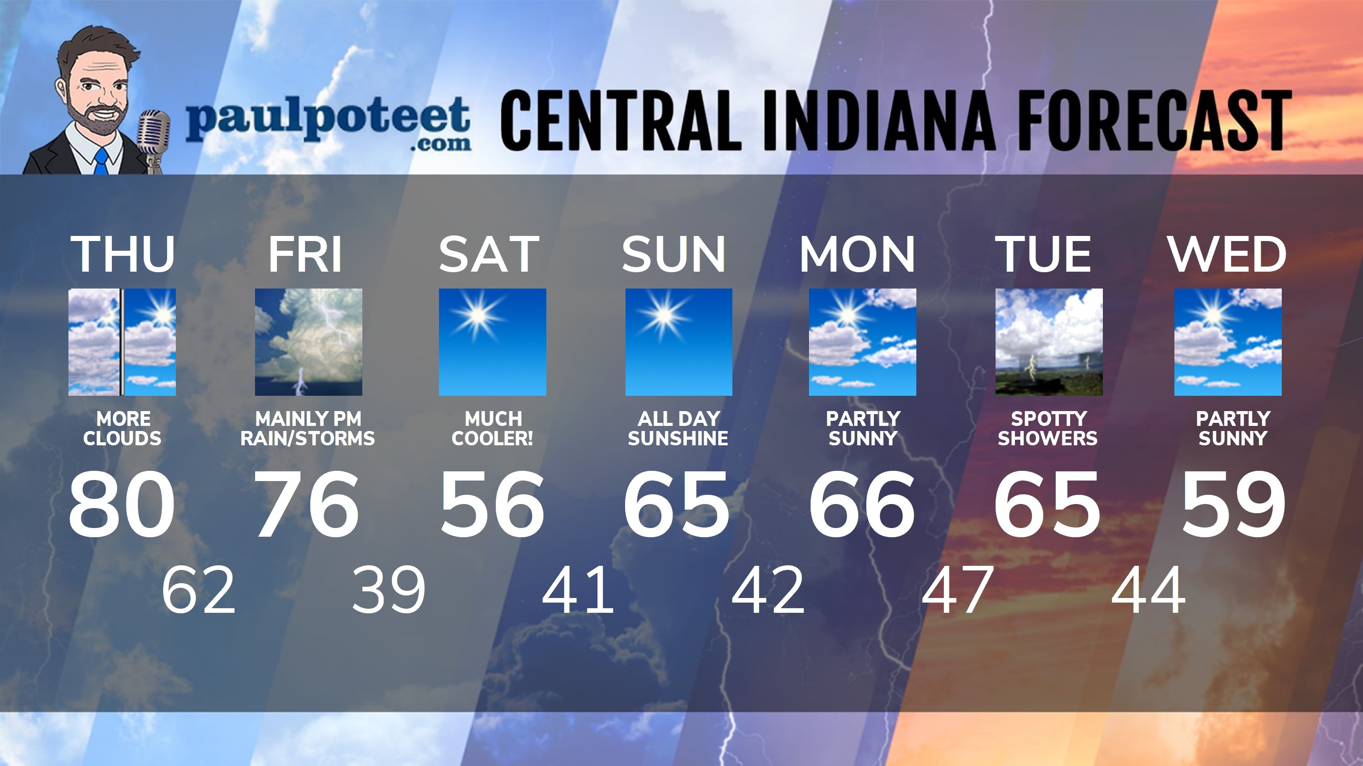
INDY SEVEN DAY FORECAST
Today: Mostly to partly cloudy. High 80.
Tonight: Partly cloudy. Mostly cloudy after midnight. Low 62.
Friday: Mostly cloudy. Spotty showers during the day. Showers and storms in the afternoon. High 76.
Friday Night: Scattered showers and storms in the early evening. Temps falling quickly with lingering showers in the late evening. Low 39.
Saturday: Sunny. High 56.
Saturday: Clear. Low 41.
Sunday: Sunny. High 65.
Sunday Night: Clear. Low 42.
Monday: Partly sunny. High 66.
Monday Night: Partly cloudy. Low 47.
Tuesday: Partly to mostly cloudy with spotty showers and storms. High 65.
Tuesday Night: Scattered showers and storms. Low 44.
Wednesday: Partly sunny. High 59.
Never miss me! Subscribe for free. My Huge Radar has real-time weather tracking, current temperatures, and severe weather watches and warnings. Get detailed Indiana conditions by clicking here. Click here to see my central Indiana 7-Day Forecast. Follow these links to get my forecasts for Lafayette, Muncie, Hendricks County, and Hamilton County. Need a second opinion? Click here for central Indiana National Weather Service forecasts. (Some charts via WeatherBELL.)


Indiana’s Weather For Thursday
Gaze at that big system locked up in the middle of the country today.
That sucker… https://t.co/Jt9FSa8jZQ
RT @PaulPoteet: Indiana’s Weather For Thursday
Gaze at that big system locked up in the middle of the country today.
That sucker is head…