The last of the red-hot record-setters is today! It will be the third consecutive day at Indianapolis. BTW, these are the *first* high temperature records of the entire year. Ma Nature was saving up for us.
Let’s review the big numbers so far this week, shall we?
INDY: 92 Monday, 92 Tuesday
MUNCIE: 92 Monday, 93 Tuesday
LAFAYETTE: 89 Monday, 90 Tuesday
BLOOMINGTON 93 Monday, 93 Tuesday
TERRE HAUTE: 92 Monday, 93 Tuesday
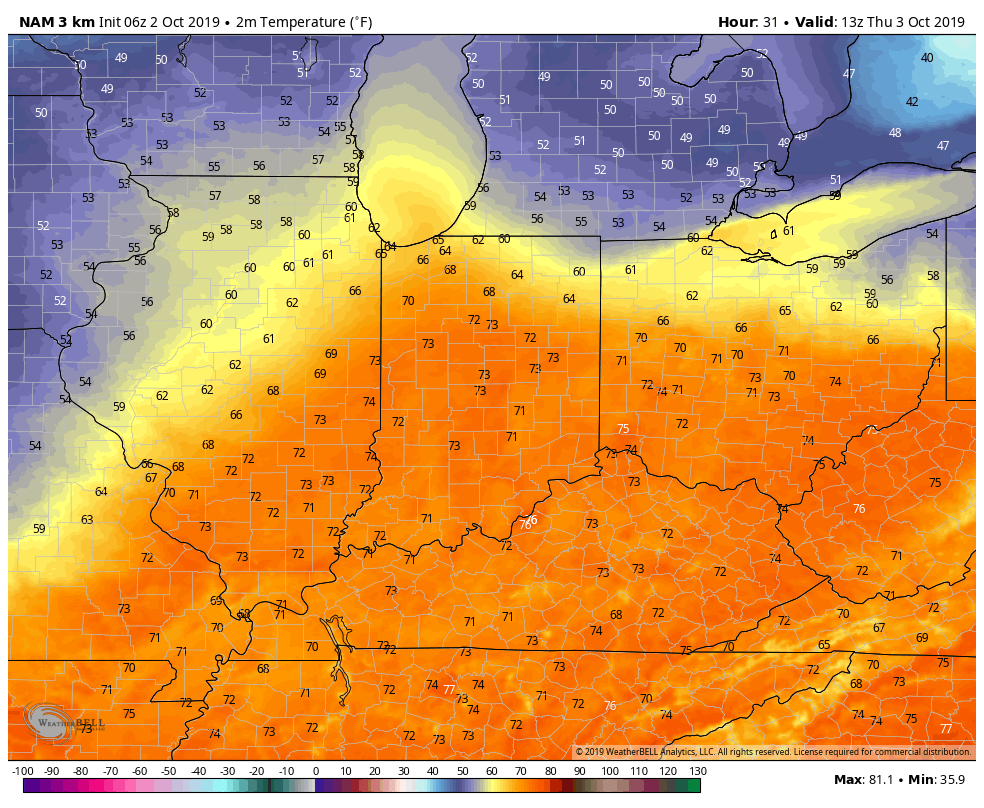
It’s all about to be a warm memory. Cold front coming tomorrow! Cooler air by Thursday night! (Chart via weatherbell.com.)
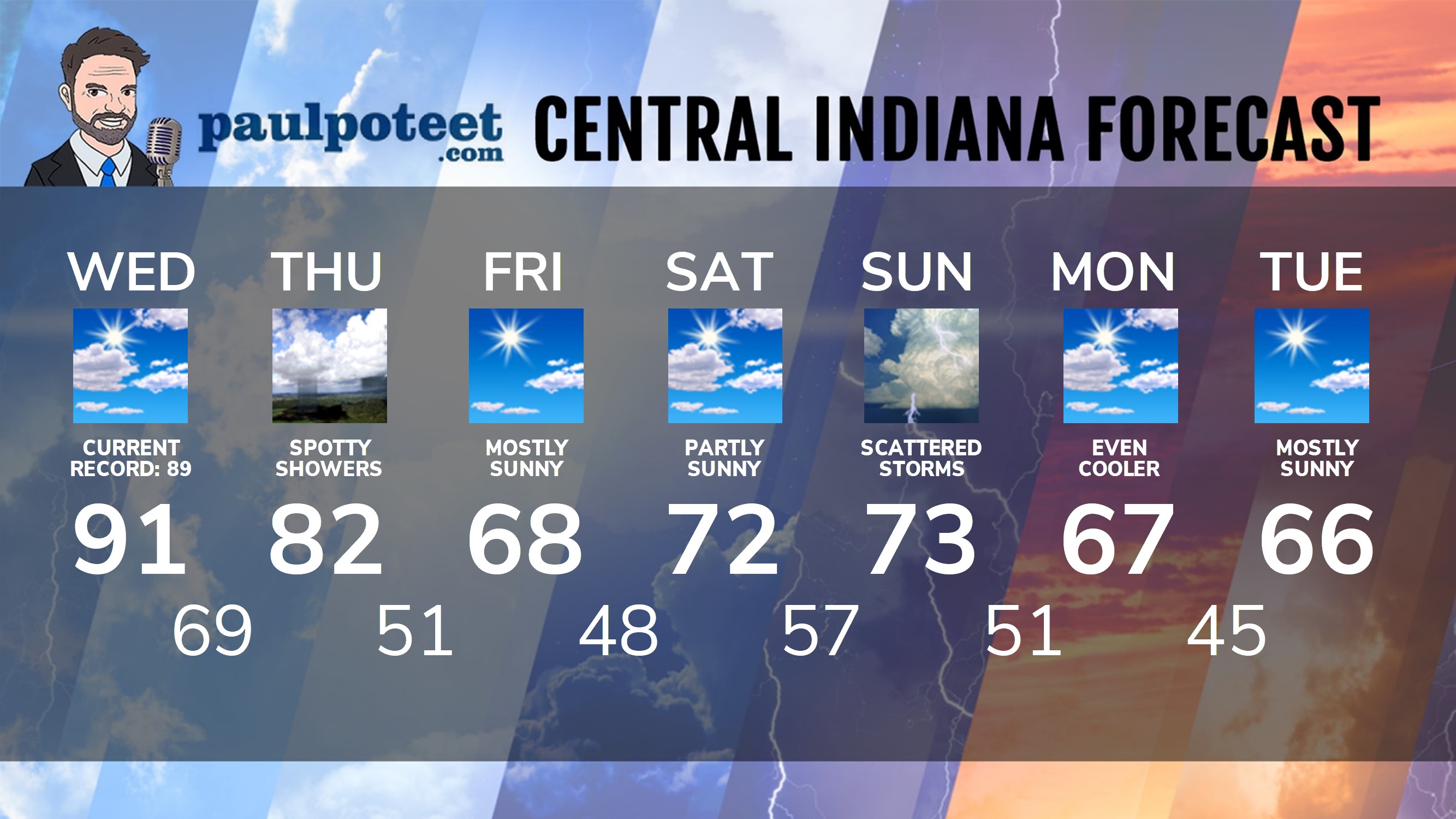
INDY SEVEN DAY FORECAST
Today: Partly sunny, hot and humid. (Record high: 89, from 1954.) High 91.
Tonight: Partly cloudy. Low 69.
Thursday: Partly sunny. Spotty shower possible. High 82.
Thursday Night: Partly cloudy and COOLER. Low 51.
Friday: Mostly sunny. High 68.
Friday Night: Mostly clear. Low 48.
Saturday: Partly sunny. High 72.
Saturday Night: Scattered showers after midnight. Low 57.
Sunday: Scattered showers. High 73.
Sunday Night: Scattered showers. Low 51.
Monday: Partly sunny. High 67.
Monday Night: Mostly clear. Low 45.
Tuesday: Mostly sunny. High 66.
Never miss me! Subscribe for free. My Huge Radar has real-time weather tracking, current temperatures, and severe weather watches and warnings. Get detailed Indiana conditions by clicking here. Click here to see my central Indiana 7-Day Forecast. Follow these links to get my forecasts for Lafayette, Muncie, Hendricks County, and Hamilton County. Need a second opinion? Click here for central Indiana National Weather Service forecasts. (Some charts via WeatherBELL.)


RT @PaulPoteet: Indiana’s Weather For Wednesday
The last of the red-hot record-setters is today! It will be the third consecutive day at…