I expect today to be the 24th time this year the Indy Airport reaches 90 degrees or hotter. The record highs today through Wednesday are 89, and they are all in danger. It will be hot and humid until Thursday when a cold front arrives. Let me type that again: A COLD FRONT ARRIVES.
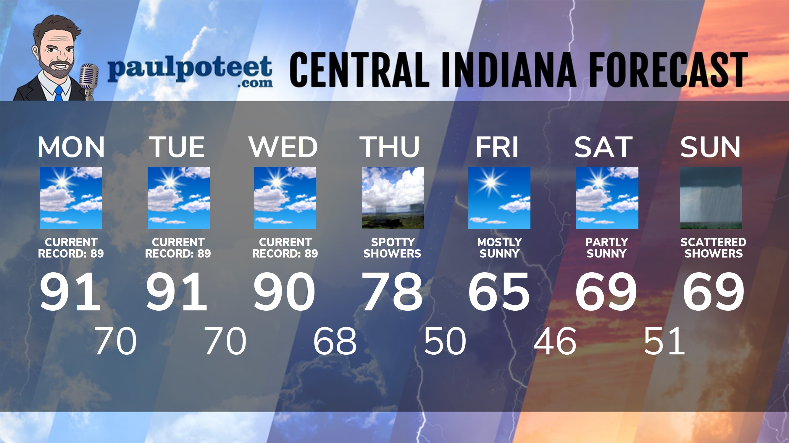
INDY SEVEN DAY FORECAST
Today: Mostly to partly sunny, hot and humid. (Record high: 89, from 1971.) High 91.
Tonight: Mostly clear and muggy. Low 70.
Tuesday: Mostly to partly sunny, hot and humid. (Record high: 89, from 1897.) High 91.
Tuesday Night: Partly cloudy. Low 70.
Wednesday: Partly sunny, hot and humid. (Record high: 89, from 1954.) High 90.
Wednesday Night: Partly cloudy. Low 68.
Thursday: Partly sunny. Spotty showers and storms. High 78.
Thursday: Partly cloudy and COOLER. Low 50.
Friday: Mostly sunny. High 65.
Friday Night: Mostly clear. Low 46.
Saturday: Partly sunny. High 69.
Saturday Night: Scattered showers. Low 51.
Sunday: Scattered showers. High 69.
Never miss me! Subscribe for free. My Huge Radar has real-time weather tracking, current temperatures, and severe weather watches and warnings. Get detailed Indiana conditions by clicking here. Click here to see my central Indiana 7-Day Forecast. Follow these links to get my forecasts for Lafayette, Muncie, Hendricks County, and Hamilton County. Need a second opinion? Click here for central Indiana National Weather Service forecasts. (Some charts via WeatherBELL.)


RT @PaulPoteet: Indiana’s Weather For Monday
I expect today to be the 24th time this year the Indy Airport reaches 90 degrees or hotter.…