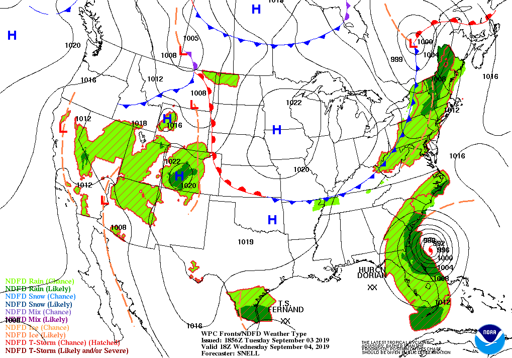
As Dorian prowls near the coastline, we enjoy a few days under the sway of high pressure moving down into the Midwest. The cold front cleared the state overnight and that’s it for rain chances until Sunday.
The average high temperature this time of year is 82. We’ll be mostly below that for the near future.
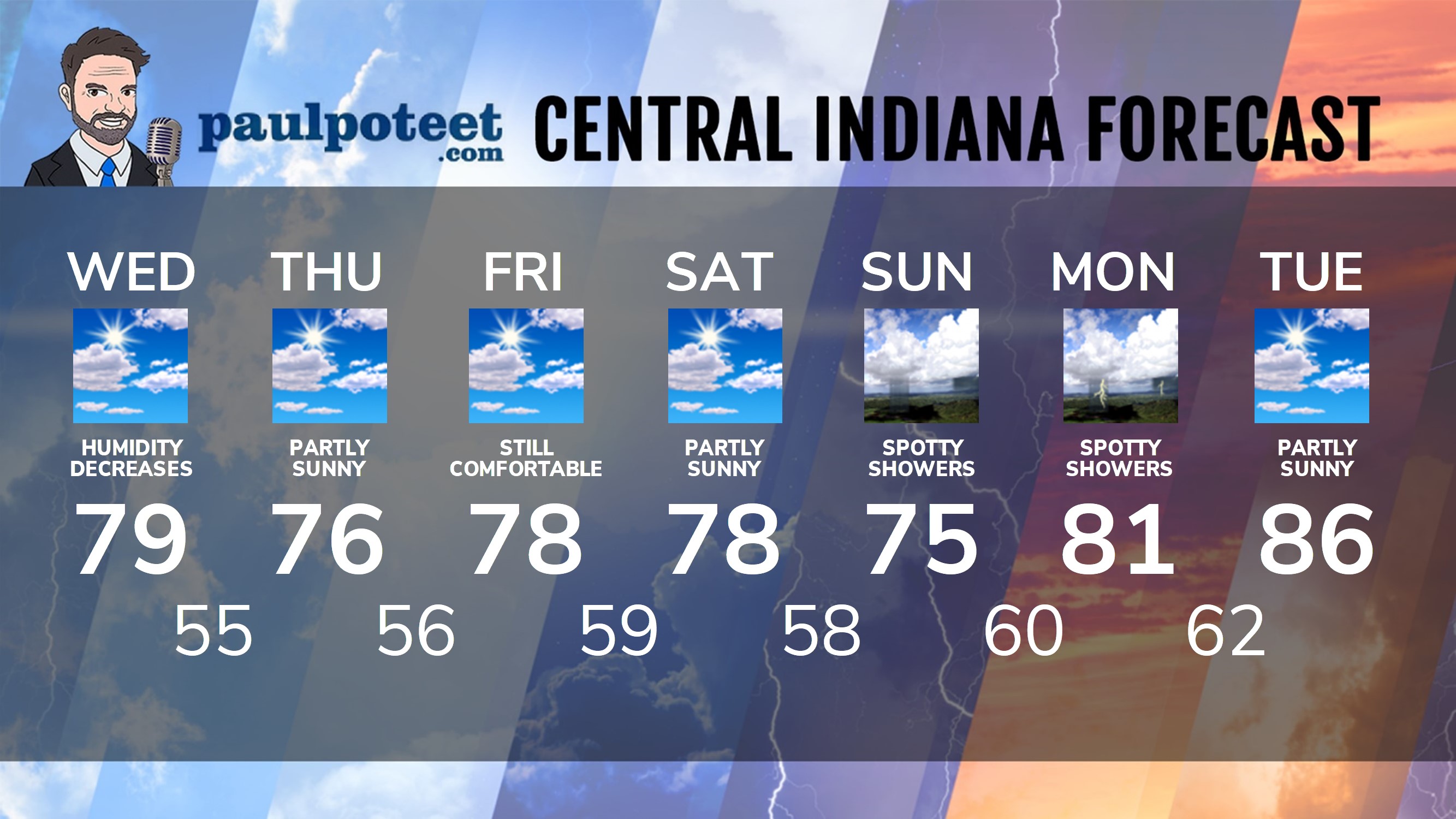
INDY SEVEN DAY FORECAST
Today: Partly to mostly sunny, with lower humidity. High 79.
Tonight: Mostly clear. Low 55.
Thursday: Sunny. High 76.
Thursday Night: Clear. Low 56.
Friday: Mostly sunny. High 78.
Friday Night: Partly cloudy. Low 59.
Saturday: Partly sunny. High 78.
Saturday Night: Partly cloudy. Low 58.
Sunday: Partly to mostly cloudy with spotty showers. High 75.
Sunday Night: Spotty showers. Low 60.
Monday: Mostly cloudy with spotty showers, mainly in the morning. High 81.
Monday Night: Spotty showers. Low 62.
Tuesday: Partly cloudy. High 86.
Never miss me! Subscribe for free. My Huge Radar has real-time weather tracking, current temperatures, and severe weather watches and warnings. Get detailed Indiana conditions by clicking here. Click here to see my central Indiana 7-Day Forecast. Follow these links to get my forecasts for Lafayette, Muncie, Hendricks County, and Hamilton County. Need a second opinion? Click here for central Indiana National Weather Service forecasts. (Some charts via WeatherBELL.)


Indiana’s Weather For Wednesday
As Dorian prowls near the coastline, we enjoy a few days under the sway of high p… https://t.co/AU9ChIyGBl
RT @PaulPoteet: Indiana’s Weather For Wednesday
As Dorian prowls near the coastline, we enjoy a few days under the sway of high pressure…