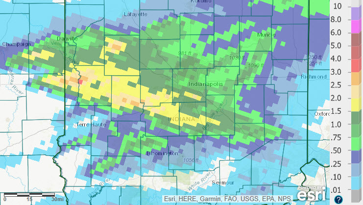
Here’s a picture of the super cell that slammed Central Indiana Sunday afternoon and evening.
This is the large storm complex that is headed towards northern Indy metro. Be ready to take shelter when it approaches. #inwx https://t.co/yOOxI5zslg
— NWS Indianapolis (@NWSIndianapolis) August 18, 2019
The storm downed limbs in several counties and the wind gusted to 60 mph in Marion and Hendricks counties, and to 65 mph in Morgan County. Rain was also heavy, with over two inches in Putnam County.
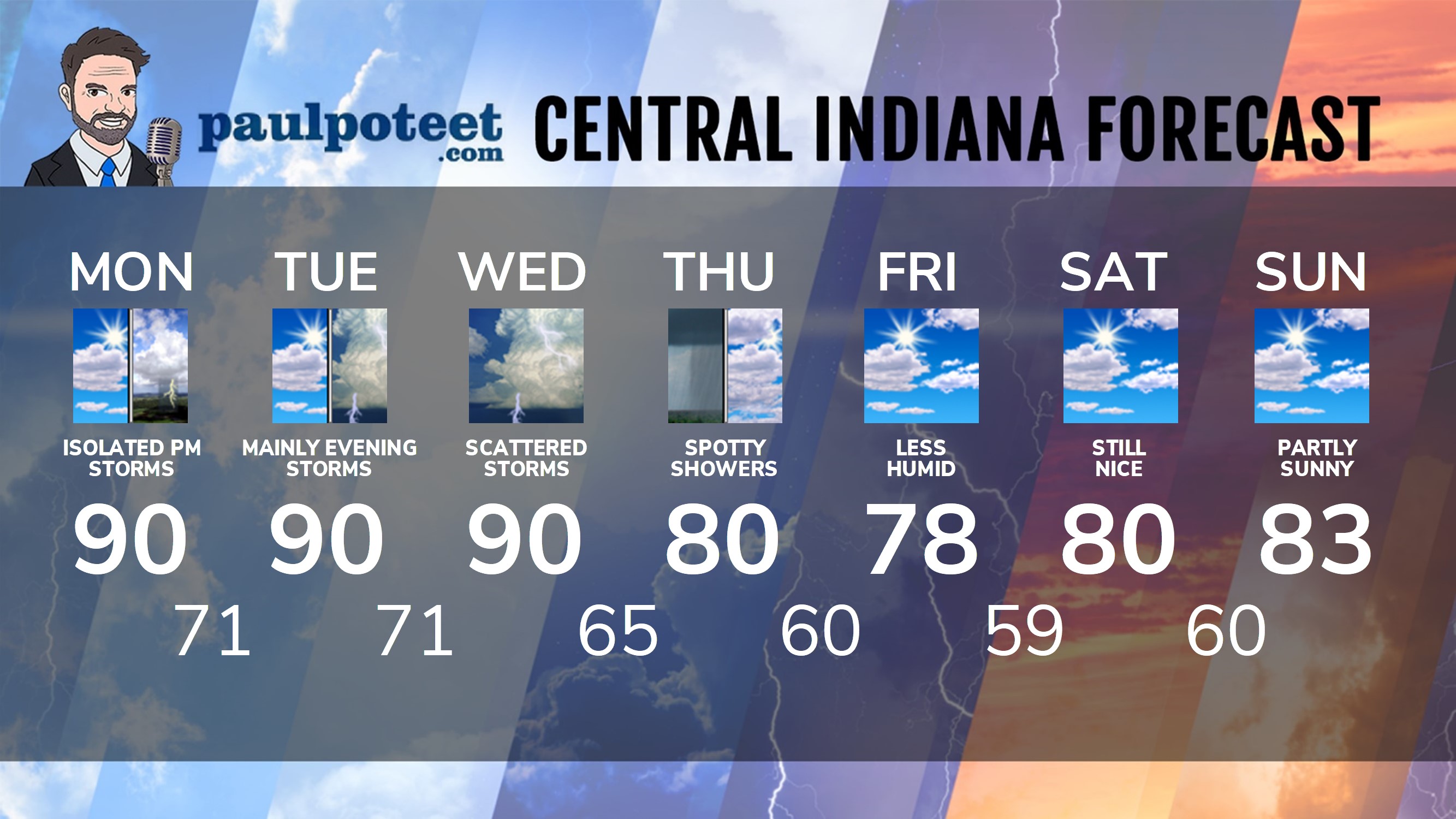
INDY SEVEN DAY FORECAST
Today: Mostly to partly sunny, hot and humid. An isolated afternoon shower or storm in the afternoon and early evening. High 90.
Tonight: Partly to mostly clear, warm and muggy. Low 71.
Tuesday: Partly sunny, hot and humid. Isolated shower or storm possible in the afternoon. High 90.
Tuesday Night: Scattered showers and storms. Low 71.
Wednesday: Partly sunny, hot and humid. Scattered showers and storms. High 90.
Wednesday Night: Scattered showers and storms. Low 65.
Thursday: Partly cloudy and less humid. A stray shower possible. High 80.
Thursday Night: Partly cloudy. Low 60.
Friday: Partly cloudy. High 78.
Friday Night: Partly cloudy. Low 59.
Saturday: Partly sunny. High 80.
Saturday Night: Partly cloudy. Low 60.
Sunday: Partly cloudy. High 83.
Never miss me! Subscribe for free. My Huge Radar has real-time weather tracking, current temperatures, and severe weather watches and warnings. Get detailed Indiana conditions by clicking here. Click here to see my central Indiana 7-Day Forecast. Follow these links to get my forecasts for Lafayette, Muncie, Hendricks County, and Hamilton County. Need a second opinion? Click here for central Indiana National Weather Service forecasts. (Some charts via WeatherBELL.)


Indiana’s Weather For Monday
Here’s a picture of the super cell that slammed Central Indiana Sunday afternoon and… https://t.co/epwR0J3tNj