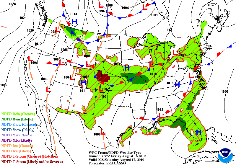
Here comes the heat! As a warm front moves northward through the state Friday the air will become more humid into the weekend.
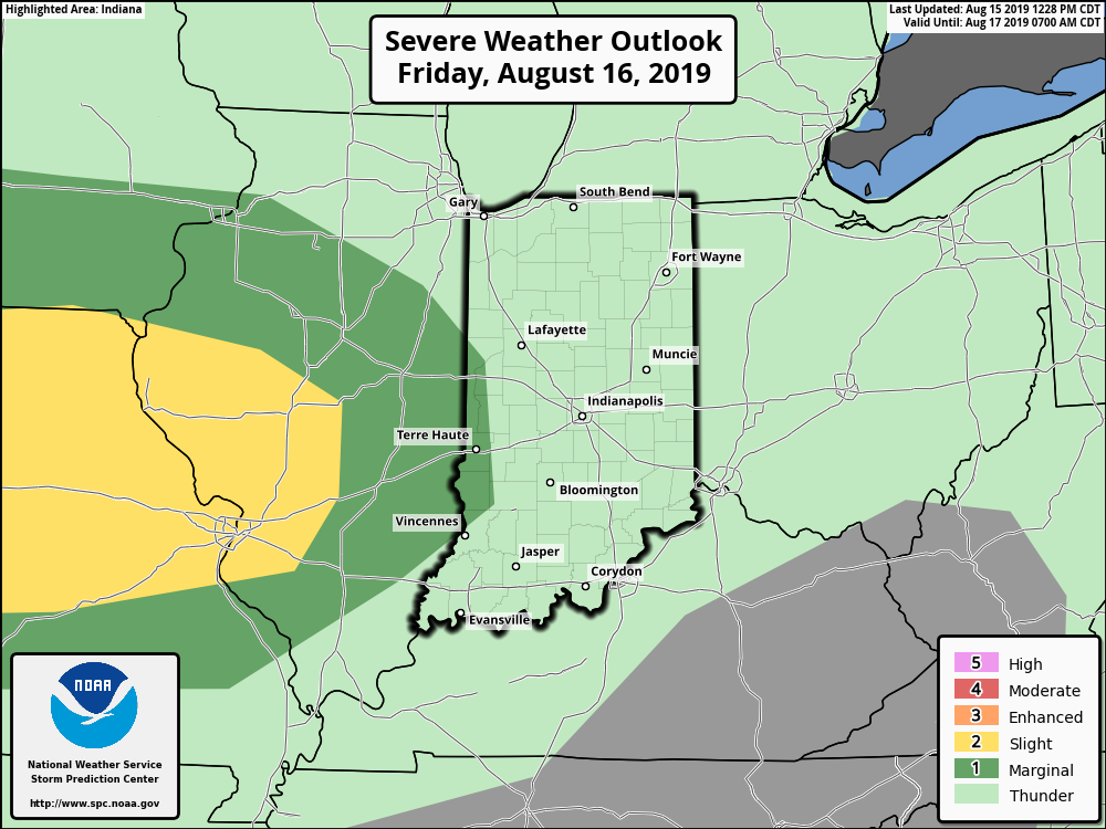
Indiana will be on the eastern edge of some frisky upper level winds Friday, which could produce severe weather just to our west. (This outlook is from late Thursday night. See the latest severe weather outlook on My Huge Radar page.)
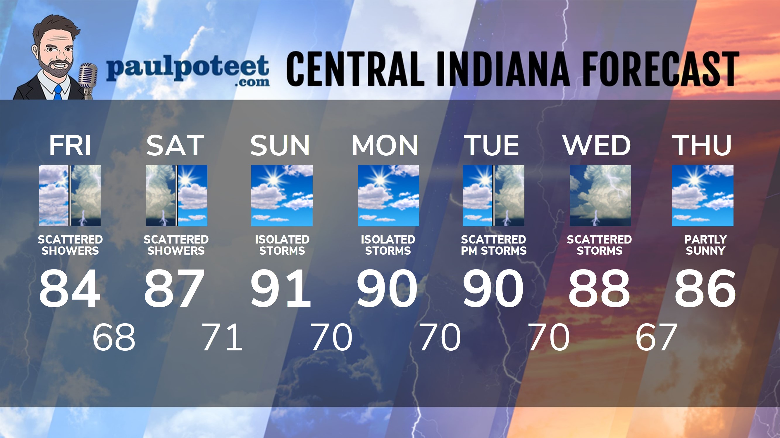
INDY SEVEN DAY FORECAST
Today: Mostly cloudy. Scattered showers and storms. High 84.
Tonight: Partly cloudy. Isolated shower or storm early. Low 68.
Saturday: Mostly to partly cloudy, hotter and more humid. Scattered showers and storms. High 87.
Saturday Night: Partly cloudy. Isolated shower or storm possible. Low 71.
Sunday: Partly sunny. Isolated shower or storm possible in the afternoon. High 91.
Sunday Night: Partly cloudy. Low 70.
Monday: Partly sunny. Isolated shower or storm possible in the afternoon. High 90.
Monday Night: Partly cloudy. Low 70.
Tuesday: Partly sunny. Scattered showers and storms. High 90.
Tuesday Night: Partly cloudy. Scattered showers and storms. Low 70.
Wednesday: Partly sunny. Scattered showers and storms. High 88.
Wednesday Night: Partly cloudy. Scattered showers and storms. Low 67.
Thursday: Partly sunny. High 86.
Never miss me! Subscribe for free. My Huge Radar has real-time weather tracking, current temperatures, and severe weather watches and warnings. Get detailed Indiana conditions by clicking here. Click here to see my central Indiana 7-Day Forecast. Follow these links to get my forecasts for Lafayette, Muncie, Hendricks County, and Hamilton County. Need a second opinion? Click here for central Indiana National Weather Service forecasts. (Some charts via WeatherBELL.)


Indiana’s Weather For The Weekend
Here comes the heat! As a warm front moves northward through the state Friday t… https://t.co/RTGJ2Fowv2
RT @PaulPoteet: Indiana’s Weather For The Weekend
Here comes the heat! As a warm front moves northward through the state Friday the air w…