aThunderstorms tonight could be severe. The biggest risk is from damaging wind gusts.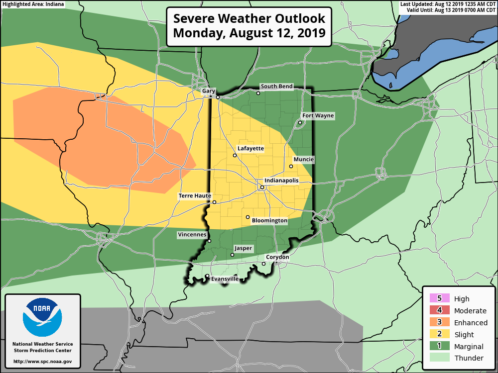
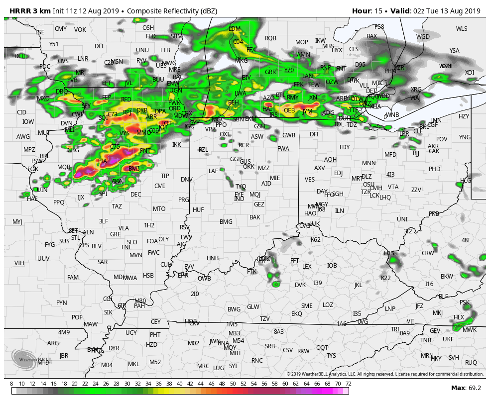
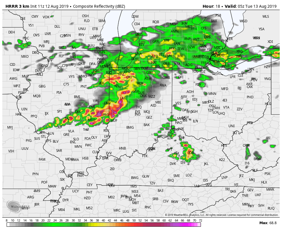
The storms are most likely after 10pm. Here’s one computer model depicting radar at that time and at 1am.
 INDY SEVEN DAY FORECAST
Today: Partly to mostly cloudy, with more and heat and humidity. A spotty shower is possible. High 87.
Tonight: Showers and storms, mainly late evening and overnight. Storms could be severe. Low 75.
Tuesday: Partly to mostly cloudy, with a few spotty showers and storms. High 83.
Tuesday Night: Clouds and humidity decrease. Low 67.
Wednesday: Partly sunny. High 82.
Wednesday Night: Partly cloudy. Low 63.
Thursday: Partly sunny. High 81.
Thursday Night: Mostly clear. Low 61.
Friday: Partly sunny. High 84.
Friday Night: Partly cloudy. Low 65.
Saturday: Partly sunny. Humidity increases. High 89.
Saturday Night: Mostly clear. Low 68.
Sunday: Partly sunny. High 92.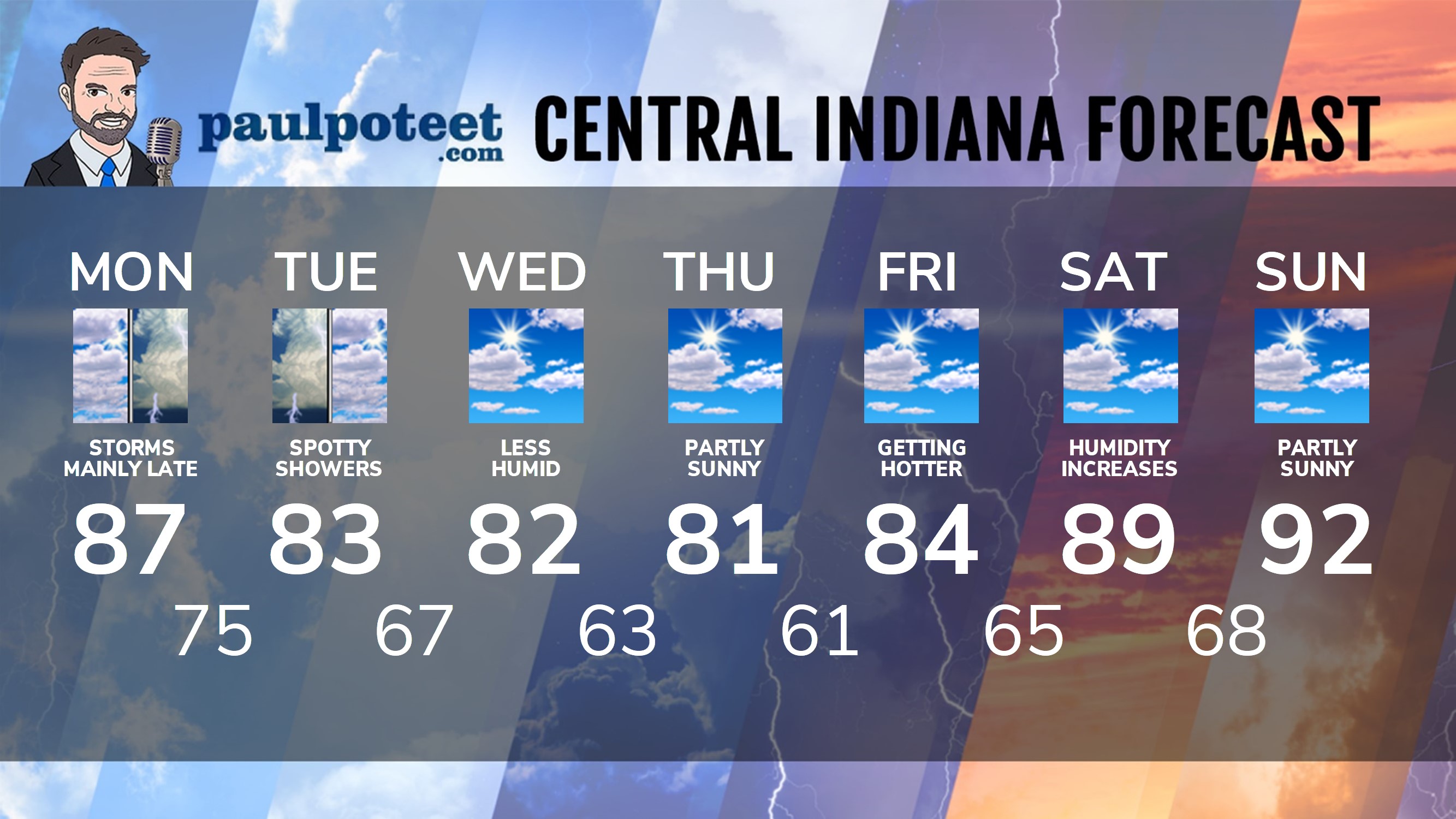
Never miss me! Subscribe for free. My Huge Radar has real-time weather tracking, current temperatures, and severe weather watches and warnings. Get detailed Indiana conditions by clicking here. Click here to see my central Indiana 7-Day Forecast. Follow these links to get my forecasts for Lafayette, Muncie, Hendricks County, and Hamilton County. Need a second opinion? Click here for central Indiana National Weather Service forecasts. (Some charts via WeatherBELL.)


Indiana’s Weather For Monday
Thunderstorms tonight could be severe. The biggest risk is from damaging wind gusts.… https://t.co/8ORLIwtLtG
RT @PaulPoteet: Indiana’s Weather For Monday
Thunderstorms tonight could be severe. The biggest risk is from damaging wind gusts.
The st…