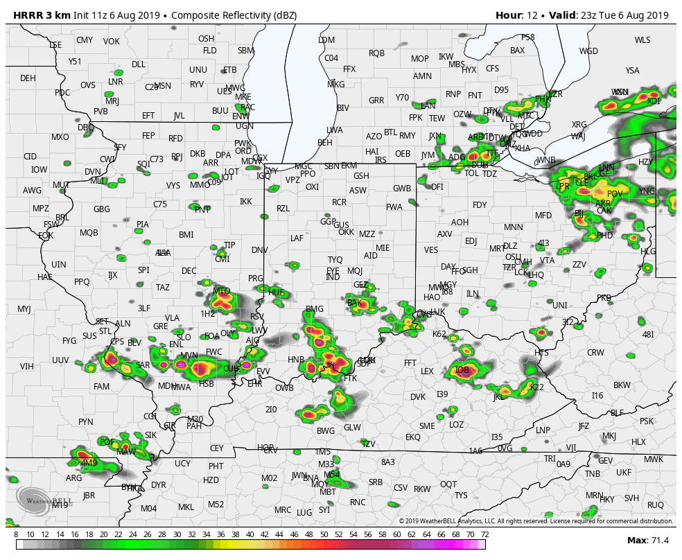
Most likely time for rain and storms today is after 4pm.
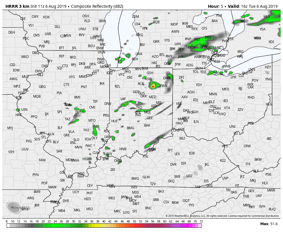
Most likely place, especially this evening, is south of Indianapolis.
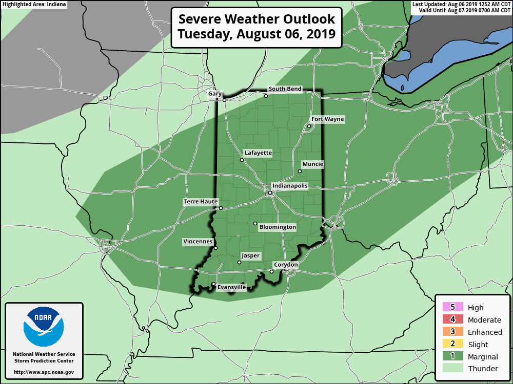
As of Tuesday morning, the Storm Prediction has our area in a marginal risk of severe weather.
(Computer modeling graphics via WeatherBELL.)
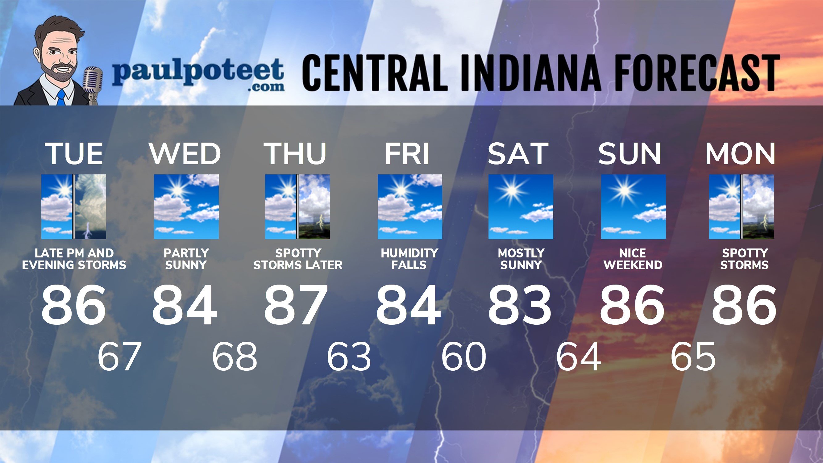
INDY SEVEN DAY FORECAST
Today: Clouds increase. Scattered showers and storms, especially in the afternoon. A few could be strong to severe. High 86.
Tonight: Scattered showers and storms. Low 67.
Wednesday: Partly sunny. High 84.
Wednesday Night: Partly cloudy. Low 68.
Thursday: Partly sunny. Spotty showers and storms in the afternoon. High 87.
Thursday Night: Scattered showers and storms. Low 63.
Friday: Partly sunny. Humidity falls. High 84.
Friday Night: Mostly clear. Low 60.
Saturday: Mostly sunny. High 83.
Saturday Night: Mostly clear. Low 64.
Sunday: Mostly sunny. High 86.
Sunday Night: Partly cloudy. Low 65.
Monday: Partly sunny. Spotty shower or storm. High 86.
Never miss me! Subscribe for free. My Huge Radar has real-time weather tracking, current temperatures, and severe weather watches and warnings. Get detailed Indiana conditions by clicking here. Click here to see my central Indiana 7-Day Forecast. Follow these links to get my forecasts for Lafayette, Muncie, Hendricks County, and Hamilton County. Need a second opinion? Click here for central Indiana National Weather Service forecasts. (Some charts via WeatherBELL.)


Indiana’s Weather For Tuesday
Most likely time for rain and storms today is after 4pm.
Most likely place, especi… https://t.co/Ihmr7WyKPU
RT @PaulPoteet: Indiana’s Weather For Tuesday
Most likely time for rain and storms today is after 4pm.
Most likely place, especially thi…