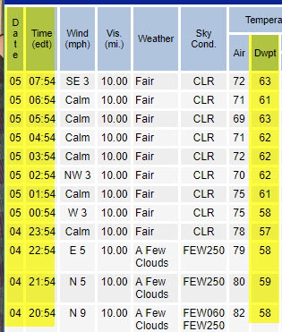
The trend is not our friend. This chart highlights the dew point temperature at from 8pm Sunday through 8am Monday, and it’s heading upward.
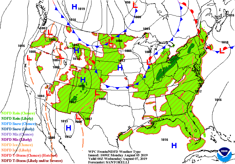
Next to return: showers and storms. Here’s the first of two fronts approaching Indiana Tuesday.
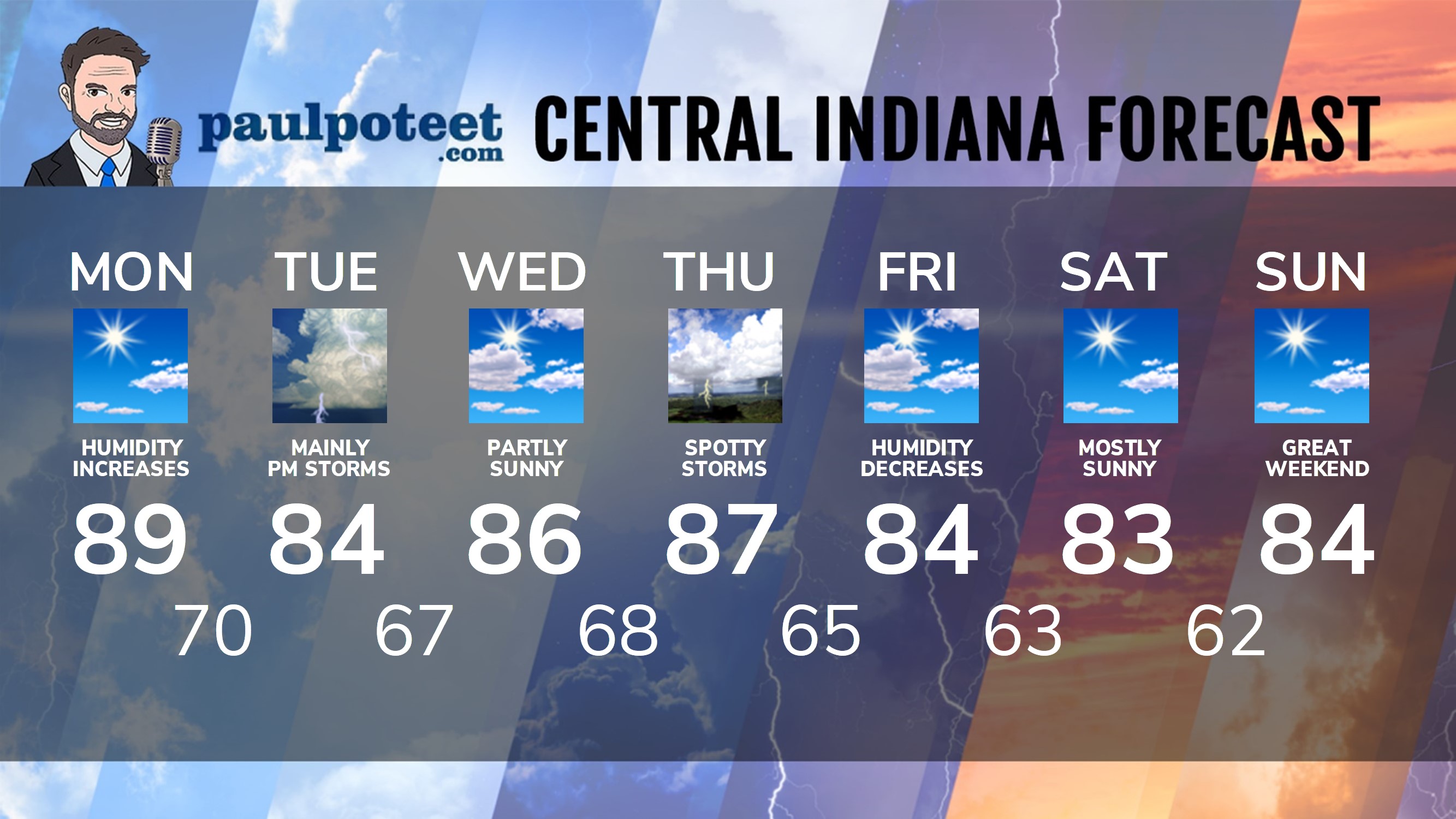
INDY SEVEN DAY FORECAST
Today: Mostly sunny. A little more humid. High 89.
Tonight: Partly cloudy. Low 70.
Tuesday: Mostly cloudy and muggy. Scattered showers and storms, especially in the afternoon. High 84.
Tuesday Night: Scattered showers and storms. Low 67.
Wednesday: Partly sunny. High 86.
Wednesday Night: Partly cloudy. Low 68.
Thursday: Partly sunny. Spotty showers and storms. High 87.
Thursday Night: Spotty showers and storms. Low 65.
Friday: Partly sunny. Humidity falls. High 84.
Friday Night: Mostly clear. Low 63.
Saturday: Mostly sunny. High 83.
Saturday Night: Mostly clear. Low 62.
Sunday: Mostly sunny. High 84.
Never miss me! Subscribe for free. My Huge Radar has real-time weather tracking, current temperatures, and severe weather watches and warnings. Get detailed Indiana conditions by clicking here. Click here to see my central Indiana 7-Day Forecast. Follow these links to get my forecasts for Lafayette, Muncie, Hendricks County, and Hamilton County. Need a second opinion? Click here for central Indiana National Weather Service forecasts. (Some charts via WeatherBELL.)


RT @PaulPoteet: Indiana’s Weather For Monday
The trend is not our friend. This chart highlights the dew point temperature at from 8pm Sun…
RT @PaulPoteet: Indiana’s Weather For Monday
The trend is not our friend. This chart highlights the dew point temperature at from 8pm Sun…