This map shows heat watches, warnings, and advisories covering much of the Mississippi and Ohio River valleys for the next several days.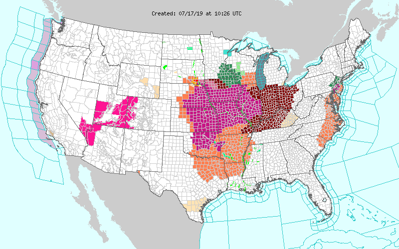 Click here for nationwide watches and warnings any time.
I hope you’ve gotten the rain you wanted, because chances are slim again now until at least Sunday.
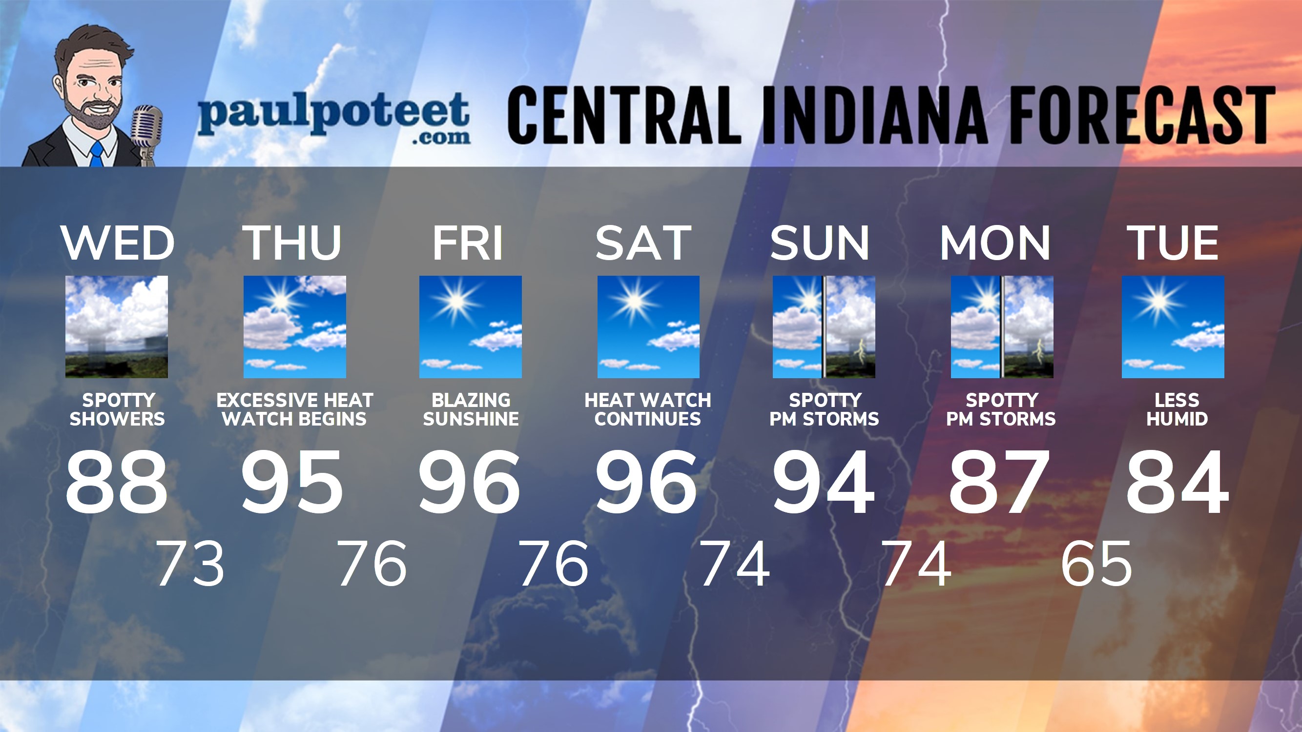
INDY SEVEN DAY FORECAST
Today: Partly sunny, with scattered showers in the early morning. A spotty shower or storm in the afternoon. High 88.
Tonight: Mostly clear. Low 73.
Thursday: Partly sunny. EXCESSIVE HEAT WATCH in the afternoon. High 95.
Thursday Night: Mostly clear. Low 76.
Friday: Mostly sunny. EXCESSIVE HEAT WATCH. High 96.
Friday Night: Mostly clear. Low 76.
Saturday: Mostly sunny. EXCESSIVE HEAT WATCH. High 96.
Saturday Night: Mostly clear. Low 74.
Sunday: Mostly to partly sunny, hot and humid. Scattered afternoon showers and storms. EXCESSIVE HEAT WATCH. High 94.
Sunday Night: Partly cloudy. Scattered shower or storm. Low 74.
Monday: Partly sunny, hot and humid. Scattered afternoon shower or storm. High 87.
Monday Night: Partly cloudy. Not as humid. Low 65.
Tuesday: Mostly sunny. Not as humid. High 84.
Never miss me! Subscribe for free. My Huge Radar has real-time weather tracking, current temperatures, and severe weather watches and warnings. Get detailed Indiana conditions by clicking here. Click here to see my central Indiana 7-Day Forecast. Follow these links to get my forecasts for Lafayette, Muncie, Hendricks County, and Hamilton County. Need a second opinion? Click here for central Indiana National Weather Service forecasts. (Some charts via WeatherBELL.)


