Refreshing Tuesday lows!
58 Crawfordsville,
59 Indpls Executive Airport
60 Martinsville, Lafayette
61 Anderson, Kokomo
63 Muncie, Columbus, Bloomington
64 Terre Haute
66 Indy
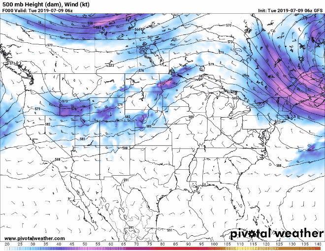
We are *mostly* above average for the next week, but a dip in the upper air flow will stir up storms Wednesday and lead to “just average” temperatures Thursday and Friday before the big ridge builds again for a hot weekend ahead.
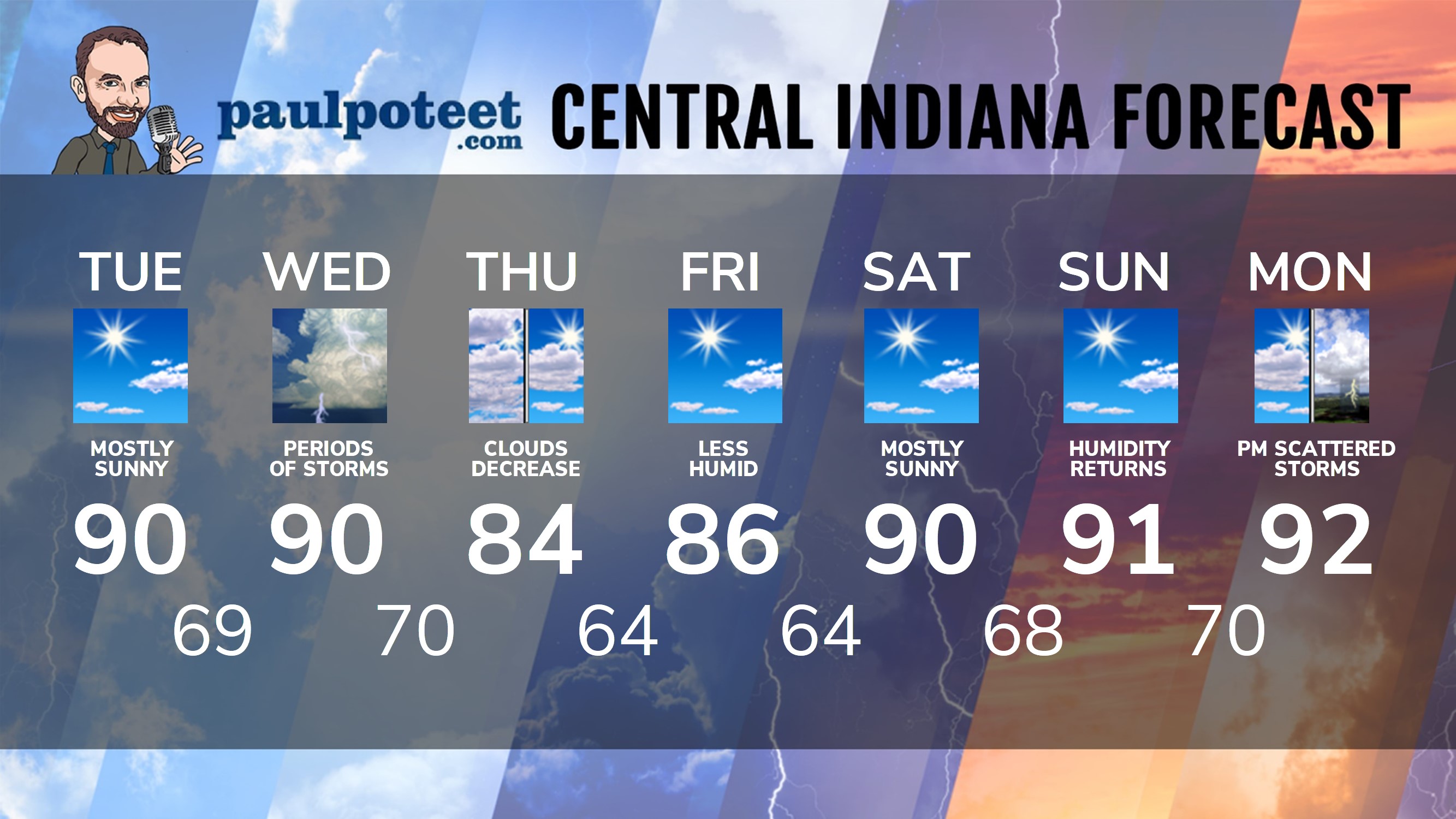
INDY SEVEN DAY FORECAST
Today: Mostly sunny and hotter. High 90.
Tonight: Mostly clear. Humidity increases. Low 69.
Wednesday: Partly sunny, hot and humid. A couple of periods of showers and storms. Some could be strong to severe. High 90.
Wednesday Night: Scattered showers and storms, with a few strong to severe. Low 70.
Thursday: Decreasing cloudiness. High 84.
Thursday Night: Clear. Humidity falls again. Low 64.
Friday: Mostly sunny. High 86.
Friday Night: Clear. Low 64.
Saturday: Mostly sunny. High 90.
Saturday Night: Mostly clear. Low 68.
Sunday: Mostly sunny. Humidity returns. High 91.
Sunday Night: Partly cloudy. Low 70.
Monday: Partly sunny. Scattered afternoon shower or storm. High 92.
Never miss me! Subscribe for free. My Huge Radar has real-time weather tracking, current temperatures, and severe weather watches and warnings. Get detailed Indiana conditions by clicking here. Click here to see my central Indiana 7-Day Forecast. Follow these links to get my forecasts for Lafayette, Muncie, Hendricks County, and Hamilton County. Need a second opinion? Click here for central Indiana National Weather Service forecasts. (Some charts via WeatherBELL.)


Indiana’s Weather For Tuesday
Refreshing Tuesday lows!
58 Crawfordsville,
59 Indpls Executive Airport
60 Martinsv… https://t.co/Sl2fSIxGWe
RT @PaulPoteet: Indiana’s Weather For Tuesday
Refreshing Tuesday lows!
58 Crawfordsville,
59 Indpls Executive Airport
60 Martinsville, La…