Showers and storms Monday will be mainly in the afternoon and evening. By my count there have been eight tornadoes confirmed so far from the weekend. The Indianapolis office of the National Weather Service will be out again, looking at damage in Rush County. (Here’s what they found so far.) (Here are the findings regarding Indiana tornadoes from the Wilmington Ohio office.)
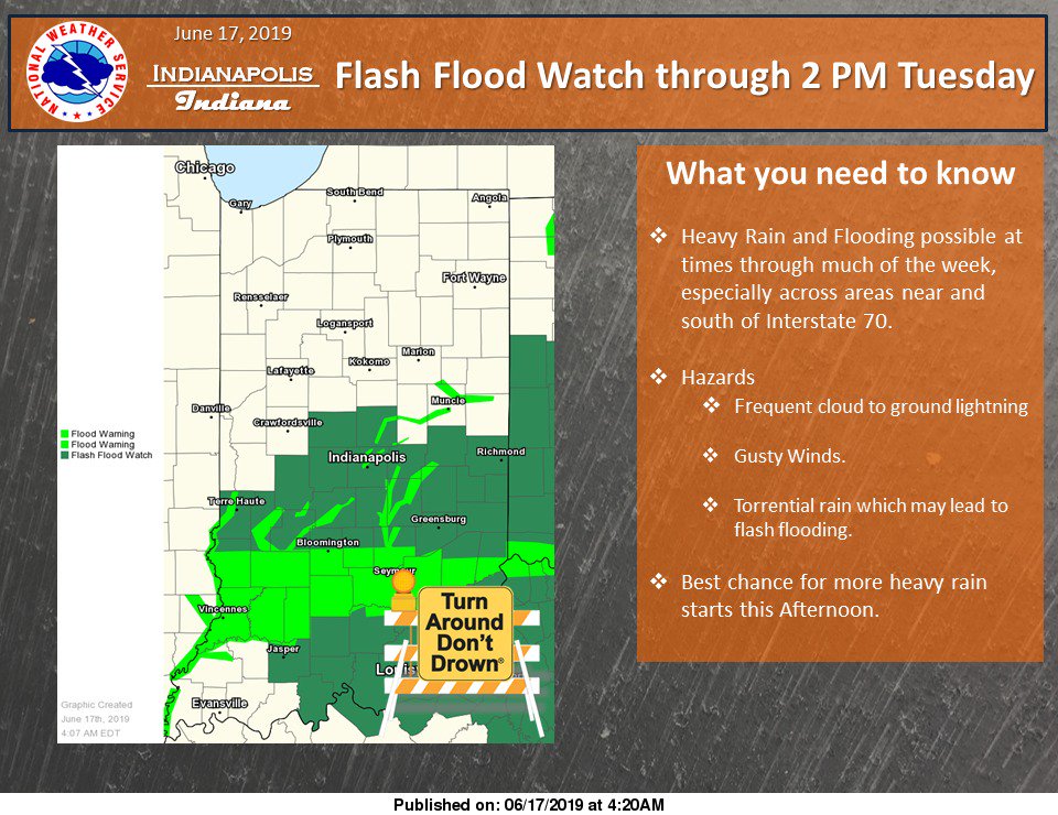
Severe weather and flash flooding are possibilities today, especially in the south half of the state, where up to five inches of rain fell over the weekend.
48 hour rainfall totals for select cities. pic.twitter.com/MiEDBHC390
— NWS Wilmington OH (@NWSILN) June 17, 2019
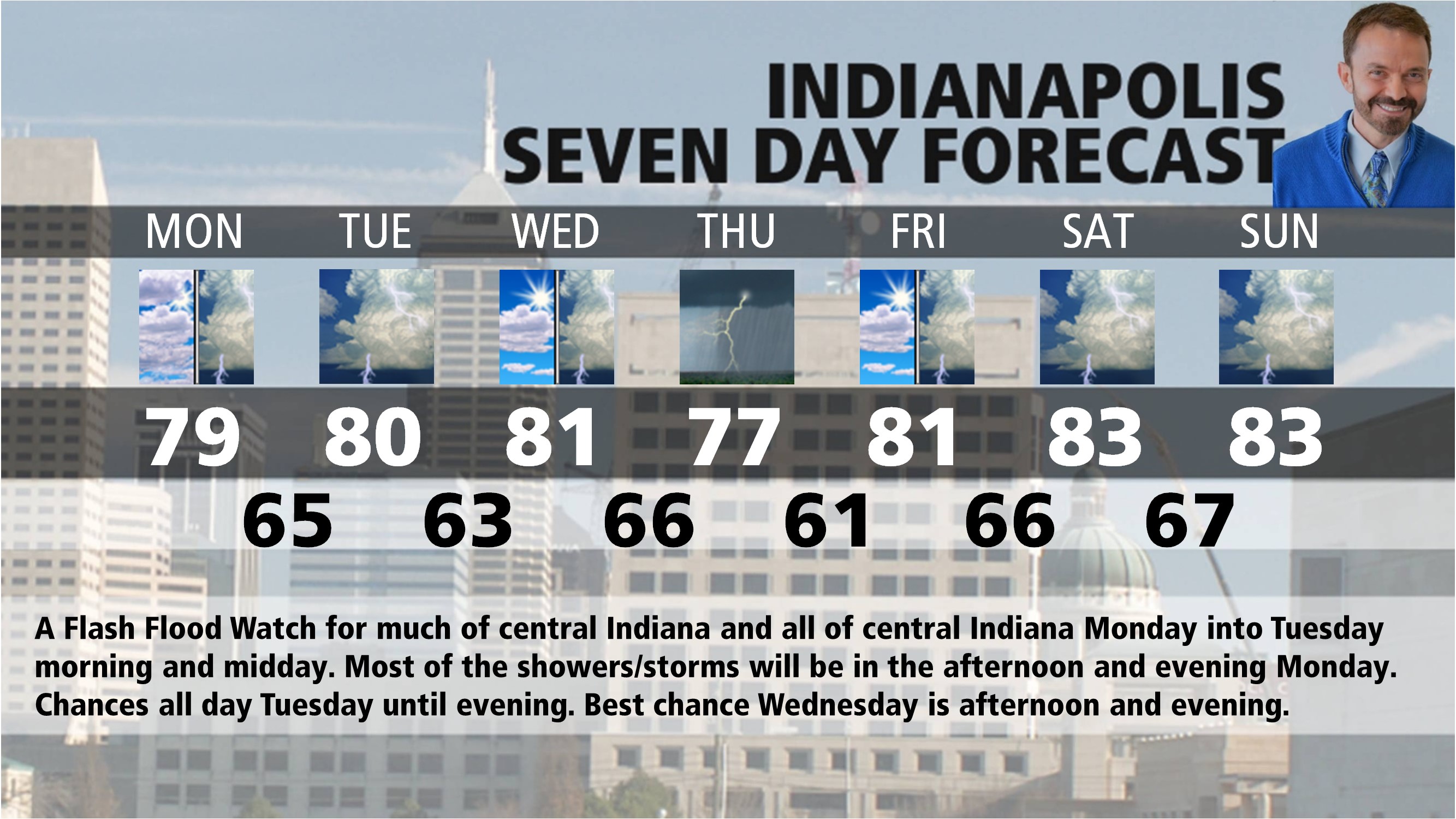
INDY SEVEN DAY FORECAST
FLASH FLOOD WATCH 8AM MONDAY THROUGH TUESDAY AFTERNOON.
Today: Mostly cloudy. Scattered afternoon showers and storms. High 79.
Tonight: Scattered showers and storms. Low 65.
Tuesday: Mostly to partly cloudy. Scattered showers and storms. High 80.
Tuesday Night: Partly cloudy. Low 63.
Wednesday: Partly to mostly cloudy. Mainly afternoon showers and storms. High 81.
Wednesday Night: Showers and storms. Low 66.
Thursday: Scattered showers and storms. High 77.
Thursday Night: Partly cloudy. Low 61.
Friday: Partly sunny. High 81.
Friday Night: Mostly cloudy. Scattered showers and storms. Low 66.
Saturday: Partly to mostly cloudy. Scattered showers and storms. High 83.
Saturday Night: Partly to mostly cloudy. Scattered showers and storms. Low 67.
Sunday: Partly to mostly cloudy. Scattered showers and storms. High 83.
Never miss me! Subscribe for free. My Huge Radar has real-time weather tracking, current temperatures, and severe weather watches and warnings. Get detailed Indiana conditions by clicking here. Click here to see my central Indiana 7-Day Forecast. Follow these links to get my forecasts for Lafayette, Muncie, Hendricks County, and Hamilton County. Need a second opinion? Click here for central Indiana National Weather Service forecasts. (Some charts via WeatherBELL.)


