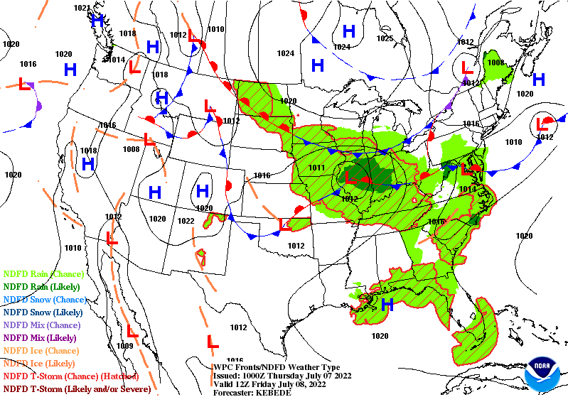
There’s only been one day this month in Indy where the high did not reach 90. It should be close today, with highs in the upper 80s to around 90. After today highs will be in the lower 80s Friday through the weekend. The catalyst is an area of low pressure pulling a cold front south through the state Friday.
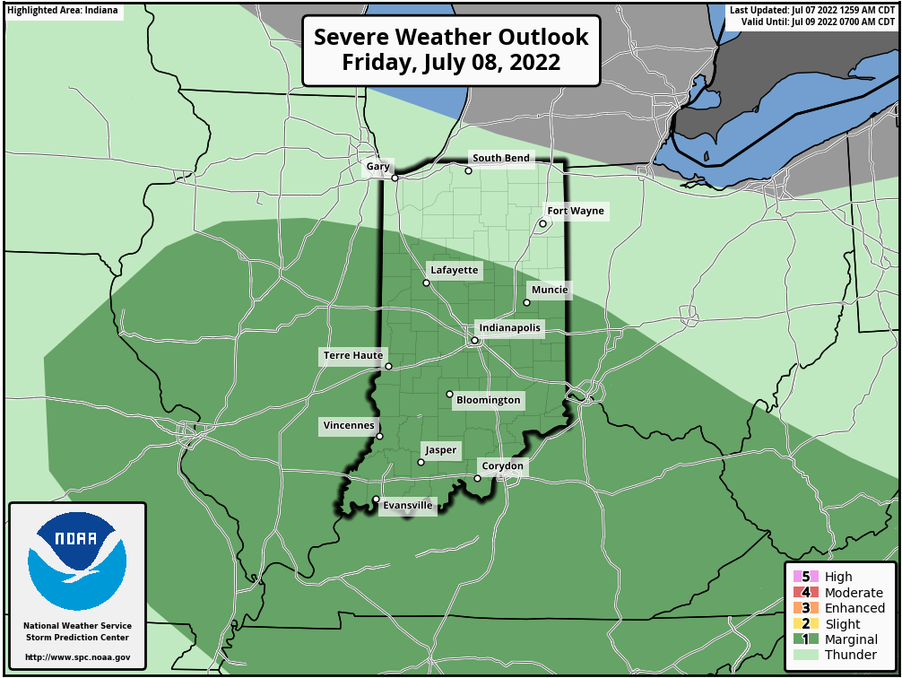
Storms tomorrow have a 1 out of 5 chance of becoming severe.
Never miss me! Subscribe for free. My Huge Radar has real-time weather tracking, current temperatures, and severe weather watches and warnings. Get detailed Indiana conditions by clicking here. Click here to see my central Indiana 7-Day Forecast. Follow these links to get my forecasts for Lafayette, Muncie, Hendricks County, and Hamilton County. Need a second opinion? Click here for central Indiana National Weather Service forecasts. (Some charts via WeatherBELL.)
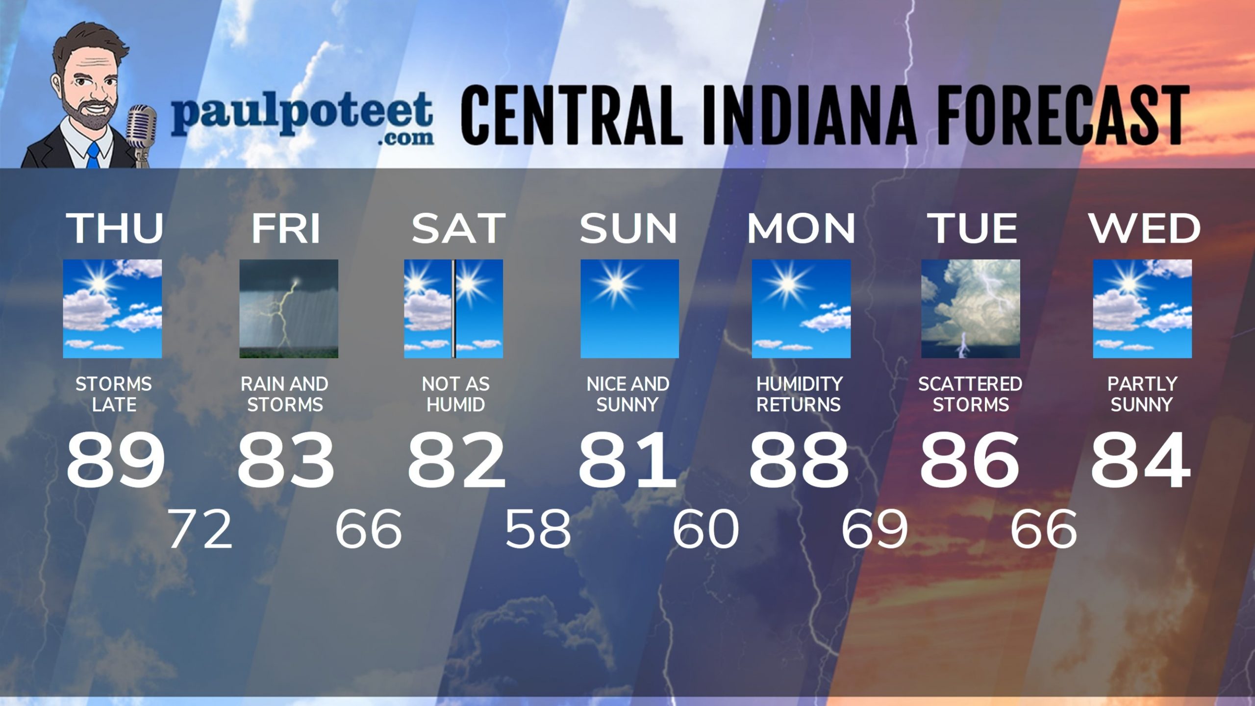
INDY SEVEN DAY FORECAST
Today: Partly sunny, hot and humid. Spotty showers and storms. High 89.
Tonight: Scattered showers and storms possible in the evening, mainly to the south of Indy. Better chances overnight. Low 72.
Friday: Showers likely, with some thunder. High 83.
Friday Night: Spotty showers and storms early, then partly cloudy. Low 66.
Saturday: Partly to mostly sunny and less humid. High 82.
Saturday Night: Clear and comfortable. Low 58.
Sunday: Nice and sunny. High 81.
Sunday Night: Clear. Low 60.
Monday: Mostly sunny. High 88.
Monday Night: Mostly clear. Low 69.
Tuesday: Partly sunny. Scattered showers and storms. High 86.
Tuesday Night: Scattered showers and storms. Low 66.
Wednesday: Partly sunny. High 84.
Never miss me! Subscribe for free. My Huge Radar has real-time weather tracking, current temperatures, and severe weather watches and warnings. Get detailed Indiana conditions by clicking here. Click here to see my central Indiana 7-Day Forecast. Follow these links to get my forecasts for Lafayette, Muncie, Hendricks County, and Hamilton County. Need a second opinion? Click here for central Indiana National Weather Service forecasts. (Some charts via WeatherBELL.)


