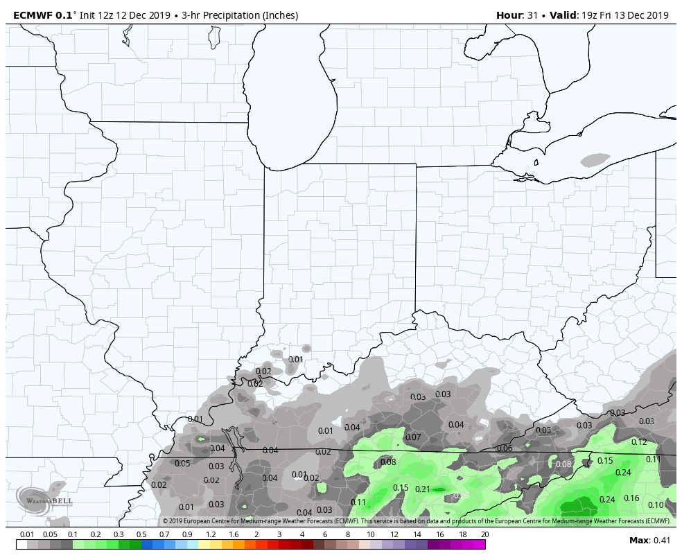
Two chances for rain and snow over the next few days. Saturday’s system brings the biggest totals southeast of Indianapolis, and should be mainly a rain thing.
The second system swings out of the Southwest Sunday morning. The surface low pressure system will move from southwest Arkansas Monday morning to Western New York State Tuesday morning. This is the one with at least some light accumulation potential Sunday night into Monday morning drive, and again Monday night.
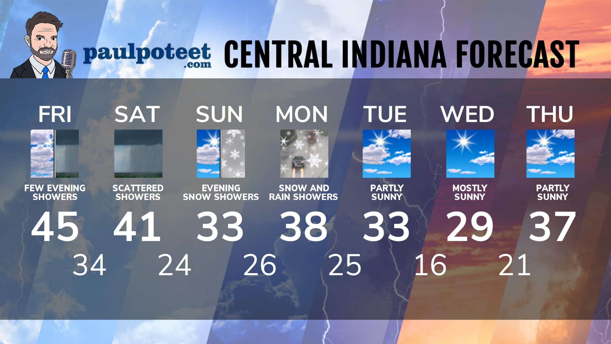
INDY SEVEN DAY FORECAST
Friday: Mostly cloudy. High 45.
Friday Night: A few showers. Low 34.
Saturday: Scattered showers, possibly mixed with snow. High 41.
Saturday Night: Chance of drizzle or freezing drizzle. Low 24.
Sunday: Partly to mostly cloudy. High 33.
Sunday Night: Snow shower chances. Low 26.
Monday: Rain and snow showers. Some snow accumulation is possible. High 38.
Monday Night: Snow showers possible, with small accumulations possible. Low 25.
Tuesday: Partly sunny. High 33.
Tuesday Night: Partly cloudy. Low 16.
Wednesday: Mostly sunny. High 29.
Wednesday Night: Mostly clear. Low 21.
Thursday: Partly sunny. High 37.
Never miss me! Subscribe for free. My Huge Radar has real-time weather tracking, current temperatures, and severe weather watches and warnings. Get detailed Indiana conditions by clicking here. Click here to see my central Indiana 7-Day Forecast. Follow these links to get my forecasts for Lafayette, Muncie, Hendricks County, and Hamilton County. Need a second opinion? Click here for central Indiana National Weather Service forecasts. (Some charts via WeatherBELL.)


Indiana’s Weather For The Weekend
Two chances for rain and snow over the next few days. Saturday’s system brings… https://t.co/YJ6KEXahkN
RT @PaulPoteet: Indiana’s Weather For The Weekend
Two chances for rain and snow over the next few days. Saturday’s system brings the bigg…