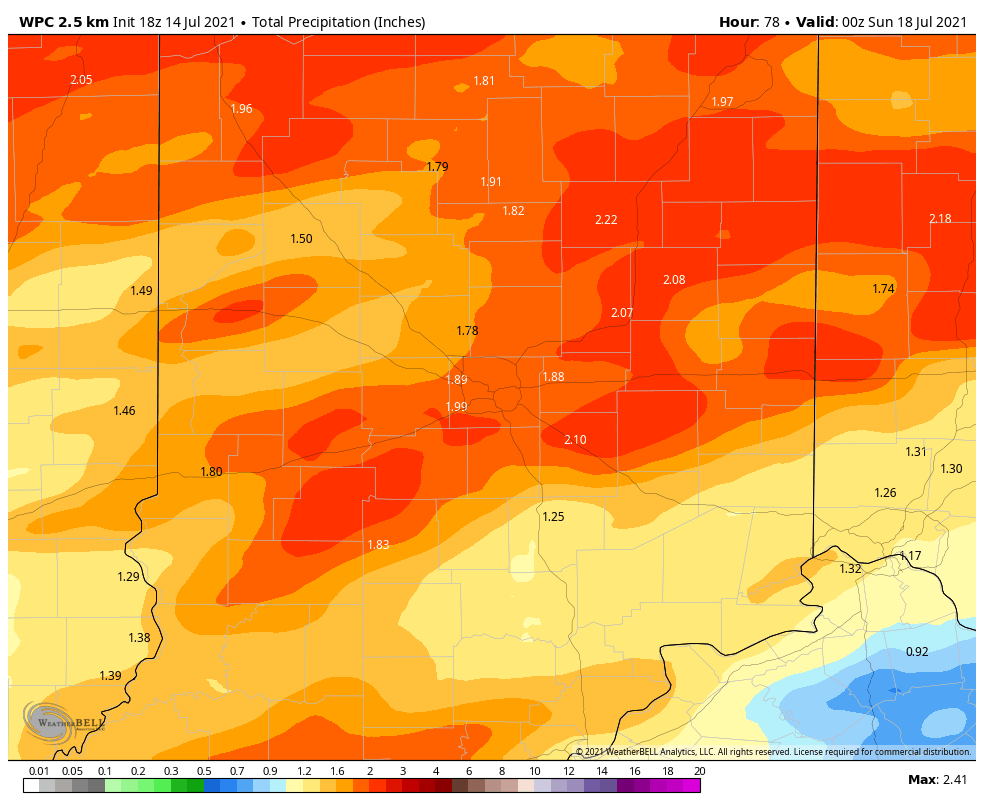
The showers and storms earlier this week were connected to an upper level low that finally faded Wednesday and gave us the gift of a dry day. The next round of rain is connected to strong low pressure and cold front that will move slowly across Indiana through Saturday.
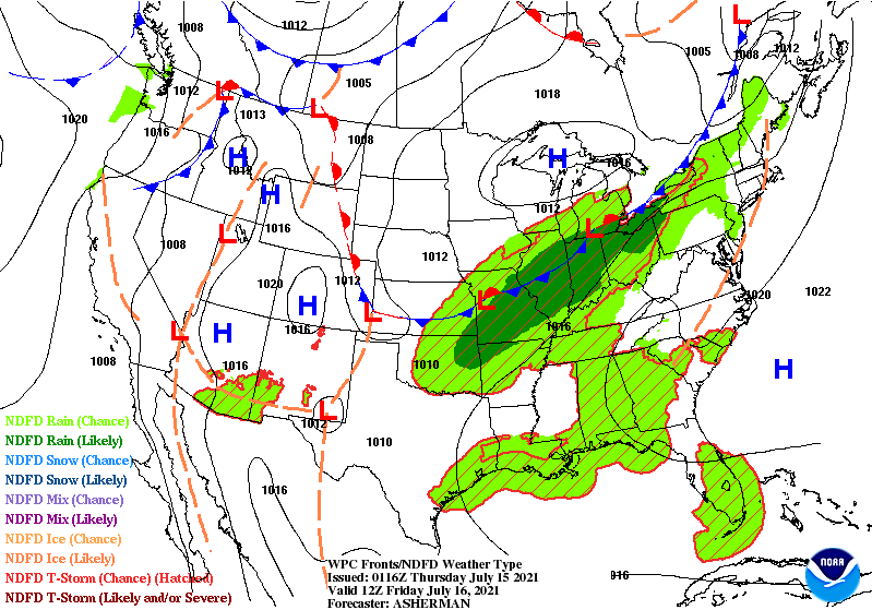
Storms tonight and overnight have a small risk of becoming severe with respect to wind gusts. There is also a risk of localized flooding through Friday. Another two inches of rainfall is possible out of this weather maker.
Never miss me! Subscribe for free. My Huge Radar has real-time weather tracking, current temperatures, and severe weather watches and warnings. Get detailed Indiana conditions by clicking here. Click here to see my central Indiana 7-Day Forecast. Follow these links to get my forecasts for Lafayette, Muncie, Hendricks County, and Hamilton County. Need a second opinion? Click here for central Indiana National Weather Service forecasts. (Some charts via WeatherBELL.)
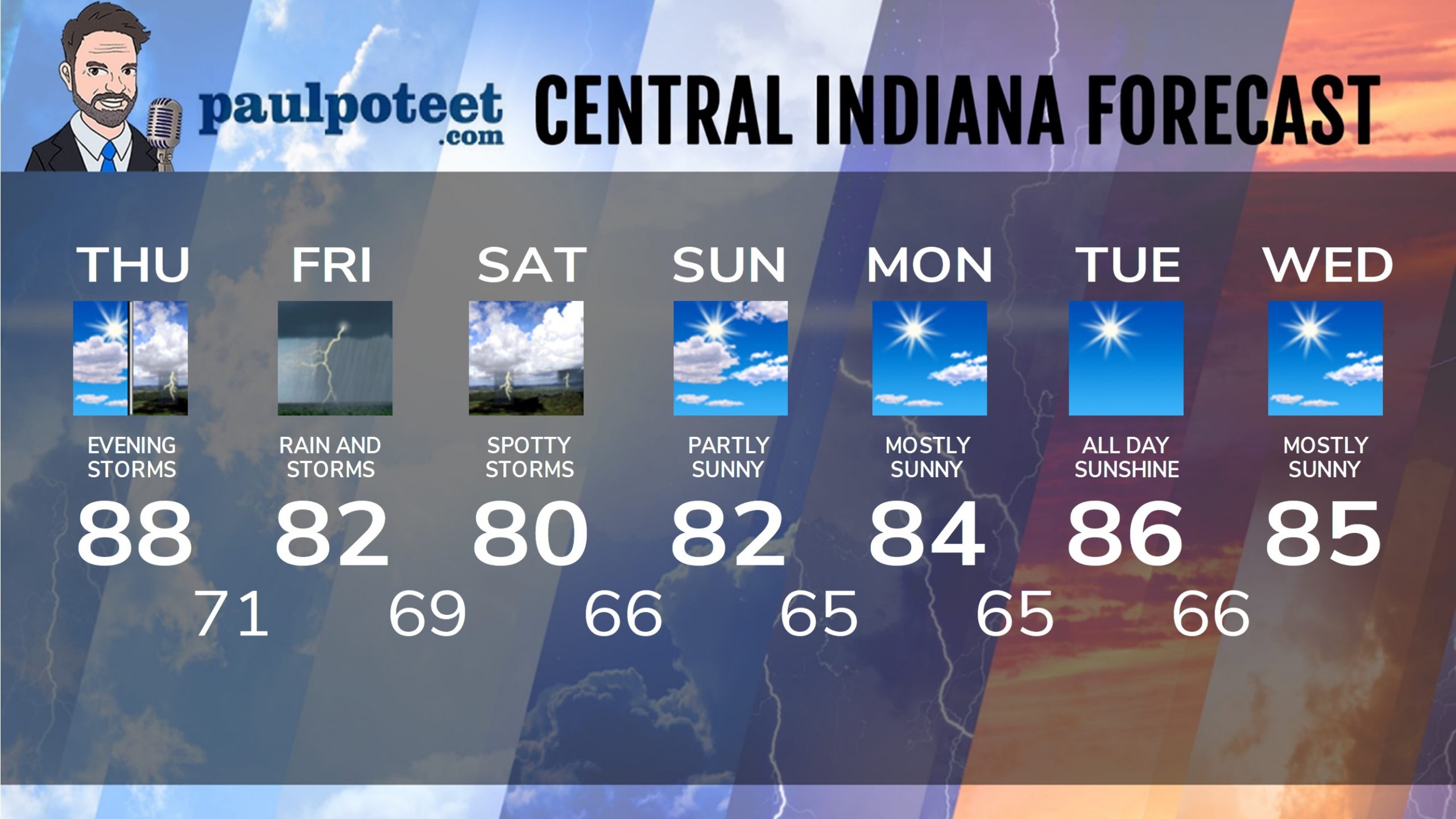
INDY SEVEN DAY FORECAST
Today: Partly sunny. High 88.
Tonight: Scattered showers and storms mid to late evening and overnight. Low 71.
Friday: Periods of showers and storms. High 82.
Friday Night: Scattered showers and storms. Low 69.
Saturday: Partly sunny. Spotty showers or storms are possible. High 80.
Saturday Night: Partly cloudy. Low 66.
Sunday: Partly sunny. High 82.
Sunday Night: Partly cloudy. Low 65.
Monday: Mostly sunny. High 84.
Monday Night: Mostly clear. Low 65.
Tuesday: Sunny. High 86.
Tuesday Night: Clear. Low 66.
Wednesday: Mostly sunny. High 85.
Never miss me! Subscribe for free. My Huge Radar has real-time weather tracking, current temperatures, and severe weather watches and warnings. Get detailed Indiana conditions by clicking here. Click here to see my central Indiana 7-Day Forecast. Follow these links to get my forecasts for Lafayette, Muncie, Hendricks County, and Hamilton County. Need a second opinion? Click here for central Indiana National Weather Service forecasts. (Some charts via WeatherBELL.)


