Gusted and dusted tonight! Rain will mix over to snow, with an inch *or less* for most. Winds will gust at times to 35 mph around Indy, and up to 40 mph near Lafayette and Muncie.
Never miss me! Subscribe for free. My Huge Radar has real-time weather tracking, current temperatures, and severe weather watches and warnings. Get detailed Indiana conditions by clicking here. Click here to see my central Indiana 7-Day Forecast. Follow these links to get my forecasts for Lafayette, Muncie, Hendricks County, and Hamilton County. Need a second opinion? Click here for central Indiana National Weather Service forecasts. (Some charts via WeatherBELL.)
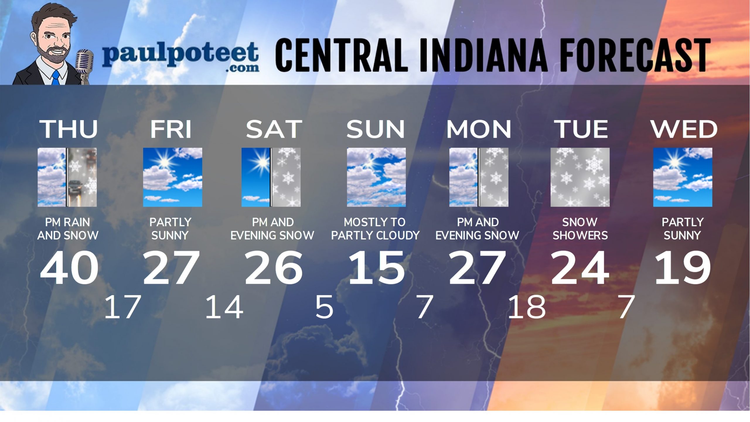
INDY SEVEN DAY FORECAST
Tonight: Rain mixing with and changing to snow. Less than an inch expected.
Wind gusting to 35 mph. Low 17.
Friday: Partly sunny. Wind gusting to 30 mph. High 27.
Friday Night: Partly cloudy. Low 14.
Saturday: Morning sun gives way to snow showers in the afternoon. High 26.
Saturday Night: Snow in the evening. Totals of 1-3 inches. Low 5.
Sunday: Mostly to partly cloudy. High 15.
Sunday Night: Mostly cloudy. Low 7.
Monday: Mostly cloudy. Afternoon snow showers. High 27.
Monday Night: More snow! Accumulation likely. Low 18.
Tuesday: Snow showers. Lighter additional accumulation. High 24.
Tuesday Night: Scattered snow showers. Low 7.
Wednesday: Partly sunny. High 19.
Never miss me! Subscribe for free. My Huge Radar has real-time weather tracking, current temperatures, and severe weather watches and warnings. Get detailed Indiana conditions by clicking here. Click here to see my central Indiana 7-Day Forecast. Follow these links to get my forecasts for Lafayette, Muncie, Hendricks County, and Hamilton County. Need a second opinion? Click here for central Indiana National Weather Service forecasts. (Some charts via WeatherBELL.)


