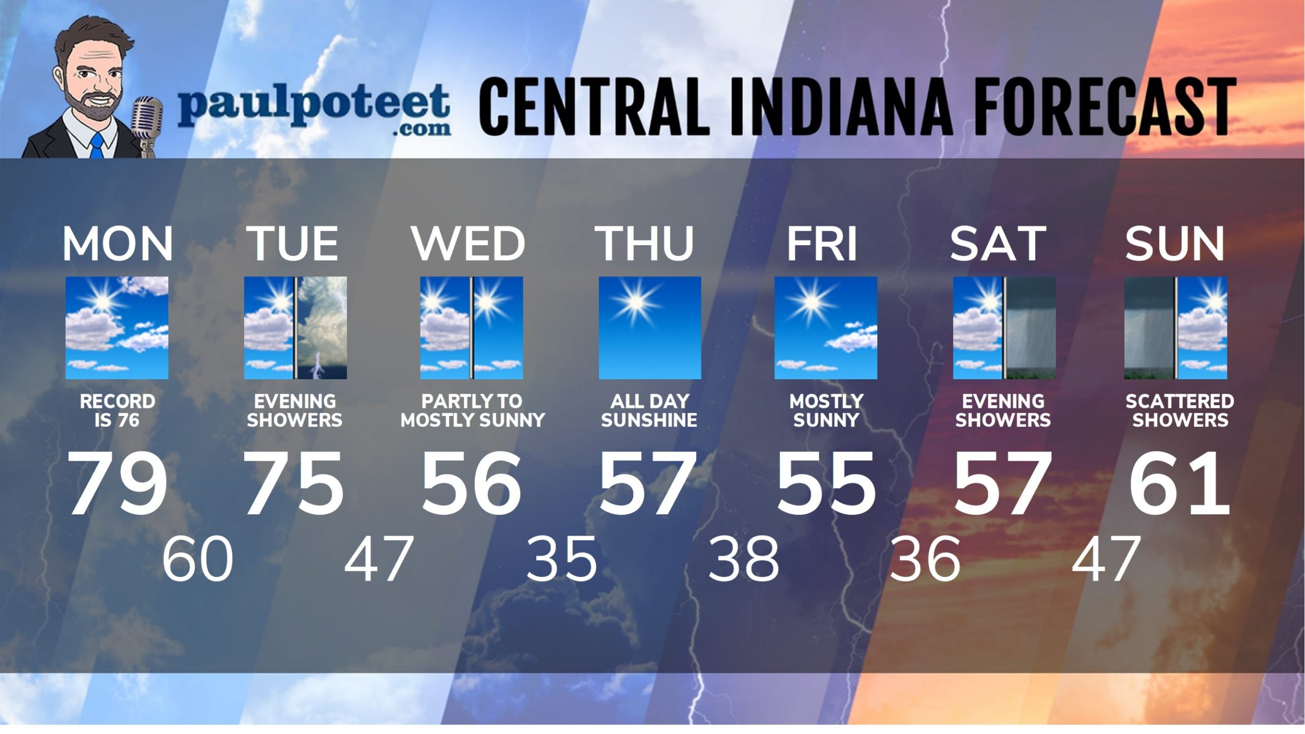
Going for two today! Yesterday’s Indy high was 79, breaking a 1999 record of 76 degrees. Today’s number to beat is 76, from 1999. And it’ll still be close tomorrow. The forecast is 75, and that’s the record, from 1949. This is also the FOURTH consecutive November day in the 70s.
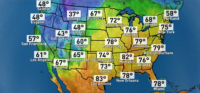
The heat was on Sunday all over the eastern part of the country. Minneapolis was warmer than Dallas or LA!
2020’s latest tropical system is Eta, and it’s soaked southern Florida overnight. Several heavy rainfall reports coming in overnight from the greater Miami area due to Tropical Storm Eta. A moderate risk of excessive rainfall remains in effect this morning for southeast Florida with rainfall rates of up to 2-3 inches per hour possible.
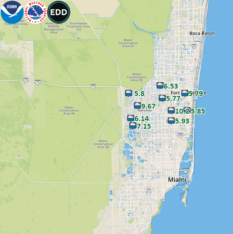
Eta could re-strengthen into a hurricane over the Gulf Of Mexico this week, and could hit up around Tampa as a Tropical Storm later this week. No impact for central Indiana.
INDY SEVEN DAY FORECAST
Today: Partly sunny. Record-breaking heat. High 79.
Tonight: Partly cloudy. Low 60.
Tuesday: Partly cloudy morning. Mostly cloudy afternoon. High 75.
Tuesday Night: Scattered showers and storms. Low 47.
Wednesday: Partly sunny morning, mostly sunny afternoon. High 56.
Wednesday Night: Clearing and cooler. Low 35.
Thursday: Sunny. High 57.
Thursday Night: Mostly clear. Low 38.
Friday: Mostly sunny. High 55.
Friday Night: Partly cloudy. Low 36.
Saturday: Partly sunny. High 57.
Saturday Night: Scattered showers. Low 47.
Sunday: Partly to mostly cloudy. Scattered showers, mainly in the morning. High 61.
Never miss me! Subscribe for free. My Huge Radar has real-time weather tracking, current temperatures, and severe weather watches and warnings. Get detailed Indiana conditions by clicking here. Click here to see my central Indiana 7-Day Forecast. Follow these links to get my forecasts for Lafayette, Muncie, Hendricks County, and Hamilton County. Need a second opinion? Click here for central Indiana National Weather Service forecasts. (Some charts via WeatherBELL.)


