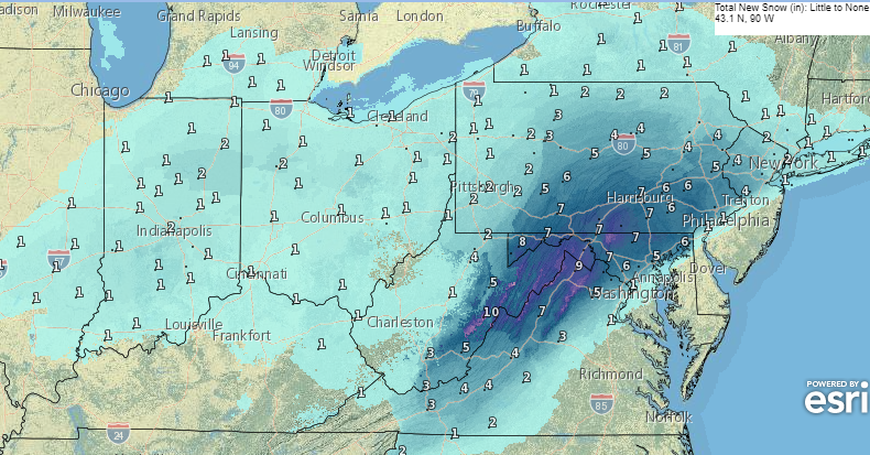
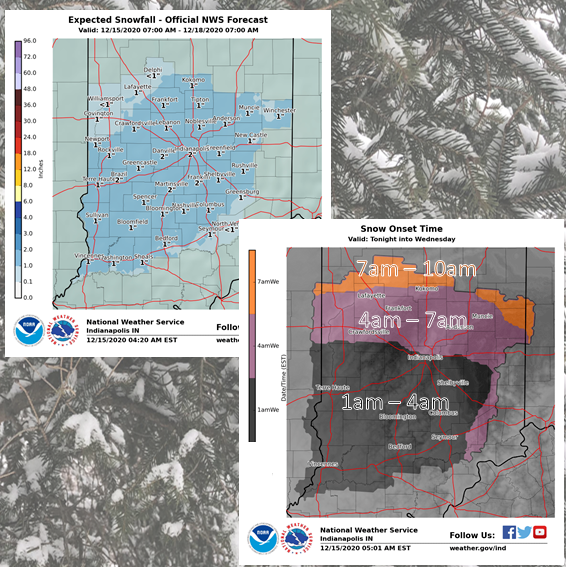
An inch or two of snow is expected from after midnight tonight into Wednesday in central Indiana, and a Nor’easter will dump much more in New York, Pennsylvania and down into Virginia. This chart shows expected totals through Wednesday.
Snow will start just after midnight from Indy southward, and later in the overnight hours north of Indianapolis.
Never miss me! Subscribe for free. My Huge Radar has real-time weather tracking, current temperatures, and severe weather watches and warnings. Get detailed Indiana conditions by clicking here. Click here to see my central Indiana 7-Day Forecast. Follow these links to get my forecasts for Lafayette, Muncie, Hendricks County, and Hamilton County. Need a second opinion? Click here for central Indiana National Weather Service forecasts. (Some charts via WeatherBELL.)
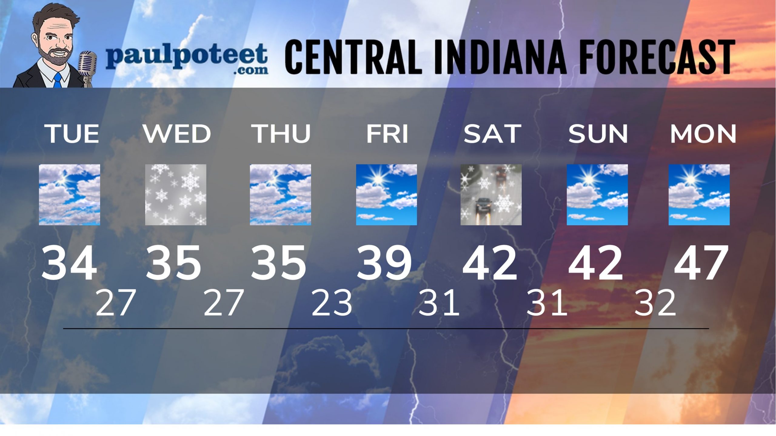
INDY SEVEN DAY FORECAST
Today: Partly to mostly cloudy. High 34.
Tonight: Cloudy, with around an inch of snow after midnight. Low 27.
Wednesday: Another inch of snow. High 35.
Wednesday Night: Mostly cloudy. Low 27.
Thursday: Mostly cloudy. High 35.
Thursday Night: Partly cloudy. Low 23.
Friday: Partly sunny. High 39.
Friday Night: Partly cloudy. Low 31.
Saturday: Scattered showers. High 42.
Saturday Night: Rain and/or snow showers. Low 31.
Sunday: Partly sunny. High 42.
Sunday Night: Partly cloudy. Low 32.
Monday: Partly sunny. High 47.
Never miss me! Subscribe for free. My Huge Radar has real-time weather tracking, current temperatures, and severe weather watches and warnings. Get detailed Indiana conditions by clicking here. Click here to see my central Indiana 7-Day Forecast. Follow these links to get my forecasts for Lafayette, Muncie, Hendricks County, and Hamilton County. Need a second opinion? Click here for central Indiana National Weather Service forecasts. (Some charts via WeatherBELL.)


