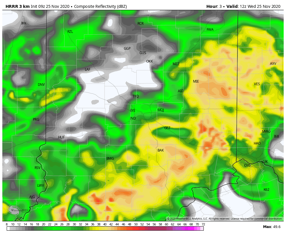
Wet and windy Wednesday, with gusts to 30 mph, and a small risk of severe thunderstorms from around 4-8 pm. The projected radar shows the blob of rain in the morning giving way to more scattered showers and storms in the afternoon and evening.
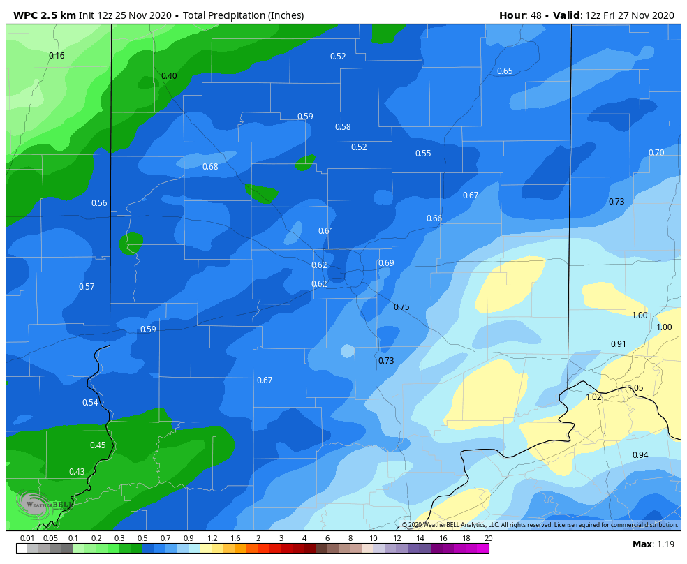
Most of central Indiana should see at least a half-inch of rainfall today. The biggest rain totals today will be in the southeastern corner of the state.
Never miss me! Subscribe for free. My Huge Radar has real-time weather tracking, current temperatures, and severe weather watches and warnings. Get detailed Indiana conditions by clicking here. Click here to see my central Indiana 7-Day Forecast. Follow these links to get my forecasts for Lafayette, Muncie, Hendricks County, and Hamilton County. Need a second opinion? Click here for central Indiana National Weather Service forecasts. (Some charts via WeatherBELL.)
INDY SEVEN DAY FORECAST
Today: Rainy morning. Scattered showers and storms in the afternoon. High 58.
Tonight: Evening showers and storms. Cloudy overnight. Low 47.
Thanksgiving Day: Mostly cloudy. High 52.
Thursday Night: Mostly cloudy. Low 40.
Friday: Partly cloudy. High 55.
Friday Night: Partly cloudy. Low 31.
Saturday: Mostly sunny. High 48.
Saturday Night: Mostly clear. Low 30.
Sunday: Partly sunny. Spotty shower possible in the afternoon. High 49.
Sunday Night: Rain and then snow showers. Light accumulations possible. Low 29.
Monday: Snow showers. Light accumulations possible. High 34.
Monday Night: Partly cloudy. Low 23.
Tuesday: Partly sunny. High 34.

Never miss me! Subscribe for free. My Huge Radar has real-time weather tracking, current temperatures, and severe weather watches and warnings. Get detailed Indiana conditions by clicking here. Click here to see my central Indiana 7-Day Forecast. Follow these links to get my forecasts for Lafayette, Muncie, Hendricks County, and Hamilton County. Need a second opinion? Click here for central Indiana National Weather Service forecasts. (Some charts via WeatherBELL.)


