Three-peat! Today’s high temperature in Indy is expected to tie or break a record once again. The party’s over tonight, with the arrival of a cold front.
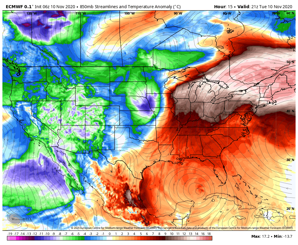
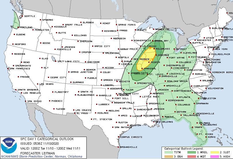
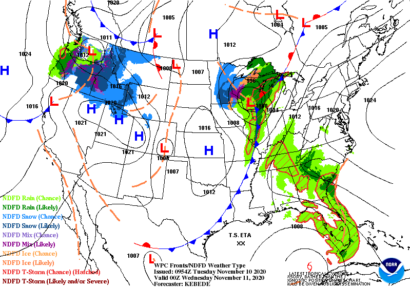
Severe storms are possible this evening just to the north and west of Lafayette, with bigger chances closer to the surface low dragging the front eastward. Central Indiana’s biggest risk would be gusty winds with any thunderstorms.
Never miss me! Subscribe for free. My Huge Radar has real-time weather tracking, current temperatures, and severe weather watches and warnings. Get detailed Indiana conditions by clicking here. Click here to see my central Indiana 7-Day Forecast. Follow these links to get my forecasts for Lafayette, Muncie, Hendricks County, and Hamilton County. Need a second opinion? Click here for central Indiana National Weather Service forecasts. (Some charts via WeatherBELL.)
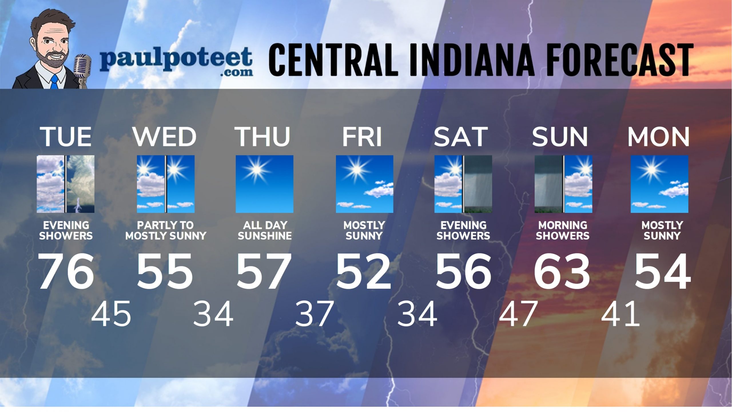
INDY SEVEN DAY FORECAST
Today: Mostly cloudy, with more record breaking heat. High 76.
Tonight: Showers and storms, ending after midnight. Low 45.
Wednesday: Partly sunny morning, mostly sunny afternoon. High 55.
Wednesday Night: Clearing and cooler. Low 34.
Thursday: Sunny. High 57.
Thursday Night: Mostly clear. Low 37.
Friday: Mostly sunny. High 52.
Friday Night: Partly cloudy. Low 34.
Saturday: Partly sunny. High 56.
Saturday Night: Scattered showers. Low 47.
Sunday: Partly to mostly cloudy. Scattered showers in the early morning. High 63.
Sunday Night: Mostly clear. Low 41.
Monday: Mostly sunny. High 54.
Never miss me! Subscribe for free. My Huge Radar has real-time weather tracking, current temperatures, and severe weather watches and warnings. Get detailed Indiana conditions by clicking here. Click here to see my central Indiana 7-Day Forecast. Follow these links to get my forecasts for Lafayette, Muncie, Hendricks County, and Hamilton County. Need a second opinion? Click here for central Indiana National Weather Service forecasts. (Some charts via WeatherBELL.)


