Most of central Indiana escaped showers and storms this morning, but they pounded places near and north of Kokomo over to Muncie.
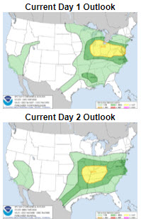
Central Indiana storms tonight have a slight risk (2/5) of being severe and the risk is marginal (1/5) Wednesday night.
Updates from the SPC, and any warnings, are always on My Huge Radar page.
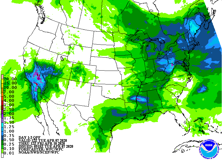
Rain amounts should stay between a quarter-inch and a half-inch.
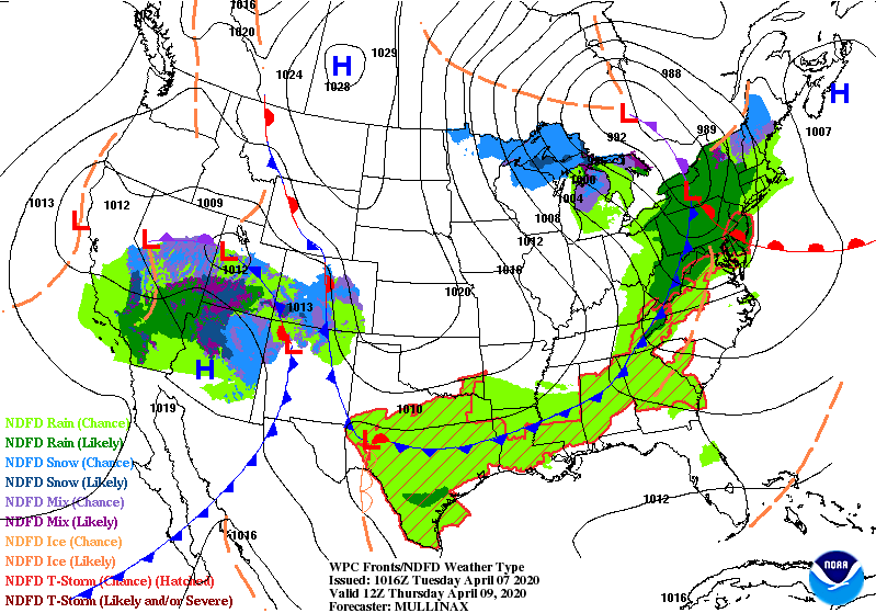
Two cold fronts triggering these storms. The charts show the positions early Wednesday and early Thursday morning. Behind the second front? Temps in the 40s, and wind gusting to 40 mph Thursday!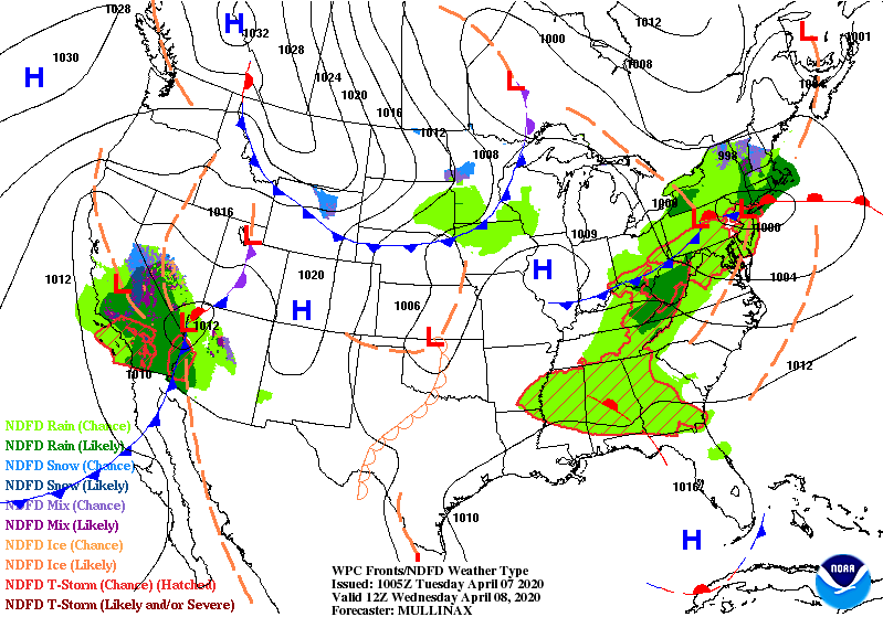
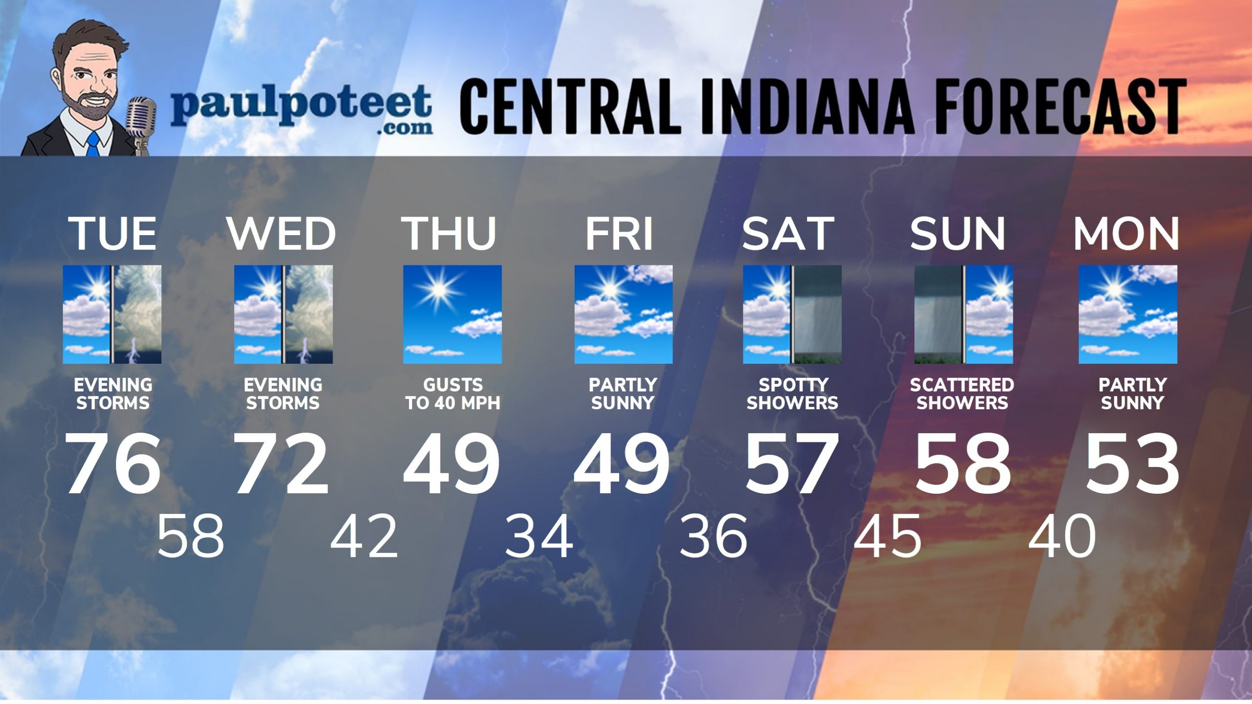
INDY SEVEN DAY FORECAST
Today: Partly sunny and warmer. High 76.
Tonight: Scattered showers and storms. Some could be severe. Low 58.
Wednesday: Mostly to partly sunny. High 72.
Wednesday Night: Scattered showers and storms. Some could be severe. Low 42.
Thursday: Mostly to partly sunny. Much cooler. Wind gusting to 40 mph. High 49.
Thursday Night: Partly cloudy. Low 34.
Friday: Mostly to partly sunny. High 49.
Friday Night: Partly cloudy. Low 36.
Saturday: Partly sunny. A few showers possible. High 57.
Saturday Night: Mostly cloudy with scattered showers. Low 45.
Sunday: Mostly cloudy. Scattered showers. High 58.
Sunday Night: Mostly cloudy. Spotty showers. Low 40.
Monday: Partly sunny. High 53.
Never miss me! Subscribe for free. My Huge Radar has real-time weather tracking, current temperatures, and severe weather watches and warnings. Get detailed Indiana conditions by clicking here. Click here to see my central Indiana 7-Day Forecast. Follow these links to get my forecasts for Lafayette, Muncie, Hendricks County, and Hamilton County. Need a second opinion? Click here for central Indiana National Weather Service forecasts. (Some charts via WeatherBELL.)


RT @PaulPoteet: Indiana’s Weather For Tuesday: Most of central Indiana escaped showers and storms this morning, but they pounded places nea…