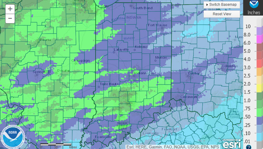
The biggest rain totals from our latest system were down in the southern third of the state.
0.78″ Bloomington
0.24″ Lafayette
0.22″ Muncie, Terre Haute
0.21″ Indianapolis
That front pulls away today and temps fall to the upper 40s to around 50 this afternoon.
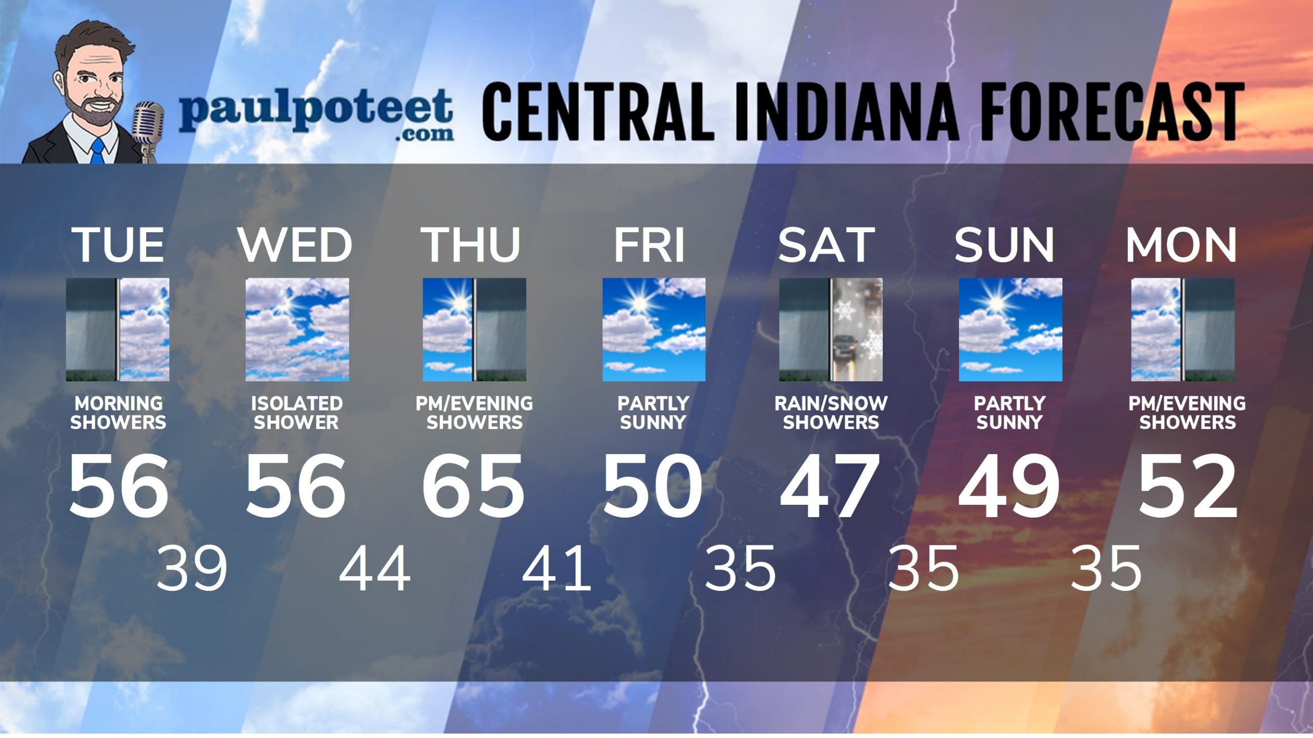
INDY SEVEN DAY FORECAST
Today: Morning showers. Afternoon temps fall into the upper 40 to around 50, with some peeks of sunshine.
Tonight: Partly to mostly cloudy. Low 39.
Wednesday: Mostly cloudy. Isolated shower possible. High 56.
Wednesday Night: Partly cloudy. Low 44.
Thursday: Scattered showers mainly in the afternoon. High 65.
Thursday Night: Scattered showers. Low 41.
Friday: Partly sunny. High 50.
Friday Night: Partly cloudy. Low 35.
Saturday: Scattered showers in the afternoon. Snow could mix in. High 47.
Saturday Night: Snow and/or rain showers. Low 35.
Sunday: Partly sunny. High 49.
Sunday Night: Partly cloudy. Low 35.
Monday: Clouds increase. Afternoon shower chance. High 52.
Never miss me! Subscribe for free. My Huge Radar has real-time weather tracking, current temperatures, and severe weather watches and warnings. Get detailed Indiana conditions by clicking here. Click here to see my central Indiana 7-Day Forecast. Follow these links to get my forecasts for Lafayette, Muncie, Hendricks County, and Hamilton County. Need a second opinion? Click here for central Indiana National Weather Service forecasts. (Some charts via WeatherBELL.)


Indiana’s Weather For Tuesday: The biggest rain totals from our latest system were down in the southern third of th… https://t.co/DYU99xzSwT
RT @PaulPoteet: Indiana’s Weather For Tuesday: The biggest rain totals from our latest system were down in the southern third of the state.…