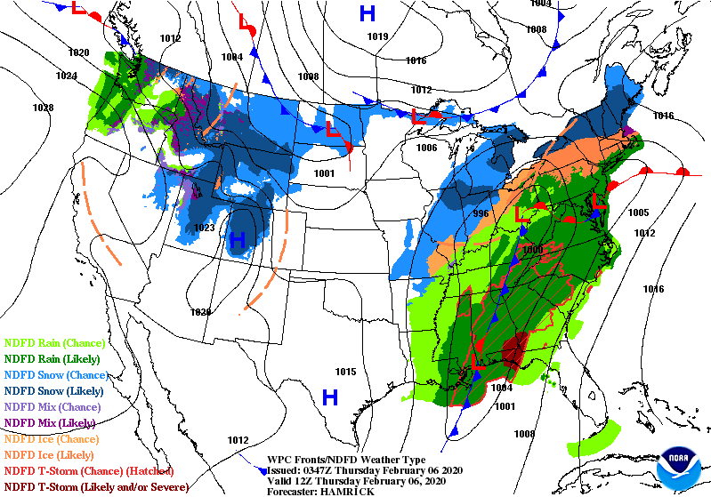
The storm system pulls away today, but freezing drizzle, freezing rain, or snow could last through the morning, A few snow showers are also possible into the afternoon and early evening. The Thursday morning map shows another system in the bullpen back in Northern Dakota.
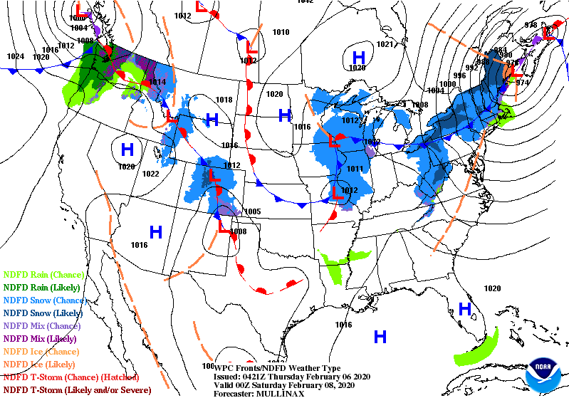
By Friday evening that low has moved southeastward. It brings snow showers to us Saturday. The snows today and Saturday will be more of an inconvenience than anything else. Up to an inch of snow is possible either day.
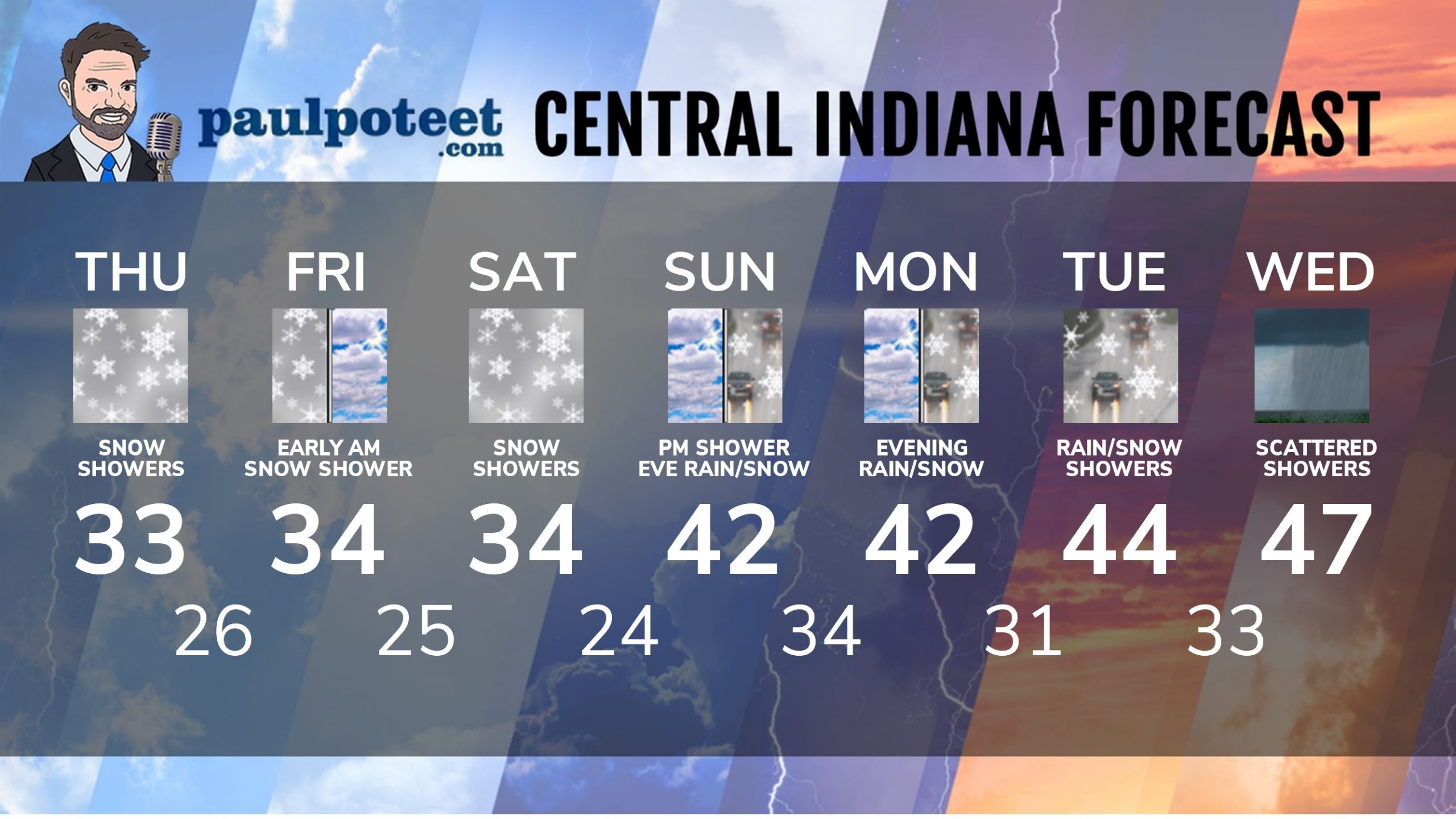
INDY SEVEN DAY FORECAST
Today: Spotty wintry mix or snow in the morning and snow showers in the afternoon. High 33.
Tonight: Snow showers. Low 26.
Friday: Mostly cloudy. Early morning snow showers are possible. High 34.
Friday Night: Mostly cloudy. Low 25.
Saturday: Mostly cloudy, with some snow showers. High 34.
Saturday Night: Partly cloudy. Low 24.
Sunday: Mostly cloudy. Scattered showers in the afternoon. High 42.
Sunday Night: Rain showers, possibly mixed with snow. Low 34.
Monday: Mostly cloudy. High 42.
Monday Night: Cloudy. Spotty rain and snow showers. Low 31.
Tuesday: Mostly cloudy. Spotty rain and snow showers. High 44.
Tuesday Night: Rain and snow showers. Low 33.
Wednesday: Mostly cloudy, with scattered showers. High 47.
Never miss me! Subscribe for free. My Huge Radar has real-time weather tracking, current temperatures, and severe weather watches and warnings. Get detailed Indiana conditions by clicking here. Click here to see my central Indiana 7-Day Forecast. Follow these links to get my forecasts for Lafayette, Muncie, Hendricks County, and Hamilton County. Need a second opinion? Click here for central Indiana National Weather Service forecasts. (Some charts via WeatherBELL.)


Indiana’s Weather For Thursday: The storm system pulls away today, but freezing drizzle, freezing rain, or snow cou… https://t.co/hBFL6AkO0q
RT @PaulPoteet: Indiana’s Weather For Thursday: The storm system pulls away today, but freezing drizzle, freezing rain, or snow could last…