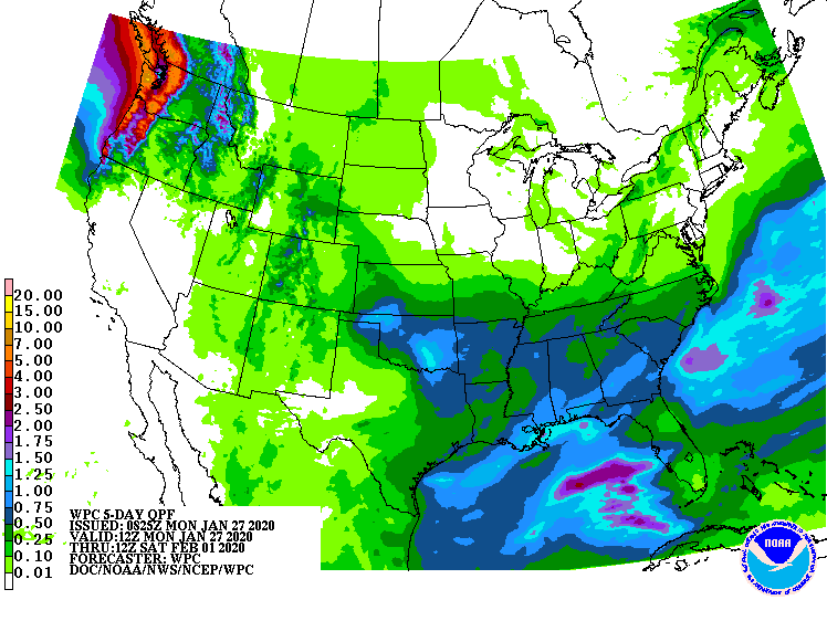
Look at this map of expected precipitation through Saturday morning. Little or no rain/snow is expected in central Indiana.
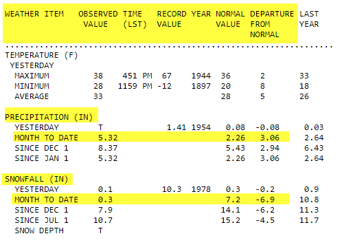
The average high this time of year is 36, so we will be near normal most of the work week. We are way below the average on snow. There’s only been one-third of an inch this month at the Indy Airport. At the same time, total precipitation is more than twice the normal number, thanks to all that rain.
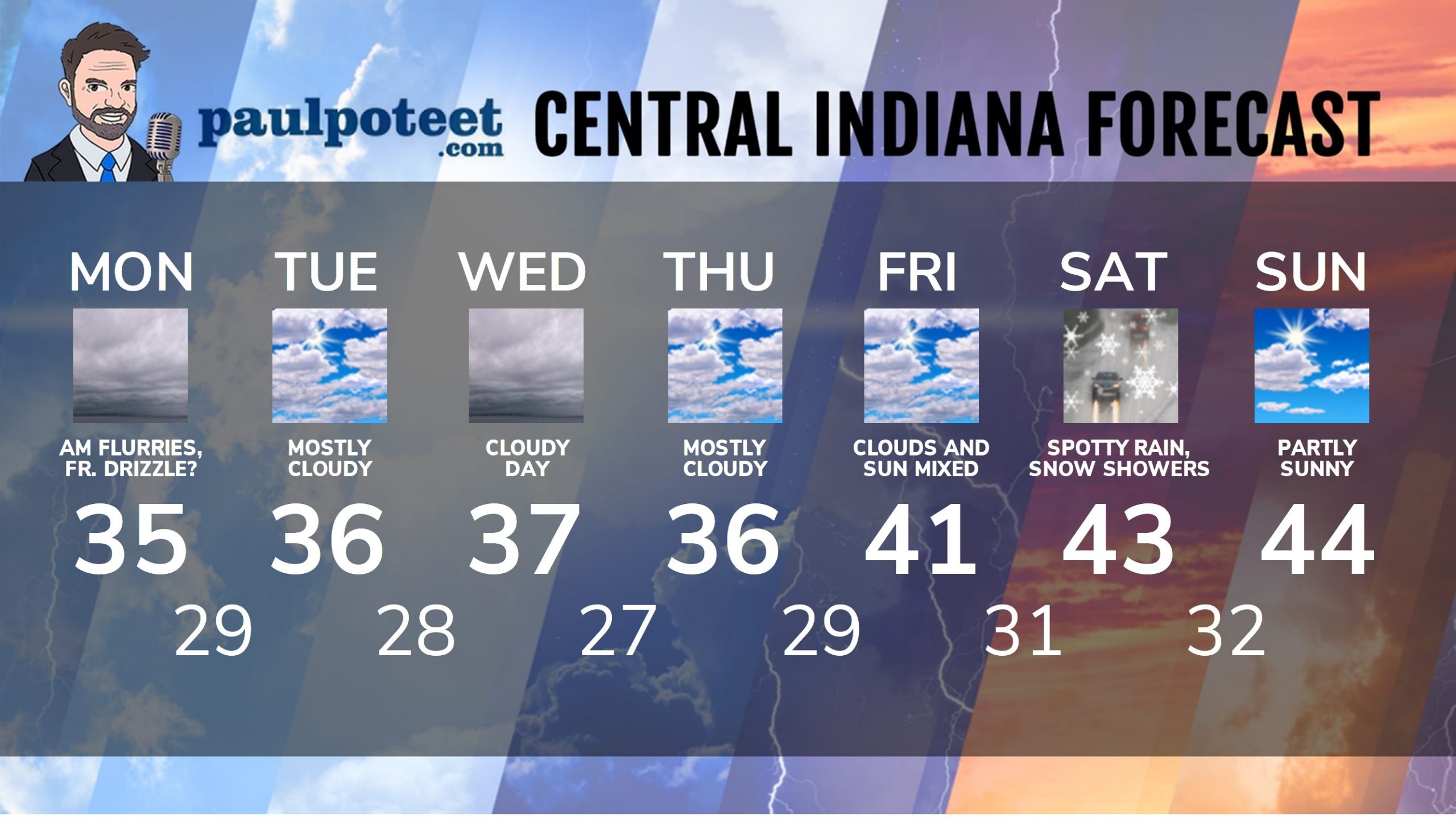
INDY SEVEN DAY FORECAST
Today: Cloudy. A few flurries or patchy freezing drizzle possible in the morning. High 35.
Tonight: Mostly cloudy. Low 29.
Tuesday: Mostly cloudy. High 36.
Tuesday Night: Mostly cloudy. Low 28.
Wednesday: Cloudy. High 37.
Wednesday Night: Mostly cloudy. Low 27.
Thursday: Partly to mostly cloudy. High 36.
Thursday Night: Mostly cloudy. Low 29.
Friday: Mostly to partly cloudy. High 41.
Friday Night: Partly cloudy. Low 31.
Saturday: Spotty rain and snow showers. High 43.
Saturday Night: Mostly cloudy. Low 32.
Sunday: Partly sunny. High 44.
Never miss me! Subscribe for free. My Huge Radar has real-time weather tracking, current temperatures, and severe weather watches and warnings. Get detailed Indiana conditions by clicking here. Click here to see my central Indiana 7-Day Forecast. Follow these links to get my forecasts for Lafayette, Muncie, Hendricks County, and Hamilton County. Need a second opinion? Click here for central Indiana National Weather Service forecasts. (Some charts via WeatherBELL.)


RT @PaulPoteet: Indiana’s Weather For Monday
Look at this map of expected precipitation through Saturday morning. Little or no rain/snow…
RT @PaulPoteet: Indiana’s Weather For Monday
Look at this map of expected precipitation through Saturday morning. Little or no rain/snow…